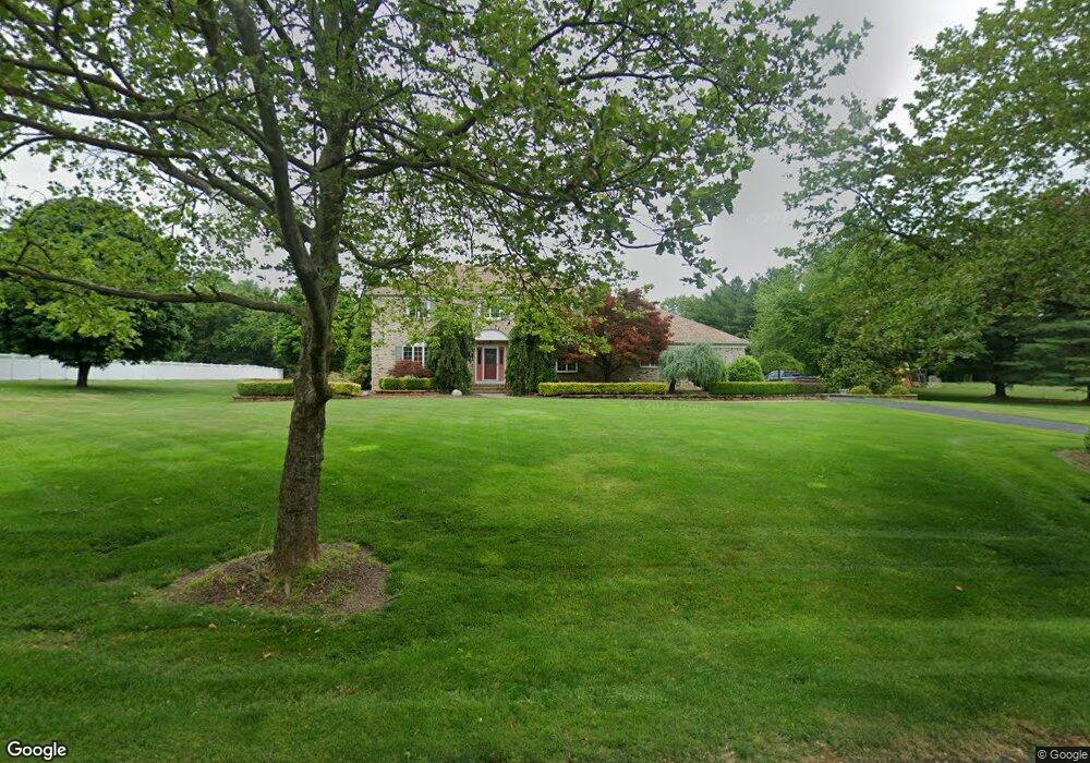
6 Shield Rd Millstone Township, NJ 08535
Estimated Value: $912,390 - $1,093,000
4
Beds
3
Baths
2,720
Sq Ft
$372/Sq Ft
Est. Value
About This Home
This home is located at 6 Shield Rd, Millstone Township, NJ 08535 and is currently estimated at $1,012,098, approximately $372 per square foot. 6 Shield Rd is a home located in Monmouth County with nearby schools including Millstone Township Primary School, Millstone Township Elementary School, and Millstone Township Middle School.
Ownership History
Date
Name
Owned For
Owner Type
Purchase Details
Closed on
May 21, 2014
Sold by
Toia Frank P and Toiai Ramona
Bought by
Toia Frank P and Toia Ramona
Current Estimated Value
Home Financials for this Owner
Home Financials are based on the most recent Mortgage that was taken out on this home.
Original Mortgage
$238,500
Interest Rate
4.33%
Mortgage Type
New Conventional
Purchase Details
Closed on
Mar 31, 1994
Sold by
Colson Daniel
Bought by
Frank Toia and Toia Ramona
Home Financials for this Owner
Home Financials are based on the most recent Mortgage that was taken out on this home.
Original Mortgage
$135,000
Interest Rate
7.45%
Create a Home Valuation Report for This Property
The Home Valuation Report is an in-depth analysis detailing your home's value as well as a comparison with similar homes in the area
Home Values in the Area
Average Home Value in this Area
Purchase History
| Date | Buyer | Sale Price | Title Company |
|---|---|---|---|
| Toia Frank P | -- | None Available | |
| Frank Toia | $263,000 | -- |
Source: Public Records
Mortgage History
| Date | Status | Borrower | Loan Amount |
|---|---|---|---|
| Closed | Toia Frank P | $238,500 | |
| Previous Owner | Frank Toia | $135,000 |
Source: Public Records
Tax History
| Year | Tax Paid | Tax Assessment Tax Assessment Total Assessment is a certain percentage of the fair market value that is determined by local assessors to be the total taxable value of land and additions on the property. | Land | Improvement |
|---|---|---|---|---|
| 2025 | $11,383 | $549,400 | $144,200 | $405,200 |
| 2024 | $11,811 | $475,300 | $156,600 | $318,700 |
| 2023 | $11,811 | $475,300 | $156,600 | $318,700 |
| 2022 | $11,474 | $475,300 | $156,600 | $318,700 |
| 2021 | $11,474 | $475,300 | $156,600 | $318,700 |
| 2020 | $11,345 | $475,300 | $156,600 | $318,700 |
| 2019 | $11,132 | $475,300 | $156,600 | $318,700 |
| 2018 | $10,856 | $475,300 | $156,600 | $318,700 |
| 2017 | $10,808 | $475,300 | $156,600 | $318,700 |
| 2016 | $10,728 | $475,300 | $156,600 | $318,700 |
| 2015 | $10,550 | $444,400 | $156,600 | $287,800 |
| 2014 | $10,680 | $410,600 | $151,600 | $259,000 |
Source: Public Records
Map
Nearby Homes
- 184 Smithburg Rd
- 19 Roberts Rd
- 225 Woodville Rd
- 159 Oakland Mills Rd
- 15 Summit Ave
- 3 Manalapan Woods Dr
- 207C Woodward Rd
- 6 Hillcrest Rd
- 1 Michael Ct
- 30 Carriage Way
- 3 Lisa Ct
- 6 Lamb Ln
- 304 Smithburg Rd
- 40 Highland Ridge Rd
- 12 Tall Woods Dr
- 10 Ivy Ln
- 8 Hartnett Way
- 2111 Wander Ln Unit 2101
- 1214 Auburn Terrace Unit 1204
- 2014 Wander Ln Unit 2004
Your Personal Tour Guide
Ask me questions while you tour the home.