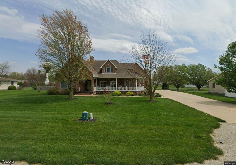
6 Spencer Dr Edinburg, IL 62531
Estimated Value: $200,000 - $457,789
5
Beds
--
Bath
1,945
Sq Ft
$153/Sq Ft
Est. Value
About This Home
This home is located at 6 Spencer Dr, Edinburg, IL 62531 and is currently estimated at $297,930, approximately $153 per square foot. 6 Spencer Dr is a home located in Christian County with nearby schools including Edinburg Elementary School, Edinburg Junior High School, and Edinburg High School.
Ownership History
Date
Name
Owned For
Owner Type
Purchase Details
Closed on
Feb 11, 2019
Sold by
Wiltsie Ronald L and Wiltsie Teresa J
Bought by
Wiltsie Ronald L and Wiltsie Teresa J
Current Estimated Value
Home Financials for this Owner
Home Financials are based on the most recent Mortgage that was taken out on this home.
Original Mortgage
$350,000
Outstanding Balance
$319,548
Interest Rate
6.63%
Mortgage Type
Adjustable Rate Mortgage/ARM
Estimated Equity
-$21,618
Create a Home Valuation Report for This Property
The Home Valuation Report is an in-depth analysis detailing your home's value as well as a comparison with similar homes in the area
Purchase History
We collect this data history from publicly available records. To have your information removed, we recommend requesting removal directly through your county’s website.
| Date | Buyer | Sale Price | Title Company |
|---|---|---|---|
| Wiltsie Ronald L | -- | -- |
Source: Public Records
Mortgage History
We collect this data history from publicly available records. To have your information removed, we recommend requesting removal directly through your county’s website.
| Date | Status | Borrower | Loan Amount |
|---|---|---|---|
| Open | Wiltsie Ronald L | $350,000 |
Source: Public Records
Tax History
| Year | Tax Paid | Tax Assessment Tax Assessment Total Assessment is a certain percentage of the fair market value that is determined by local assessors to be the total taxable value of land and additions on the property. | Land | Improvement |
|---|---|---|---|---|
| 2024 | $9,444 | $158,774 | $10,744 | $148,030 |
| 2023 | $9,150 | $148,707 | $10,063 | $138,644 |
| 2022 | $8,691 | $136,204 | $9,217 | $126,987 |
| 2021 | $8,483 | $134,893 | $9,127 | $125,766 |
| 2020 | $8,579 | $134,893 | $9,127 | $125,766 |
| 2019 | $8,512 | $134,893 | $9,127 | $125,766 |
| 2018 | $8,362 | $130,357 | $8,820 | $121,537 |
| 2017 | $8,209 | $128,493 | $9,563 | $118,930 |
| 2016 | $8,096 | $125,156 | $9,375 | $115,781 |
| 2015 | $7,846 | $120,179 | $9,002 | $111,177 |
| 2014 | $7,615 | $117,650 | $8,813 | $108,837 |
| 2013 | $6,117 | $100,290 | $4,090 | $96,200 |
| 2011 | $7,048 | $100,290 | $4,090 | $96,200 |
Source: Public Records
Map
Nearby Homes
- 319 S Sheridan St
- 701 W Vine St
- 301 S Curtis St
- 106 E Lincoln St
- 307 S Eaton St
- 824 E 1800 North Rd
- 2522 N 625 East Rd
- 503 Grand Ave
- 204 Henry St
- 225 Parker St
- 106 Henry St
- 230 Elm St
- 210 Cedar St
- 108 Mason St
- 610 Mason St
- 2618 N 625 East Rd
- 7355 New City Rd
- 0 Llamarada Unit 63859831
- 5915 Long Creek Dr Unit 1
- 8519 Cardinal Hill Rd
- 10 Spencer Dr
- 4 Spencer Dr
- 206 S Wilkinson St
- 2 Spencer Dr
- 18 Spencer Dr
- 743 E 2100 North Rd
- 16 Spencer Dr
- 20 Spencer Dr
- 22 Spencer Dr
- 14 Spencer Dr
- 421 W Lincoln St
- 24 Spencer Dr
- 205 Wilkinson St
- 207 S Wilkinson St
- 3 Wilkinson St
- 2 Wilkinson St
- 1 Wilkinson St
- 418 W Lincoln St
- 418 W Franklin St
- 423 W Washington St
Your Personal Tour Guide
Ask me questions while you tour the home.