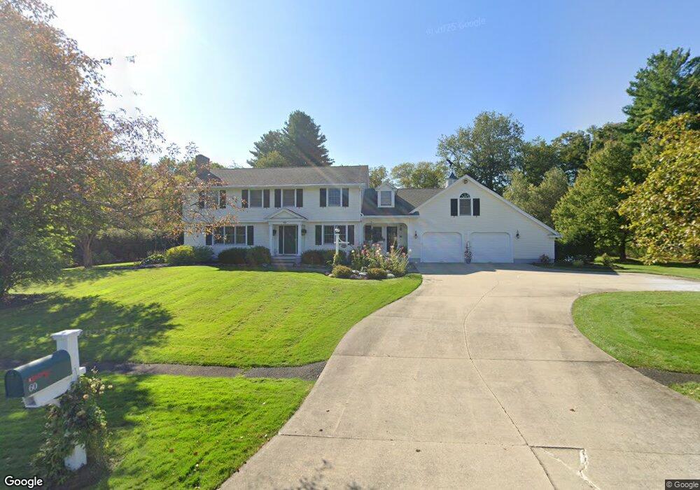
60 Stonehenge Rd Pittsfield, MA 01201
Estimated Value: $670,000 - $807,000
5
Beds
3
Baths
2,981
Sq Ft
$245/Sq Ft
Est. Value
About This Home
This home is located at 60 Stonehenge Rd, Pittsfield, MA 01201 and is currently estimated at $729,291, approximately $244 per square foot. 60 Stonehenge Rd is a home located in Berkshire County with nearby schools including Williams Elementary School, Theodore Herberg Middle School, and Pittsfield High School.
Ownership History
Date
Name
Owned For
Owner Type
Purchase Details
Closed on
Sep 12, 2024
Sold by
Collins William K
Bought by
W Kelly Collins Ret and Collins
Current Estimated Value
Purchase Details
Closed on
Aug 27, 2012
Sold by
Collins William K and Collins Deborah B
Bought by
Collins William K
Purchase Details
Closed on
Jan 22, 1987
Sold by
Cave Robert S
Bought by
Collins William K
Home Financials for this Owner
Home Financials are based on the most recent Mortgage that was taken out on this home.
Original Mortgage
$160,000
Interest Rate
9.36%
Mortgage Type
Purchase Money Mortgage
Create a Home Valuation Report for This Property
The Home Valuation Report is an in-depth analysis detailing your home's value as well as a comparison with similar homes in the area
Home Values in the Area
Average Home Value in this Area
Purchase History
We collect this data history from publicly available records. To have your information removed, we recommend requesting removal directly through your county’s website.
| Date | Buyer | Sale Price | Title Company |
|---|---|---|---|
| W Kelly Collins Ret | -- | None Available | |
| W Kelly Collins Ret | -- | None Available | |
| Collins William K | -- | -- | |
| Collins William K | -- | -- | |
| Collins William K | $253,000 | -- |
Source: Public Records
Mortgage History
We collect this data history from publicly available records. To have your information removed, we recommend requesting removal directly through your county’s website.
| Date | Status | Borrower | Loan Amount |
|---|---|---|---|
| Previous Owner | Collins William K | $249,500 | |
| Previous Owner | Collins William K | $150,000 | |
| Previous Owner | Collins William K | $160,000 |
Source: Public Records
Tax History
| Year | Tax Paid | Tax Assessment Tax Assessment Total Assessment is a certain percentage of the fair market value that is determined by local assessors to be the total taxable value of land and additions on the property. | Land | Improvement |
|---|---|---|---|---|
| 2025 | $13,787 | $768,500 | $81,800 | $686,700 |
| 2024 | $12,288 | $666,000 | $81,800 | $584,200 |
| 2023 | $11,236 | $613,300 | $81,800 | $531,500 |
| 2022 | $10,100 | $544,200 | $81,800 | $462,400 |
| 2021 | $9,221 | $479,000 | $81,800 | $397,200 |
| 2020 | $9,254 | $469,500 | $81,800 | $387,700 |
| 2019 | $7,927 | $408,200 | $81,800 | $326,400 |
| 2018 | $7,824 | $391,000 | $76,800 | $314,200 |
| 2017 | $7,730 | $393,800 | $81,800 | $312,000 |
| 2016 | $7,527 | $401,200 | $81,800 | $319,400 |
| 2015 | $7,246 | $401,200 | $81,800 | $319,400 |
Source: Public Records
Map
Nearby Homes
- 50 Stonehenge Rd
- 70 Stonehenge Rd
- 61 Stonehenge Rd
- 51 Stonehenge Rd
- 71 Stonehenge Rd
- 40 Stonehenge Rd
- 80 Stonehenge Rd
- 20 Brookside Dr
- 22 Brookside Dr
- 18 Brookside Dr
- 41 Stonehenge Rd
- 24 Brookside Dr
- 81 Stonehenge Rd
- 16 Brookside Dr
- 14 Brookside Dr
- 30 Stonehenge Rd
- 21 Brookside Dr
- 17 Brookside Dr
- 23 Brookside Dr
- 90 Stonehenge Rd
Your Personal Tour Guide
Ask me questions while you tour the home.