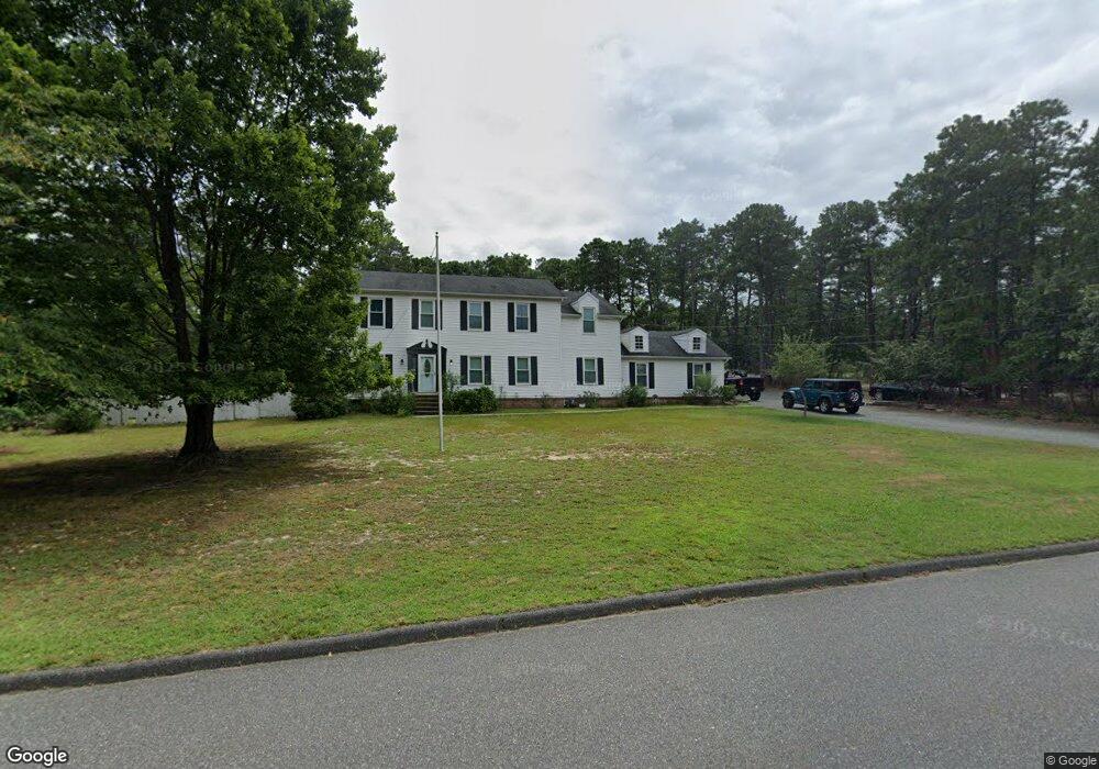
600 Bloomfield Ave Whiting, NJ 08759
Estimated Value: $672,000 - $801,000
4
Beds
3
Baths
2,868
Sq Ft
$252/Sq Ft
Est. Value
About This Home
This home is located at 600 Bloomfield Ave, Whiting, NJ 08759 and is currently estimated at $721,388, approximately $251 per square foot. 600 Bloomfield Ave is a home located in Ocean County with nearby schools including Manchester Township High School.
Ownership History
Date
Name
Owned For
Owner Type
Purchase Details
Closed on
Apr 24, 2007
Sold by
Reid Francis N and Reid Violet
Bought by
Fiorentino Jessica
Current Estimated Value
Home Financials for this Owner
Home Financials are based on the most recent Mortgage that was taken out on this home.
Original Mortgage
$348,000
Outstanding Balance
$211,104
Interest Rate
6.21%
Mortgage Type
Purchase Money Mortgage
Estimated Equity
$510,284
Create a Home Valuation Report for This Property
The Home Valuation Report is an in-depth analysis detailing your home's value as well as a comparison with similar homes in the area
Home Values in the Area
Average Home Value in this Area
Purchase History
| Date | Buyer | Sale Price | Title Company |
|---|---|---|---|
| Fiorentino Jessica | $435,000 | Chicago Title Insurance Co |
Source: Public Records
Mortgage History
| Date | Status | Borrower | Loan Amount |
|---|---|---|---|
| Open | Fiorentino Jessica | $348,000 |
Source: Public Records
Tax History
| Year | Tax Paid | Tax Assessment Tax Assessment Total Assessment is a certain percentage of the fair market value that is determined by local assessors to be the total taxable value of land and additions on the property. | Land | Improvement |
|---|---|---|---|---|
| 2025 | $10,358 | $711,900 | $218,900 | $493,000 |
| 2024 | $9,131 | $391,900 | $98,700 | $293,200 |
| 2023 | $8,681 | $391,900 | $98,700 | $293,200 |
| 2022 | $8,681 | $391,900 | $98,700 | $293,200 |
| 2021 | $8,492 | $391,900 | $98,700 | $293,200 |
| 2020 | $8,269 | $391,900 | $98,700 | $293,200 |
| 2019 | $8,554 | $333,500 | $98,700 | $234,800 |
| 2018 | $8,521 | $333,500 | $98,700 | $234,800 |
| 2017 | $8,554 | $333,500 | $98,700 | $234,800 |
| 2016 | $8,451 | $333,500 | $98,700 | $234,800 |
| 2015 | $8,294 | $333,500 | $98,700 | $234,800 |
| 2014 | $8,124 | $333,500 | $98,700 | $234,800 |
Source: Public Records
Map
Nearby Homes
- 1820 Perth Amboy Ave
- 6 Columbus Blvd Unit C
- 6 Orchard Dr Unit 73
- 10 Hartford Rd
- 13 S Chestnut Ave Unit 70
- 7 Eaton Ln Unit 73
- 55 Chelsea Dr Unit 70
- 19 Attleboro Ln Unit 73
- 19 Attleboro Ln
- 3 Apple Ln Unit 72
- 13 Churchill Rd Unit 71
- 29 Keene St Unit 70
- 56 S Chestnut Ave
- 21 Churchill Rd Unit 71
- 36 Westport Dr Unit 71
- 36 Westport Dr
- 25 Churchill Rd
- 53 Central Ave
- 53 Central Ave Unit 72
- 51 Central Ave Unit 72
- 1961 New Brunswick Ave
- 1960 Perth Amboy Ave
- 601 Bloomfield Ave
- 651 Bloomfield Ave
- 1980 New Brunswick Ave
- 1981 Perth Amboy Ave
- 1941 New Brunswick Ave
- 1940 Perth Amboy Ave
- 1960 New Brunswick Ave
- 1961 Perth Amboy Ave
- 551 Bloomfield Ave
- 2021 New Brunswick Ave
- 2020 Perth Amboy Ave
- 701 Bloomfield Ave
- 1940 New Brunswick Ave
- 1941 Perth Amboy Ave
- 2020 New Brunswick Ave
- 2021 Perth Amboy Ave
- 1921 New Brunswick Ave
- 1920 Perth Amboy Ave
Your Personal Tour Guide
Ask me questions while you tour the home.