600 Long Cane Rd Lagrange, GA 30240
Estimated Value: $162,399 - $192,000
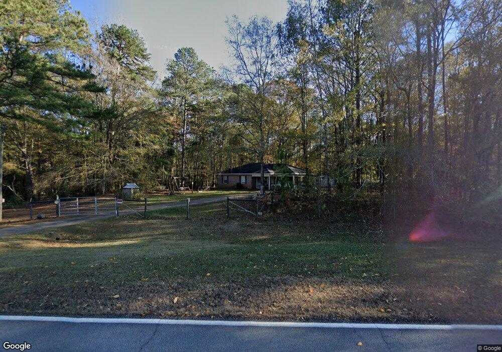
About This Home
This home is located at 600 Long Cane Rd, Lagrange, GA 30240 and is currently estimated at $179,350, approximately $171 per square foot. 600 Long Cane Rd is a home located in Troup County with nearby schools including Long Cane Elementary School, Whitesville Road Elementary School, and West Point Elementary School.
Ownership History
We collect this data history from publicly available records. To have your information removed, we recommend requesting removal directly through your county’s website.
Purchase Details
Home Financials for this Owner
Home Financials are based on the most recent Mortgage that was taken out on this home.Purchase Details
Purchase History
We collect this data history from publicly available records. To have your information removed, we recommend requesting removal directly through your county’s website.
| Date | Buyer | Sale Price | Title Company |
|---|---|---|---|
| $94,000 | -- | ||
| -- | -- |
Mortgage History
We collect this data history from publicly available records. To have your information removed, we recommend requesting removal directly through your county’s website.
| Date | Status | Borrower | Loan Amount |
|---|---|---|---|
| Open | $94,000 |
Tax History
We collect this data history from publicly available records. To have your information removed, we recommend requesting removal directly through your county’s website.
| Year | Tax Paid | Tax Assessment Tax Assessment Total Assessment is a certain percentage of the fair market value that is determined by local assessors to be the total taxable value of land and additions on the property. | Land | Improvement |
|---|---|---|---|---|
| 2025 | $1,419 | $57,040 | $5,000 | $52,040 |
| 2024 | $1,268 | $48,480 | $5,000 | $43,480 |
| 2023 | $1,080 | $41,600 | $5,000 | $36,600 |
| 2022 | $1,040 | $39,240 | $5,000 | $34,240 |
| 2021 | $740 | $26,520 | $3,600 | $22,920 |
| 2020 | $740 | $26,520 | $3,600 | $22,920 |
| 2019 | $571 | $24,600 | $3,600 | $21,000 |
| 2018 | $623 | $22,640 | $3,600 | $19,040 |
| 2017 | $623 | $22,640 | $3,600 | $19,040 |
| 2016 | $625 | $22,718 | $3,600 | $19,118 |
| 2015 | $627 | $22,718 | $3,600 | $19,118 |
| 2014 | $597 | $21,712 | $3,600 | $18,112 |
| 2013 | -- | $23,264 | $3,600 | $19,664 |
Map
- 5047 W Point Rd
- 23 Tucker Cir
- 23 Tucker Cir Unit LOT 23
- 2663-2683 W Point Rd
- 102 Bridgewater Dr
- 5714 W Point Rd
- 0 Ferrell Tatum Rd Unit 10771699
- 107 Waters Edge Dr
- 0 Sandtown Rd Unit 10255987
- 131 Rob Roy Rd
- 100 Colorado Ct
- 105 Redwood Dr
- 0 Lambert Rd
- 90 Hickory Ln
- 1408 New Hutchinson Mill Rd
- 0 Warner Rd Unit 10758748
- 648 Warner Rd
- 3658 W Point Rd
- 801 Glass Bridge Rd
- 1054 Glass Bridge Rd
- 0 Cannonville Rd Unit 23060653
- 0 Cannonville Rd Unit 7358330
- 0 Cannonville Rd Unit 7348020
- 0 Cannonville Rd Unit 8868269
- 0 Cannonville Rd Unit Lot 96 8487655
- 660 Long Cane Rd
- 780 Long Cane Rd
- 680 Long Cane Rd
- 790 Long Cane Rd
- 248 Robert Taylor Rd
- 272 Robert Taylor Rd
- 220 Robert Taylor Rd
- 210 Robert Taylor Rd
- 226 Robert Taylor Rd
- 236 Robert Taylor Rd
- 320 Robert Taylor Rd
- 186 Robert Taylor Rd
- 477 Long Cane Rd
- 176 Robert Taylor Rd
- 0 Robert Hayes Rd Unit 8309783
Ask me questions while you tour the home.