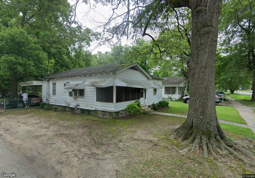
601 S Main St Dermott, AR 71638
Estimated Value: $44,604 - $66,000
Studio
1
Bath
948
Sq Ft
$59/Sq Ft
Est. Value
About This Home
This home is located at 601 S Main St, Dermott, AR 71638 and is currently estimated at $55,901, approximately $58 per square foot. 601 S Main St is a home located in Chicot County with nearby schools including Dermott Elementary School and Dermott High School.
Ownership History
Date
Name
Owned For
Owner Type
Purchase Details
Closed on
Jan 3, 2023
Sold by
Commissioner Of State Lands
Bought by
Freeman Lamarcus
Current Estimated Value
Purchase Details
Closed on
Jul 23, 2019
Sold by
Dana Dawnavan David Farm Inc
Bought by
Freeman Lamarcus
Purchase Details
Closed on
Jul 27, 2011
Sold by
Emerson Leroy and Emerson Rubye G
Bought by
Dana Dawnavan David Farm Inc
Purchase Details
Closed on
Mar 22, 2009
Sold by
Hellums Sue T
Bought by
Emerson Leroy and Emerson Rubye
Home Financials for this Owner
Home Financials are based on the most recent Mortgage that was taken out on this home.
Original Mortgage
$11,841
Interest Rate
5.14%
Purchase Details
Closed on
Sep 1, 1974
Bought by
Heirs
Create a Home Valuation Report for This Property
The Home Valuation Report is an in-depth analysis detailing your home's value as well as a comparison with similar homes in the area
Home Values in the Area
Average Home Value in this Area
Purchase History
| Date | Buyer | Sale Price | Title Company |
|---|---|---|---|
| Freeman Lamarcus | $604 | -- | |
| Freeman Lamarcus | $15,000 | Arkansas Southeast Title Inc | |
| Dana Dawnavan David Farm Inc | -- | -- | |
| Emerson Leroy | $15,000 | -- | |
| Heirs | -- | -- |
Source: Public Records
Mortgage History
| Date | Status | Borrower | Loan Amount |
|---|---|---|---|
| Previous Owner | Emerson Leroy | $11,841 |
Source: Public Records
Tax History
| Year | Tax Paid | Tax Assessment Tax Assessment Total Assessment is a certain percentage of the fair market value that is determined by local assessors to be the total taxable value of land and additions on the property. | Land | Improvement |
|---|---|---|---|---|
| 2025 | $227 | $3,360 | $380 | $2,980 |
| 2024 | $190 | $3,360 | $380 | $2,980 |
| 2023 | $151 | $2,670 | $380 | $2,290 |
| 2022 | $177 | $2,670 | $380 | $2,290 |
| 2021 | $177 | $2,670 | $380 | $2,290 |
| 2020 | $151 | $2,670 | $380 | $2,290 |
| 2019 | $168 | $2,670 | $380 | $2,290 |
| 2018 | $153 | $2,320 | $220 | $2,100 |
| 2017 | $131 | $2,320 | $220 | $2,100 |
| 2016 | $151 | $2,320 | $220 | $2,100 |
| 2015 | -- | $2,320 | $220 | $2,100 |
| 2014 | -- | $2,320 | $220 | $2,100 |
| 2013 | -- | $2,320 | $220 | $2,100 |
Source: Public Records
Map
Nearby Homes
- 0 0 Unit N Norwood St
- 221 School Dr
- 305 N School St
- Lot 7 W Ash St
- 604 E Howard St
- 1104 Chicot Dr
- 407 N Shepherd St
- 0 N Trotter St
- Lot 6 N Knox St
- 0 Wolfe St
- Lots 10-11 Wolfe St
- 0 E Hickory St
- Lot 1 N Hardy St
- 0 N Main St
- Lot 6 N Alma St
- Lot 7 N Wolf St
- Lot 5 Deer St
- 904 Elk St
- Lot 12 W Mulberry St
- 0 W Mulberry St
Your Personal Tour Guide
Ask me questions while you tour the home.