A
Seller's Agent in 2026
Alice Riviere
Cobblestone Realty, Inc.
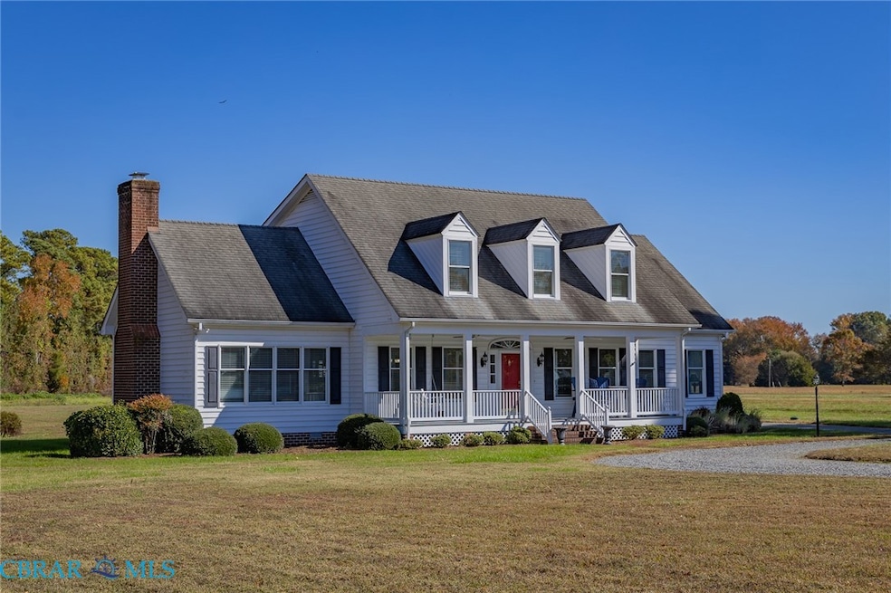
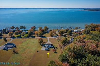
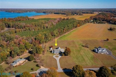


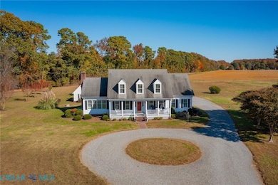
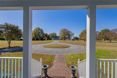
Located in the desirable Cedar Pointe community, this well maintained 4 bedroom, 4.5-bath home sits on over 2 acres and boasts Rappahannock River views from the front porch. In addition to over 2,800 sq ft of living space in the home, the oversized two car detached garage includes a 450 sq ft second floor finished space and full bath. The home boasts a spacious living room with gas fireplace, a formal dining room, an office/library, a separate laundry room with outside access and an oversized eat-in kitchen that includes a large center island and plenty of room for "multiple cooks in the kitchen." The main level primary suite includes a spa-style soaking tub, double vanity, walk-in shower and 2 walk in closets. Upstairs, 3 additional bedrooms provide comfort and privacy. One second floor bedroom includes an ensuite bath, large walk in closet and access to a huge storage space. The other second floor bedrooms also have walk in closets and share a full hall bath. The oversized garage is accessible by a covered breezeway and adjoins a back deck and patio off the home. A small conditioned shed on the property makes for a perfect exercise room. Just minutes from Kilmarnock, Irvington, and White Stone this home - priced below current assessment - is a rare opportunity to enjoy the best of Virginia’s Northern Neck.
Last Agent to Sell the Property
Alice Riviere
Cobblestone Realty, Inc. License #0225194069 Listed on: 11/06/2025
Last Buyer's Agent
Kathleen Dew
IsaBell K. Horsley Real Estate License #0225078297
| Date | Type | Sale Price | Title Company |
|---|---|---|---|
| Deed | $630,000 | Old Republic National Title | |
| Special Warranty Deed | $503,000 | Attorney | |
| Interfamily Deed Transfer | -- | None Available | |
| Warranty Deed | $380,000 | -- |
| Date | Status | Loan Amount | Loan Type |
|---|---|---|---|
| Open | $380,000 | New Conventional | |
| Previous Owner | $325,000 | New Conventional |
| Date | Event | Price | List to Sale | Price per Sq Ft |
|---|---|---|---|---|
| 03/09/2026 03/09/26 | Sold | $630,000 | 0.0% | $220 / Sq Ft |
| 01/15/2026 01/15/26 | Pending | -- | -- | -- |
| 11/06/2025 11/06/25 | For Sale | $629,900 | -- | $220 / Sq Ft |
| Year | Tax Paid | Tax Assessment Tax Assessment Total Assessment is a certain percentage of the fair market value that is determined by local assessors to be the total taxable value of land and additions on the property. | Land | Improvement |
|---|---|---|---|---|
| 2025 | $3,830 | $696,300 | $51,600 | $644,700 |
| 2024 | $3,830 | $696,300 | $51,600 | $644,700 |
| 2023 | $2,562 | $406,600 | $51,600 | $355,000 |
| 2022 | $2,562 | $406,600 | $51,600 | $355,000 |
| 2021 | $2,562 | $406,600 | $51,600 | $355,000 |
| 2020 | $2,562 | $406,600 | $51,600 | $355,000 |
| 2019 | $2,562 | $406,600 | $51,600 | $355,000 |
| 2018 | $2,191 | $371,400 | $53,400 | $318,000 |
| 2017 | $2,191 | $371,400 | $53,400 | $318,000 |
| 2016 | -- | $371,400 | $53,400 | $318,000 |
| 2014 | -- | $0 | $0 | $0 |
| 2013 | -- | $0 | $0 | $0 |
A
Seller's Agent in 2026
Alice Riviere
Cobblestone Realty, Inc.
K
Buyer's Agent in 2026
Kathleen Dew
IsaBell K. Horsley Real Estate
Source: Chesapeake Bay & Rivers Association of REALTORS®
MLS Number: 202500226
APN: 32A-1-31
Ask me questions while you tour the home.