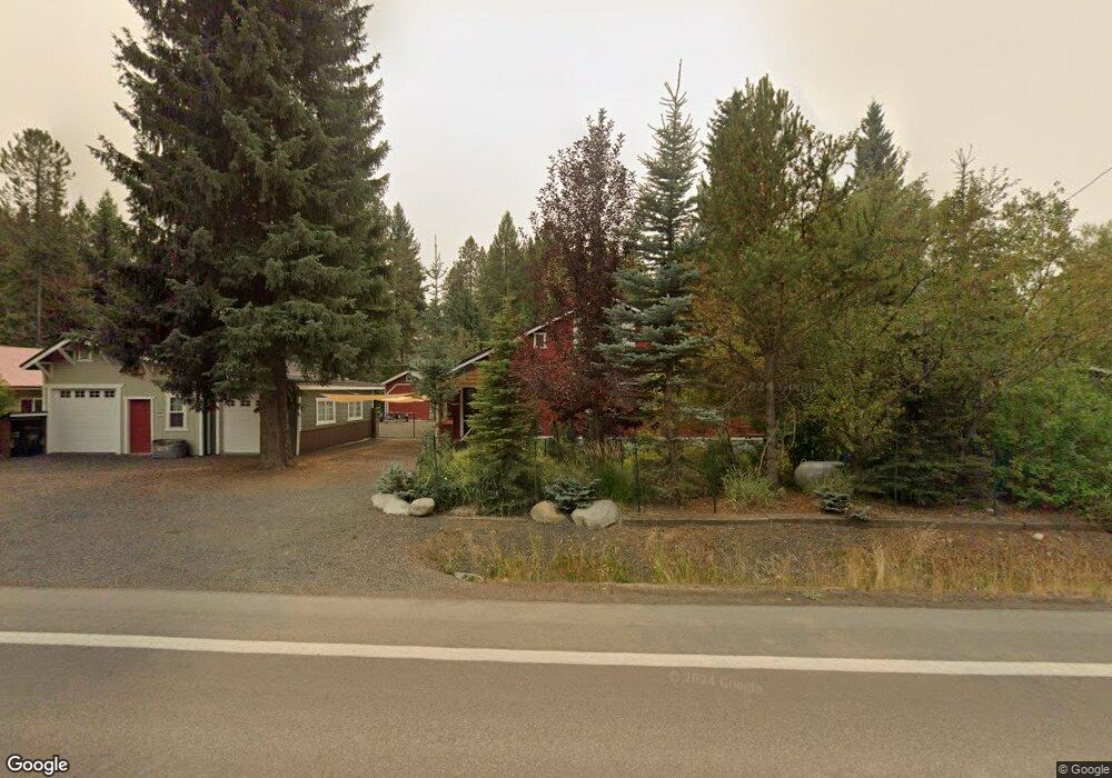
602 Thompson Ave McCall, ID 83638
Estimated Value: $696,000 - $743,000
3
Beds
1
Bath
1,868
Sq Ft
$383/Sq Ft
Est. Value
About This Home
This home is located at 602 Thompson Ave, McCall, ID 83638 and is currently estimated at $715,404, approximately $382 per square foot. 602 Thompson Ave is a home with nearby schools including McCall-Donnelly High School, Mountain Life Education, and McCall Adventist Christian School.
Ownership History
Date
Name
Owned For
Owner Type
Purchase Details
Closed on
Oct 8, 2025
Sold by
Price Emmett C
Bought by
Price Emmett M and Price Karin M
Current Estimated Value
Purchase Details
Closed on
Sep 15, 2025
Sold by
Hormaechea Carmen and Hormaechea Michael
Bought by
Hormaechea Michael
Purchase Details
Closed on
Jul 26, 2024
Sold by
Price Emmett M and Price Karin M
Bought by
Price Family Revocable Trust and Price
Create a Home Valuation Report for This Property
The Home Valuation Report is an in-depth analysis detailing your home's value as well as a comparison with similar homes in the area
Home Values in the Area
Average Home Value in this Area
Purchase History
| Date | Buyer | Sale Price | Title Company |
|---|---|---|---|
| Price Emmett M | -- | None Listed On Document | |
| Hormaechea Michael | -- | Title One | |
| Price Family Revocable Trust | -- | None Listed On Document | |
| Price Emmett M | -- | None Listed On Document |
Source: Public Records
Tax History
| Year | Tax Paid | Tax Assessment Tax Assessment Total Assessment is a certain percentage of the fair market value that is determined by local assessors to be the total taxable value of land and additions on the property. | Land | Improvement |
|---|---|---|---|---|
| 2025 | $2,663 | $584,654 | $254,649 | $330,005 |
| 2023 | $2,663 | $578,695 | $268,051 | $310,644 |
| 2022 | $2,729 | $545,830 | $293,787 | $252,043 |
| 2021 | $2,786 | $360,704 | $82,422 | $278,282 |
| 2020 | $3,066 | $350,455 | $89,409 | $261,046 |
| 2019 | $3,130 | $327,507 | $80,523 | $246,984 |
| 2018 | $3,122 | $299,929 | $77,206 | $222,723 |
| 2017 | $3,261 | $293,839 | $77,206 | $216,633 |
| 2016 | $2,992 | $270,782 | $65,899 | $204,883 |
| 2015 | $940 | $253,342 | $0 | $0 |
Source: Public Records
Map
Nearby Homes
- 697 N Samson Trail Unit 7
- 699 N Samson Trail Unit 5
- 697 N Samson Trail
- 699 N Samson Trail
- 911 Davis Ave
- TBD Divot Ln Unit 4
- 703 Wooley Ave
- 615 Syringa Dr
- 324 Sunshine
- 616 N 3rd St Unit 304
- 616 N 3rd St Unit 211
- 616 N 3rd St Unit 215
- 707 Bridle Path Way
- 601 Hemlock St Unit 10
- Lot 1 Springer Ct Unit 1
- Lot 1 Springer Ct
- 715 Spruce St
- 609 Blue Water Cir
- 622 Blue Water Cir
- 1345 Divot Ln
- 604 Thompson Ave
- 908 Ann St
- 593 Thompson Ave
- 595 Thompson Ave Unit 102
- 595 Thompson Ave Unit 101
- 595 Thompson Ave Unit 201
- 595 Thompson Ave Unit 202
- 595 Thompson Ave
- 597 Thompson Ave Unit 102
- 597 Thompson Ave Unit 202
- 597 Thompson Ave Unit 101
- 597 Thompson Ave
- 597 Thompson Ave
- 906 Ann St
- 599 Thompson Ave Unit 201
- 599 Thompson Ave Unit 102
- 599 Thompson Ave Unit 202
- 599 Thompson Ave Unit 101
- 599 Thompson Ave
- 606 Thompson Ave
Your Personal Tour Guide
Ask me questions while you tour the home.