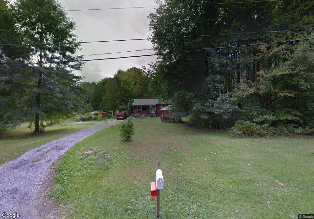
6022 Mount Everett Rd Hubbard, OH 44425
Estimated Value: $134,144 - $186,000
3
Beds
1
Bath
1,040
Sq Ft
$155/Sq Ft
Est. Value
About This Home
This home is located at 6022 Mount Everett Rd, Hubbard, OH 44425 and is currently estimated at $160,786, approximately $154 per square foot. 6022 Mount Everett Rd is a home located in Trumbull County with nearby schools including Hubbard Elementary School, Hubbard Middle School, and Hubbard High School.
Ownership History
Date
Name
Owned For
Owner Type
Purchase Details
Closed on
Jan 22, 2004
Sold by
Cataline James A and Cataline Justine A
Bought by
Cataline James J
Current Estimated Value
Home Financials for this Owner
Home Financials are based on the most recent Mortgage that was taken out on this home.
Original Mortgage
$64,000
Outstanding Balance
$29,951
Interest Rate
5.91%
Mortgage Type
New Conventional
Estimated Equity
$130,835
Purchase Details
Closed on
Jan 1, 1990
Bought by
James A Cataline
Create a Home Valuation Report for This Property
The Home Valuation Report is an in-depth analysis detailing your home's value as well as a comparison with similar homes in the area
Home Values in the Area
Average Home Value in this Area
Purchase History
| Date | Buyer | Sale Price | Title Company |
|---|---|---|---|
| Cataline James J | $80,000 | Lawyers Title | |
| James A Cataline | -- | -- |
Source: Public Records
Mortgage History
| Date | Status | Borrower | Loan Amount |
|---|---|---|---|
| Open | Cataline James J | $64,000 |
Source: Public Records
Tax History
| Year | Tax Paid | Tax Assessment Tax Assessment Total Assessment is a certain percentage of the fair market value that is determined by local assessors to be the total taxable value of land and additions on the property. | Land | Improvement |
|---|---|---|---|---|
| 2024 | $2,007 | $35,180 | $13,830 | $21,350 |
| 2023 | $2,009 | $35,180 | $13,830 | $21,350 |
| 2022 | $1,928 | $30,070 | $12,950 | $17,120 |
| 2021 | $1,937 | $30,070 | $12,950 | $17,120 |
| 2020 | $1,944 | $30,070 | $12,950 | $17,120 |
| 2019 | $1,836 | $26,890 | $12,010 | $14,880 |
| 2018 | $1,782 | $26,890 | $12,010 | $14,880 |
| 2017 | $1,777 | $26,890 | $12,010 | $14,880 |
| 2016 | $1,670 | $26,500 | $12,010 | $14,490 |
| 2015 | $1,676 | $26,500 | $12,010 | $14,490 |
| 2014 | $1,644 | $26,500 | $12,010 | $14,490 |
| 2013 | $1,641 | $26,500 | $12,010 | $14,490 |
Source: Public Records
Map
Nearby Homes
- 5950 Mount Everett Rd
- 2675 Seifert-Lewis Rd
- 0 Lakeview Dr Unit 5191346
- 0 Lakeview Dr Unit 5191352
- 0 Lakeview Dr Unit 5191342
- 0 Lakeview Dr Unit 5191347
- 0 Lakeview Dr Unit 5191335
- 0 Lakeview Dr Unit 5191338
- 0 Lakeview Dr Unit 5191326
- 0 Lakeview Dr Unit 5191349
- 5910 Chestnut Ridge Rd
- 256 Warner Rd
- 240 Warner Rd
- 2829 Tibbetts Wick Rd
- 911 Dogwood Dr SE
- 3267 Bell Wick Rd
- 60 Warner Rd
- 132 Drummond Ave
- 330 Myron St Unit 3
- 0 Appaloosa Ln
- 6000 Mount Everett Rd
- 2489 Anthony Cir
- 6052 Mount Everett Rd
- 5990 Mount Everett Rd
- 2501 Anthony Cir
- 5970 Mount Everett Rd
- 2515 Anthony Cir
- 6068 Mount Everett Rd
- 2488 Anthony Cir
- 5960 Mount Everett Rd
- 2510 Anthony Cir
- 2525 Anthony Cir
- 2497 Anthony Cir
- 2497 Anthony Cir
- 5943 Mount Everett Rd
- 2505 Anthony Cir
- 2535 Anthony Cir
- 5939 Mount Everett Rd
- 0 Anthony Cir
- 6106 Mount Everett Rd
Your Personal Tour Guide
Ask me questions while you tour the home.