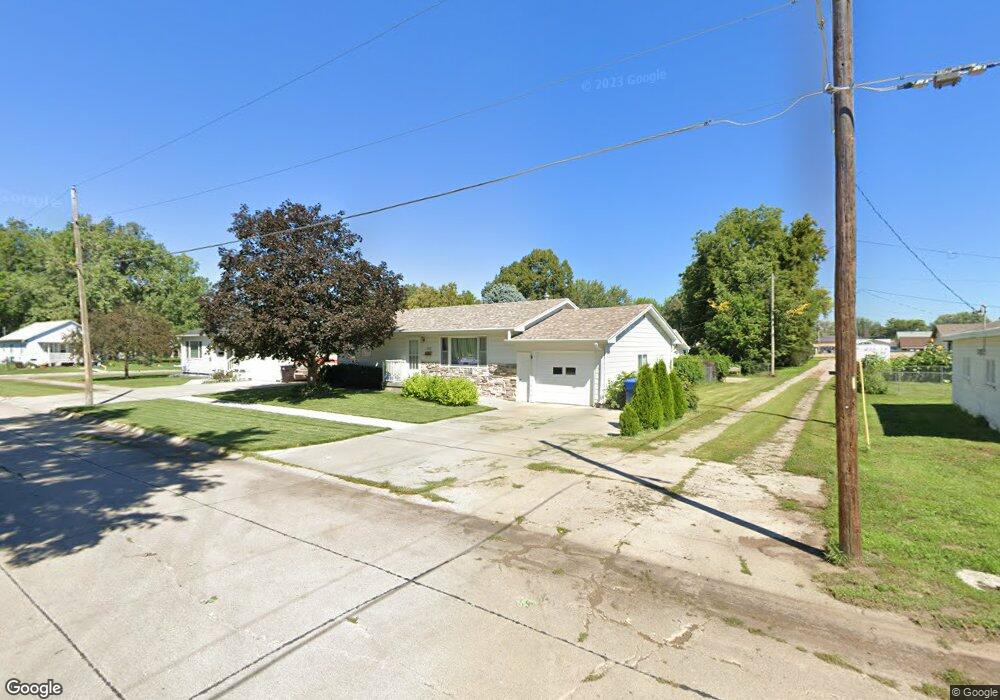
603 E Phillip Ave Norfolk, NE 68701
Estimated Value: $198,000 - $261,000
About This Home
This home is located at 603 E Phillip Ave, Norfolk, NE 68701 and is currently estimated at $228,560, approximately $219 per square foot. 603 E Phillip Ave is a home located in Madison County with nearby schools including Norfolk Senior High School, Keystone Christian Academy, and Christ Lutheran School.
Ownership History
We collect this data history from publicly available records. To have your information removed, we recommend requesting removal directly through your county’s website.
Purchase Details
Home Financials for this Owner
Home Financials are based on the most recent Mortgage that was taken out on this home.Home Values in the Area
Average Home Value in this Area
Purchase History
We collect this data history from publicly available records. To have your information removed, we recommend requesting removal directly through your county’s website.
| Date | Buyer | Sale Price | Title Company |
|---|---|---|---|
| $90,500 | -- |
Mortgage History
We collect this data history from publicly available records. To have your information removed, we recommend requesting removal directly through your county’s website.
| Date | Status | Borrower | Loan Amount |
|---|---|---|---|
| Closed | $92,800 |
Tax History
We collect this data history from publicly available records. To have your information removed, we recommend requesting removal directly through your county’s website.
| Year | Tax Paid | Tax Assessment Tax Assessment Total Assessment is a certain percentage of the fair market value that is determined by local assessors to be the total taxable value of land and additions on the property. | Land | Improvement |
|---|---|---|---|---|
| 2025 | $2,340 | $200,411 | $10,991 | $189,420 |
| 2024 | $2,314 | $186,380 | $10,991 | $175,389 |
| 2023 | $3,178 | $171,898 | $10,991 | $160,907 |
| 2022 | $2,867 | $154,658 | $10,991 | $143,667 |
| 2021 | $2,642 | $142,796 | $10,991 | $131,805 |
| 2020 | $2,433 | $131,913 | $10,991 | $120,922 |
| 2019 | $2,329 | $121,929 | $10,991 | $110,938 |
| 2018 | $2,264 | $120,495 | $9,557 | $110,938 |
| 2017 | $2,019 | $107,362 | $8,310 | $99,052 |
| 2016 | $1,891 | $100,338 | $7,766 | $92,572 |
| 2015 | $1,891 | $100,338 | $7,766 | $92,572 |
| 2014 | $1,862 | $95,930 | $7,766 | $88,164 |
| 2013 | $1,807 | $90,162 | $7,766 | $82,396 |
Map
- 800 S Chestnut St
- 205 S Pine St
- 514 Shannon Dr
- 507 Shannon Dr
- 403 E Norfolk Ave
- 301 Domar Dr
- 304 Blaine St
- 507 E Nebraska Ave
- 207 N Cottonwood St
- 802 S Chestnut St
- 400 S 1st St
- 408 S 1st St
- 404 S 1st St
- 406 S 1st St
- 711 Walnut Cir
- 209 E Klug Ave
- 0.26 acres Dopheides Subdivision Lot 3
- 701 S 2nd St
- 406 N 1st St
- 919 S Pine St
- 601 E Phillip Ave
- 207 S Hickory St
- 210 S Boxelder St
- 206 S Boxelder St
- 205 S Hickory St
- 602 E Phillip Ave
- 600 E Phillip Ave
- 606 E Phillip Ave
- 204 S Boxelder St
- 608 E Phillip Ave
- 214 S Hickory St
- 202 S Boxelder St
- 303 S Hickory St
- 209 S Boxelder St
- 206 S Hickory St
- 201 S Hickory St
- 304 S Boxelder St
- 204 S Hickory St
- 301 S Boxelder St
- 305 S Hickory St
Ask me questions while you tour the home.