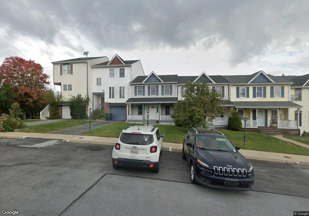
604 Knightsbridge Dr Hagerstown, MD 21740
South End NeighborhoodEstimated Value: $223,000 - $257,000
3
Beds
2
Baths
1,322
Sq Ft
$182/Sq Ft
Est. Value
About This Home
This home is located at 604 Knightsbridge Dr, Hagerstown, MD 21740 and is currently estimated at $240,761, approximately $182 per square foot. 604 Knightsbridge Dr is a home located in Washington County with nearby schools including Emma K. Doub Elementary School, E. Russell Hicks Middle School, and South Hagerstown High School.
Ownership History
Date
Name
Owned For
Owner Type
Purchase Details
Closed on
Nov 30, 2010
Sold by
Harmon Patti Lynn
Bought by
Frey Vanessa
Current Estimated Value
Home Financials for this Owner
Home Financials are based on the most recent Mortgage that was taken out on this home.
Original Mortgage
$99,750
Outstanding Balance
$65,903
Interest Rate
4.22%
Mortgage Type
New Conventional
Estimated Equity
$174,858
Purchase Details
Closed on
Aug 6, 1999
Sold by
Armon Stephen L and Armon Patti L
Bought by
Lynn Harmon Patti
Purchase Details
Closed on
Jan 19, 1993
Sold by
Kenly Farms Ptsp
Bought by
Harmon Stephen L and Harmon Patti L
Home Financials for this Owner
Home Financials are based on the most recent Mortgage that was taken out on this home.
Original Mortgage
$74,059
Interest Rate
8.04%
Create a Home Valuation Report for This Property
The Home Valuation Report is an in-depth analysis detailing your home's value as well as a comparison with similar homes in the area
Home Values in the Area
Average Home Value in this Area
Purchase History
| Date | Buyer | Sale Price | Title Company |
|---|---|---|---|
| Frey Vanessa | $105,000 | -- | |
| Lynn Harmon Patti | -- | -- | |
| Harmon Stephen L | $72,900 | -- |
Source: Public Records
Mortgage History
| Date | Status | Borrower | Loan Amount |
|---|---|---|---|
| Open | Frey Vanessa | $99,750 | |
| Previous Owner | Harmon Stephen L | $74,059 |
Source: Public Records
Tax History
| Year | Tax Paid | Tax Assessment Tax Assessment Total Assessment is a certain percentage of the fair market value that is determined by local assessors to be the total taxable value of land and additions on the property. | Land | Improvement |
|---|---|---|---|---|
| 2025 | $1,206 | $149,600 | $30,000 | $119,600 |
| 2024 | $1,206 | $139,467 | $0 | $0 |
| 2023 | $1,145 | $129,333 | $0 | $0 |
| 2022 | $1,086 | $119,200 | $30,000 | $89,200 |
| 2021 | $1,024 | $114,600 | $0 | $0 |
| 2020 | $1,024 | $110,000 | $0 | $0 |
| 2019 | $985 | $105,400 | $30,000 | $75,400 |
| 2018 | $961 | $102,733 | $0 | $0 |
| 2017 | $936 | $100,067 | $0 | $0 |
| 2016 | -- | $97,400 | $0 | $0 |
| 2015 | -- | $97,400 | $0 | $0 |
| 2014 | $2,067 | $97,400 | $0 | $0 |
Source: Public Records
Map
Nearby Homes
- 1034 202 Brinker Dr Unit 202
- 0 Kenly Ave
- 925 Frederick St
- 920 Frederick St
- 12.3 AC Southern Blvd
- 1227 Grand Legacy Dr
- 1240 Grand Legacy Dr
- 1217 S Pointe Dr
- 904 Kuhn Ave
- 341 Winding Oak Dr
- 307 Winding Oak Dr
- 229 S Fork Dr
- 1024 Pope Ave
- 112 Plantation Dr
- 122 Southern Oak Dr
- 1058 S Potomac St
- 1 W Wilson Blvd
- 115 Sunflower Dr
- 603 Frederick St
- 3 E Chestnut St
- 602 Knightsbridge Dr
- 608 Knightsbridge Dr
- 600 Knightsbridge Dr
- 610 Knightsbridge Dr
- 612 Knightsbridge Dr
- 614 Knightsbridge Dr
- 616 Knightsbridge Dr
- 618 Knightsbridge Dr
- 607 Knightsbridge Dr
- 620 Knightsbridge Dr
- 603 Knightsbridge Dr
- 609 Knightsbridge Dr
- 601 Knightsbridge Dr
- 1022 Brinker Dr Unit 101
- 1022 Brinker Dr Unit 201
- 1022 Brinker Dr Unit 302
- 1022 Brinker Dr Unit 301
- 1022 Brinker Dr Unit 102
- 1022 Brinker Dr Unit 202
- 1022 Brinker Dr
Your Personal Tour Guide
Ask me questions while you tour the home.