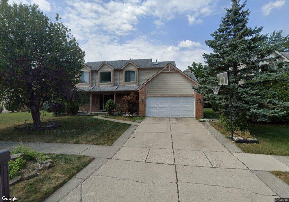
604 Stonehenge Dr Canton, MI 48188
Estimated Value: $419,000 - $461,000
Studio
3
Baths
2,152
Sq Ft
$206/Sq Ft
Est. Value
About This Home
This home is located at 604 Stonehenge Dr, Canton, MI 48188 and is currently estimated at $443,767, approximately $206 per square foot. 604 Stonehenge Dr is a home located in Wayne County with nearby schools including Canton High School, Salem High School, and Plymouth High School.
Ownership History
Date
Name
Owned For
Owner Type
Purchase Details
Closed on
Jun 4, 2013
Sold by
Raza Mohammad Abid
Bought by
Raza Mohammad Abid and Raza Tasneem Aisha
Current Estimated Value
Home Financials for this Owner
Home Financials are based on the most recent Mortgage that was taken out on this home.
Original Mortgage
$172,000
Outstanding Balance
$38,483
Interest Rate
3.43%
Mortgage Type
New Conventional
Estimated Equity
$405,284
Purchase Details
Closed on
Sep 26, 2012
Sold by
The 604 Stonehenge Trust
Bought by
Raza Mohammad Abid
Purchase Details
Closed on
May 15, 2003
Sold by
Northgrave Randall B and Northgrave Catherine M
Bought by
Samad Trust Llc and 604 Stonehenge Trust
Purchase Details
Closed on
Apr 13, 1994
Sold by
Gerish & Cook Dev Co
Bought by
Gerish Const Co
Create a Home Valuation Report for This Property
The Home Valuation Report is an in-depth analysis detailing your home's value as well as a comparison with similar homes in the area
Home Values in the Area
Average Home Value in this Area
Purchase History
| Date | Buyer | Sale Price | Title Company |
|---|---|---|---|
| Raza Mohammad Abid | -- | Crossroads Title Agency | |
| Raza Mohammad Abid | -- | None Available | |
| Samad Trust Llc | $280,000 | Greatland Title | |
| Gerish Const Co | $39,000 | -- |
Source: Public Records
Mortgage History
| Date | Status | Borrower | Loan Amount |
|---|---|---|---|
| Open | Raza Mohammad Abid | $172,000 |
Source: Public Records
Tax History
| Year | Tax Paid | Tax Assessment Tax Assessment Total Assessment is a certain percentage of the fair market value that is determined by local assessors to be the total taxable value of land and additions on the property. | Land | Improvement |
|---|---|---|---|---|
| 2025 | $2,270 | $215,200 | $0 | $0 |
| 2024 | $2,205 | $204,400 | $0 | $0 |
| 2023 | $2,102 | $176,100 | $0 | $0 |
| 2022 | $4,641 | $156,800 | $0 | $0 |
| 2021 | $4,506 | $155,000 | $0 | $0 |
| 2020 | $4,404 | $152,700 | $0 | $0 |
| 2019 | $3,594 | $115,530 | $0 | $0 |
| 2018 | $1,787 | $129,660 | $0 | $0 |
| 2017 | $4,414 | $128,000 | $0 | $0 |
| 2016 | $3,938 | $129,100 | $0 | $0 |
| 2015 | $9,817 | $104,990 | $0 | $0 |
| 2013 | $9,914 | $99,140 | $0 | $0 |
| 2010 | -- | $103,500 | $47,721 | $55,779 |
Source: Public Records
Map
Nearby Homes
- 41587 Pheasant Creek Dr
- 41226 Southwind Dr Unit 138
- 41128 Northwind Dr Unit 28
- 41058 Southwind Dr Unit 116
- 41009 Southwind Dr Unit 108
- 923 Kings Way
- 42020 Hystone St
- 42610 Beechwood Dr
- 42789 Lilley Pointe Dr Unit 146
- 42216 Metaline Dr
- 569 Worthington Rd
- 42739 Lilley Pointe Dr Unit 119
- 352 Cherry Hill Pointe Dr Unit 33
- 0 Cherry Hill Unit 16924
- 41271 N Maplewood Dr Unit 54
- 41567 Glade Rd Unit 20
- 42486 Saltz Rd
- 1399 Copeland Cir
- 41535 Bedford Dr Unit 18
- 446 Cherry Stone Dr Unit 54
- 576 Stonehenge Dr
- 662 Stonehenge Dr
- 647 Sutten Dr
- 639 Sutten Dr
- 544 Stonehenge Dr
- 657 Sutten Dr
- 629 Sutten Dr
- 605 Stonehenge Dr
- 665 Sutten Dr
- 672 Stonehenge Dr
- 591 Stonehenge Dr
- 621 Sutten Dr
- 651 Stonehenge Dr
- 512 Stonehenge Dr
- 661 Stonehenge Dr
- 543 Stonehenge Dr
- 675 Sutten Dr
- 611 Sutten Dr
- 682 Stonehenge Dr
- 671 Stonehenge Dr
Your Personal Tour Guide
Ask me questions while you tour the home.