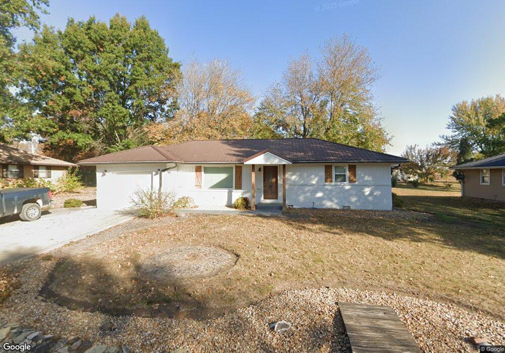
604 Virginia Ln Adrian, MO 64720
Estimated Value: $170,166 - $208,000
2
Beds
--
Bath
1,234
Sq Ft
$152/Sq Ft
Est. Value
About This Home
This home is located at 604 Virginia Ln, Adrian, MO 64720 and is currently estimated at $188,042, approximately $152 per square foot. 604 Virginia Ln is a home with nearby schools including Adrian R-III Elementary School and Adrian R-III Middle/High School.
Ownership History
Date
Name
Owned For
Owner Type
Purchase Details
Closed on
Sep 24, 2024
Sold by
Morrow Brian G
Bought by
Morrow Keenan T
Current Estimated Value
Home Financials for this Owner
Home Financials are based on the most recent Mortgage that was taken out on this home.
Original Mortgage
$194,000
Outstanding Balance
$191,252
Interest Rate
6.47%
Mortgage Type
New Conventional
Estimated Equity
-$3,210
Purchase Details
Closed on
Jun 20, 2023
Sold by
Petty Peggy
Bought by
Morrow Brian G and County Of Cass State Of Missouri
Home Financials for this Owner
Home Financials are based on the most recent Mortgage that was taken out on this home.
Original Mortgage
$136,000
Interest Rate
6.35%
Mortgage Type
New Conventional
Purchase Details
Closed on
Jun 6, 2019
Sold by
Petty Peggy
Bought by
Morrow Brian G
Home Financials for this Owner
Home Financials are based on the most recent Mortgage that was taken out on this home.
Original Mortgage
$80,000
Interest Rate
4%
Mortgage Type
Purchase Money Mortgage
Create a Home Valuation Report for This Property
The Home Valuation Report is an in-depth analysis detailing your home's value as well as a comparison with similar homes in the area
Purchase History
| Date | Buyer | Sale Price | Title Company |
|---|---|---|---|
| Morrow Keenan T | -- | None Listed On Document | |
| Morrow Brian G | $180,880 | None Listed On Document | |
| Morrow Brian G | $100,000 | -- |
Source: Public Records
Mortgage History
| Date | Status | Borrower | Loan Amount |
|---|---|---|---|
| Open | Morrow Keenan T | $194,000 | |
| Previous Owner | Morrow Brian G | $136,000 | |
| Previous Owner | Morrow Brian G | $80,000 |
Source: Public Records
Tax History
| Year | Tax Paid | Tax Assessment Tax Assessment Total Assessment is a certain percentage of the fair market value that is determined by local assessors to be the total taxable value of land and additions on the property. | Land | Improvement |
|---|---|---|---|---|
| 2025 | $822 | $14,570 | $0 | $0 |
| 2024 | $8 | $12,840 | $0 | $0 |
| 2023 | $823 | $12,840 | $0 | $0 |
| 2022 | $830 | $12,860 | $0 | $0 |
| 2020 | $802 | $12,860 | $0 | $0 |
| 2019 | $801 | $12,860 | $0 | $0 |
| 2018 | $801 | $12,860 | $0 | $0 |
| 2017 | $788 | $12,860 | $0 | $0 |
| 2016 | $680 | $12,810 | $0 | $0 |
| 2015 | -- | $12,520 | $0 | $0 |
| 2013 | -- | $65,900 | $0 | $0 |
Source: Public Records
Map
Nearby Homes
- 1005 N Old Highway 71 N A
- 1011 N Old Highway 71 N A
- 914 Edith Ave
- 321 E 7th St
- 422 NE Lakota Dr
- 104 E 8th St
- 604 N Kentucky St
- 32 E 7th St
- 30 E 7th St
- 542 N West Lexington St
- 10009 NE County Road 13004
- 124 W 5th St
- 13263A NE County Road 23 N A
- 120 W 3rd St
- 317 S Kentucky St
- 233 W 5th St
- 304 N Mulberry St
- 19 Skyline Dr
- 13 Skyline Dr
- 0 NW County Road 1001
- TBD Lot 20 Virginia Ln
- TBD Lot 23 Virginia Ln
- TBD Lot 22 Virginia Ln
- 602 Virginia Ln
- 606 Virginia Ln
- 601 Mae Ln
- 603 Virginia Ln
- 603 Mae Ln
- 803 N Old Highway 71
- 805 N Old Highway 71
- 604 Mae Ln
- 830 N Old Highway 71
- 715 N Old Highway 71
- 915 N Old Highway 71
- 830 N Old 71 Hwy
- 920 N Old Highway 71
- 603 Nancy Ln
- 930 N Old Highway 71
- 540 E 8th St
- 1001 N Old Highway 71
Your Personal Tour Guide
Ask me questions while you tour the home.