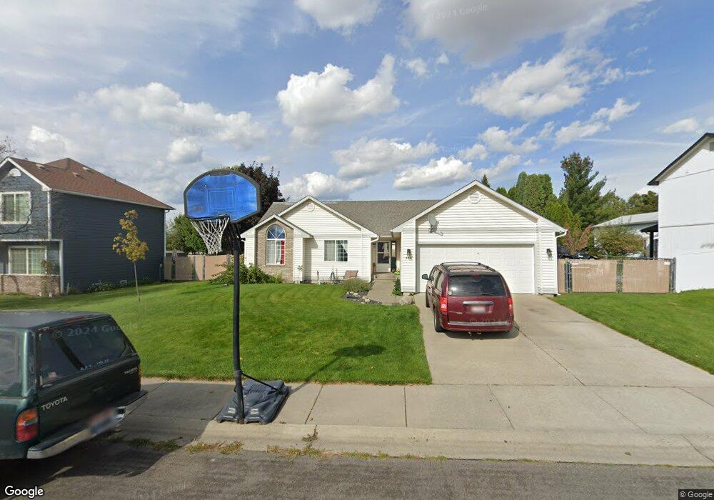
604 W Colt Ln Post Falls, ID 83854
Central Post Falls NeighborhoodEstimated Value: $422,000 - $457,000
3
Beds
2
Baths
1,422
Sq Ft
$310/Sq Ft
Est. Value
About This Home
This home is located at 604 W Colt Ln, Post Falls, ID 83854 and is currently estimated at $440,453, approximately $309 per square foot. 604 W Colt Ln is a home located in Kootenai County with nearby schools including Mullan Trail Elementary School, River City Middle School, and Post Falls High School.
Ownership History
Date
Name
Owned For
Owner Type
Purchase Details
Closed on
Aug 4, 2009
Sold by
Streeter Clifford J and Helseth Debbie D
Bought by
Lange Jared and Lange Amanda
Current Estimated Value
Home Financials for this Owner
Home Financials are based on the most recent Mortgage that was taken out on this home.
Original Mortgage
$164,900
Outstanding Balance
$116,802
Interest Rate
5.37%
Mortgage Type
USDA
Estimated Equity
$323,651
Create a Home Valuation Report for This Property
The Home Valuation Report is an in-depth analysis detailing your home's value as well as a comparison with similar homes in the area
Home Values in the Area
Average Home Value in this Area
Purchase History
We collect this data history from publicly available records. To have your information removed, we recommend requesting removal directly through your county’s website.
| Date | Buyer | Sale Price | Title Company |
|---|---|---|---|
| Lange Jared | -- | -- |
Source: Public Records
Mortgage History
We collect this data history from publicly available records. To have your information removed, we recommend requesting removal directly through your county’s website.
| Date | Status | Borrower | Loan Amount |
|---|---|---|---|
| Open | Lange Jared | $164,900 |
Source: Public Records
Tax History
| Year | Tax Paid | Tax Assessment Tax Assessment Total Assessment is a certain percentage of the fair market value that is determined by local assessors to be the total taxable value of land and additions on the property. | Land | Improvement |
|---|---|---|---|---|
| 2025 | $1,571 | $412,950 | $198,000 | $214,950 |
| 2024 | $1,508 | $391,890 | $132,000 | $259,890 |
| 2023 | $1,508 | $417,093 | $165,000 | $252,093 |
| 2022 | $2,078 | $458,676 | $165,000 | $293,676 |
| 2021 | $1,824 | $302,290 | $110,000 | $192,290 |
| 2020 | $1,748 | $250,160 | $80,000 | $170,160 |
| 2019 | $1,451 | $211,250 | $85,000 | $126,250 |
| 2018 | $1,374 | $190,220 | $75,000 | $115,220 |
| 2017 | $1,324 | $167,630 | $55,000 | $112,630 |
| 2016 | $1,310 | $156,850 | $50,000 | $106,850 |
| 2015 | $1,244 | $145,980 | $44,000 | $101,980 |
| 2013 | $1,143 | $123,380 | $32,000 | $91,380 |
Source: Public Records
Map
Nearby Homes
- 2413 N Stagecoach Dr
- 2615 N Rawhide Ridge Rd
- 2740 N Rawhide Ridge Rd
- 215 W Chippewa Dr
- 2615 N Wickiup Dr
- 2207 N Stagecoach Dr
- 2578 N Bradley Ct
- 3262 Woodford
- 3264 Van Winkle St
- 2247 N Sockeye Dr
- 940 W Wayward Cir
- 3283 N Knob Creek Ct
- 2531 N Titleist Way
- 3393 N Coleman St
- 957 W Kalama Dr
- 2109 N Lucas St
- 3495 Carriage Ct
- 3351 N Blaze Loop
- 109 W Tennessee Ave
- 3596 Blaze Loop
- 602 W Colt Ln
- 606 W Colt Ln
- 617 W Lariat Ct
- 608 W Colt Ln
- 615 W Lariat Ct
- 508 W Colt Ln
- 601 W Colt Ln
- 603 Colt Ln
- 603 W Colt Ln
- 619 W Lariat Ct
- 2303 N Rawhide Ridge Rd
- 613 W Lariat Ct
- 2515 Stagecoach Dr
- 2511 N Stagecoach Dr
- 2512 N Rawhide Ridge Rd
- 2510 N Rawhide Ridge Rd
- 2306 N Rawhide Ridge Rd
- 2535 Stagecoach Dr
- 2305 N Rawhide Ridge Rd
- 2514 N Rawhide Ridge Rd
Your Personal Tour Guide
Ask me questions while you tour the home.