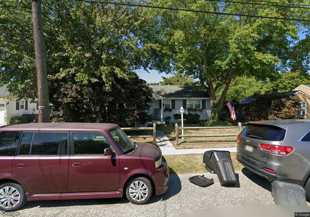
604 Wilson Ave Cape May, NJ 08204
Estimated Value: $433,152 - $892,000
Studio
--
Bath
1,331
Sq Ft
$480/Sq Ft
Est. Value
About This Home
This home is located at 604 Wilson Ave, Cape May, NJ 08204 and is currently estimated at $639,538, approximately $480 per square foot. 604 Wilson Ave is a home located in Cape May County with nearby schools including Carl T. Mitnick School, David C. Douglass Veterans Memorial School, and Maud Abrams School.
Ownership History
Date
Name
Owned For
Owner Type
Purchase Details
Closed on
Mar 29, 2000
Sold by
Patterson John
Bought by
Collins Thomas V and Houston Sharon A
Current Estimated Value
Home Financials for this Owner
Home Financials are based on the most recent Mortgage that was taken out on this home.
Original Mortgage
$64,000
Outstanding Balance
$22,037
Interest Rate
8.3%
Estimated Equity
$617,501
Purchase Details
Closed on
Nov 25, 1996
Sold by
Boucher W C and Boucher D Boucher M
Bought by
Patterson John
Home Financials for this Owner
Home Financials are based on the most recent Mortgage that was taken out on this home.
Original Mortgage
$58,000
Interest Rate
7.82%
Purchase Details
Closed on
Nov 8, 1990
Sold by
Boucher Wm C
Bought by
Bouchermichele D
Create a Home Valuation Report for This Property
The Home Valuation Report is an in-depth analysis detailing your home's value as well as a comparison with similar homes in the area
Home Values in the Area
Average Home Value in this Area
Purchase History
| Date | Buyer | Sale Price | Title Company |
|---|---|---|---|
| Collins Thomas V | $80,000 | -- | |
| Patterson John | $72,000 | -- | |
| Bouchermichele D | -- | -- | |
| Bucher Michele D | $55,000 | -- |
Source: Public Records
Mortgage History
| Date | Status | Borrower | Loan Amount |
|---|---|---|---|
| Open | Collins Thomas V | $64,000 | |
| Previous Owner | Patterson John | $58,000 |
Source: Public Records
Tax History
| Year | Tax Paid | Tax Assessment Tax Assessment Total Assessment is a certain percentage of the fair market value that is determined by local assessors to be the total taxable value of land and additions on the property. | Land | Improvement |
|---|---|---|---|---|
| 2025 | $3,831 | $188,900 | $118,500 | $70,400 |
| 2024 | $3,831 | $188,900 | $118,500 | $70,400 |
| 2023 | $3,776 | $188,900 | $118,500 | $70,400 |
| 2022 | $3,661 | $188,900 | $118,500 | $70,400 |
| 2021 | $3,280 | $188,900 | $118,500 | $70,400 |
| 2020 | $3,495 | $188,900 | $118,500 | $70,400 |
| 2019 | $3,408 | $188,900 | $118,500 | $70,400 |
| 2018 | $3,327 | $188,900 | $118,500 | $70,400 |
| 2017 | $3,330 | $188,900 | $118,500 | $70,400 |
| 2016 | $3,279 | $188,900 | $118,500 | $70,400 |
| 2015 | $3,174 | $188,900 | $118,500 | $70,400 |
| 2014 | $3,070 | $188,900 | $118,500 | $70,400 |
Source: Public Records
Map
Nearby Homes
- 1201 Rosehill Pkwy
- 718 Pacific Ave
- 402 Whildam Ave
- 506 Scotty Blvd Unit 1204
- 602 Gorham Ave
- 300 Eldredge Ave
- 507 Scotty Blvd
- 507 Scotty Blvd Unit 1301
- 502 Atlantic Ave
- 216 Hughes Ave
- 302 Gorham Ave
- 503 Howland Ave
- 5 Kenvil Rd
- 82 Beachhurst Dr
- 1331 Emerson Ave
- 118 Town Bank Rd
- 3911 Bayshore Rd
- 45 Croydon Dr
- 26 Adelphia Rd
- 7 Misty Ln
- 602 Wilson Ave
- 606 Wilson Ave
- 605 Wayne Ave
- 600 Wilson Ave
- 608 Wilson Ave
- 603 Wayne Ave
- 607 Wayne Ave
- 601 Wayne Ave
- 609 Wayne Ave
- 605 Wilson Ave
- 603 Wilson Ave
- 607 Wilson Ave
- 610 Wilson Ave
- 1000 Franklin Ave
- 601 Wilson Ave
- 1002 Franklin Ave
- 609 Wilson Ave
- 611 Wayne Ave
- 1004 Franklin Ave
- 904 Franklin Ave
Your Personal Tour Guide
Ask me questions while you tour the home.