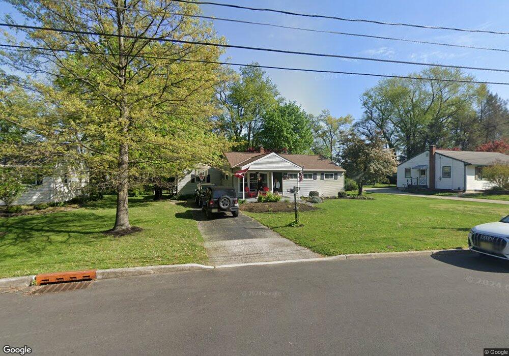
605 Devon Rd Moorestown, NJ 08057
Estimated Value: $427,371 - $537,000
About This Home
This home is located at 605 Devon Rd, Moorestown, NJ 08057 and is currently estimated at $487,843, approximately $330 per square foot. 605 Devon Rd is a home located in Burlington County with nearby schools including George C. Baker Elementary School, Moorestown Upper Elementary School, and William Allen Middle School.
Ownership History
We collect this data history from publicly available records. To have your information removed, we recommend requesting removal directly through your county’s website.
Purchase Details
Home Financials for this Owner
Home Financials are based on the most recent Mortgage that was taken out on this home.Home Values in the Area
Average Home Value in this Area
Purchase History
We collect this data history from publicly available records. To have your information removed, we recommend requesting removal directly through your county’s website.
| Date | Buyer | Sale Price | Title Company |
|---|---|---|---|
| $166,500 | Infinity Title Agency Inc |
Mortgage History
We collect this data history from publicly available records. To have your information removed, we recommend requesting removal directly through your county’s website.
| Date | Status | Borrower | Loan Amount |
|---|---|---|---|
| Open | $100,000 |
Tax History
We collect this data history from publicly available records. To have your information removed, we recommend requesting removal directly through your county’s website.
| Year | Tax Paid | Tax Assessment Tax Assessment Total Assessment is a certain percentage of the fair market value that is determined by local assessors to be the total taxable value of land and additions on the property. | Land | Improvement |
|---|---|---|---|---|
| 2025 | $5,731 | $202,000 | $118,200 | $83,800 |
| 2024 | $5,557 | $202,000 | $118,200 | $83,800 |
| 2023 | $5,557 | $202,000 | $118,200 | $83,800 |
| 2022 | $5,500 | $202,000 | $118,200 | $83,800 |
| 2021 | $5,428 | $202,000 | $118,200 | $83,800 |
| 2020 | $5,393 | $202,000 | $118,200 | $83,800 |
| 2019 | $5,298 | $202,000 | $118,200 | $83,800 |
| 2018 | $5,155 | $202,000 | $118,200 | $83,800 |
| 2017 | $5,199 | $202,000 | $118,200 | $83,800 |
| 2016 | $5,181 | $202,000 | $118,200 | $83,800 |
| 2015 | $5,119 | $202,000 | $118,200 | $83,800 |
| 2014 | $4,860 | $202,000 | $118,200 | $83,800 |
Map
- 503 Devon Rd
- 12 Circle Dr
- 36 Eraser Rd
- 3 Overbrook Cir
- 93 Westbrook Dr
- 11 Errickson Ave
- 27 S Lenola Rd
- 408 Kings Hwy
- 320 W 3rd St
- 10 S Lenola Rd
- 543 Bethel Ave
- 52 Westbrook Dr
- 444 Shady Ln
- 242 Center St
- 705 Iron Post Rd
- 421 Irving Ave
- 720 Maple Ct
- 419 Edgemoor Dr
- 400 Pleasant Valley Ave
- 10 N Close Unit 10N
- 603 Devon Rd
- 601 Devon Rd
- 599 Devon Rd
- 607 Devon Rd
- 604 Devon Rd
- 602 Devon Rd
- 609 Devon Rd
- 555 Devon Rd
- 606 Devon Rd
- 541 Devon Rd
- 310 N Colonial Ridge
- 611 Devon Rd
- 605 Covington Terrace
- 603 Covington Terrace
- 608 Devon Rd
- 613 Devon Rd
- 607 Covington Terrace
- 300 N Colonial Ridge
- 535 Devon Rd
- 311 N Colonial Ridge
Ask me questions while you tour the home.