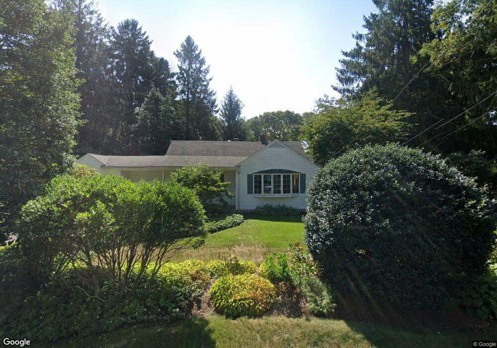
605 Poponessett Rd Cotuit, MA 02635
Cotuit NeighborhoodEstimated Value: $624,000 - $776,000
2
Beds
2
Baths
1,372
Sq Ft
$508/Sq Ft
Est. Value
About This Home
This home is located at 605 Poponessett Rd, Cotuit, MA 02635 and is currently estimated at $697,282, approximately $508 per square foot. 605 Poponessett Rd is a home located in Barnstable County with nearby schools including West Villages Elementary School, Barnstable United Elementary School, and Barnstable Intermediate School.
Ownership History
Date
Name
Owned For
Owner Type
Purchase Details
Closed on
May 11, 2021
Sold by
Sonderegger Bettina S
Bought by
Goodrich Cheryl
Current Estimated Value
Create a Home Valuation Report for This Property
The Home Valuation Report is an in-depth analysis detailing your home's value as well as a comparison with similar homes in the area
Home Values in the Area
Average Home Value in this Area
Purchase History
| Date | Buyer | Sale Price | Title Company |
|---|---|---|---|
| Goodrich Cheryl | -- | None Available | |
| Goodrich Cheryl | -- | None Available |
Source: Public Records
Tax History
| Year | Tax Paid | Tax Assessment Tax Assessment Total Assessment is a certain percentage of the fair market value that is determined by local assessors to be the total taxable value of land and additions on the property. | Land | Improvement |
|---|---|---|---|---|
| 2025 | $5,289 | $633,400 | $283,400 | $350,000 |
| 2024 | $4,936 | $626,400 | $283,400 | $343,000 |
| 2023 | $4,828 | $576,800 | $280,400 | $296,400 |
| 2022 | $4,515 | $436,700 | $179,600 | $257,100 |
| 2021 | $4,432 | $401,400 | $190,900 | $210,500 |
| 2020 | $4,648 | $396,900 | $202,100 | $194,800 |
| 2019 | $4,611 | $388,100 | $213,300 | $174,800 |
| 2018 | $3,503 | $359,500 | $212,700 | $146,800 |
| 2017 | $4,228 | $358,300 | $218,600 | $139,700 |
| 2016 | $4,072 | $353,800 | $214,100 | $139,700 |
| 2015 | $4,273 | $370,900 | $216,600 | $154,300 |
Source: Public Records
Map
Nearby Homes
- 640 Poponessett Rd
- 640 Poponessett Rd
- 311 Waquoit Rd
- 353 Simons Narrows Rd
- 11 Teal Cir
- 85 Clamshell Cove Rd
- 28 Quaker Run Rd
- 359 Santuit Rd
- 359 Santuit Rd
- 13 Cedar St
- 67 Crawford Rd
- 35 Spinnaker Dr W
- 6 Cedar St
- 6 Cedar St
- 239 Clamshell Cove Rd
- 15 Riverview Ave Unit D
- 15 Riverview Ave Unit D
- 11 Dry Hollow Ln
- 183 Simons Narrows Rd
- 1331 Main St
- 625 Poponessett Rd
- 685 Santuit Rd
- 595 Poponessett Rd
- 647 Poponessett Rd
- 592 Poponessett Rd
- 614 Poponessett Rd
- 701 Santuit Rd
- 663 Poponessett Rd
- 580 Poponessett Rd
- 628 Poponessett Rd
- 624 Poponessett Rd
- 652 Poponessett Rd
- 694 Santuit Rd
- 666 Santuit Rd
- 645 Santuit Rd
- 679 Poponessett Rd
- 664 Poponessett Rd
- 664 Poponessett Rd
- 562 Poponessett Rd
- 640 Santuit Rd
Your Personal Tour Guide
Ask me questions while you tour the home.