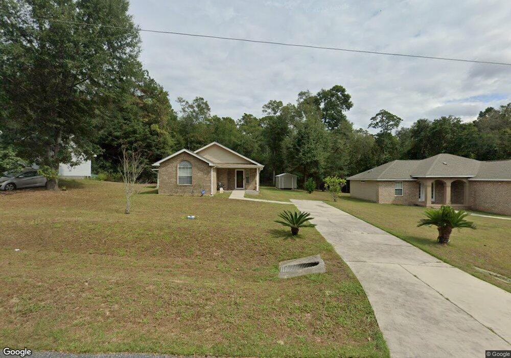
605 Sand Pine Dr Midway, FL 32343
Estimated Value: $252,541 - $278,000
3
Beds
2
Baths
1,537
Sq Ft
$172/Sq Ft
Est. Value
About This Home
This home is located at 605 Sand Pine Dr, Midway, FL 32343 and is currently estimated at $264,885, approximately $172 per square foot. 605 Sand Pine Dr is a home located in Gadsden County.
Ownership History
Date
Name
Owned For
Owner Type
Purchase Details
Closed on
Jan 15, 2008
Sold by
C B Construction Inc
Bought by
Bond Carmen A
Current Estimated Value
Home Financials for this Owner
Home Financials are based on the most recent Mortgage that was taken out on this home.
Original Mortgage
$113,426
Outstanding Balance
$70,797
Interest Rate
6.12%
Mortgage Type
FHA
Estimated Equity
$194,088
Purchase Details
Closed on
May 12, 2006
Sold by
Jlt Development Llc
Bought by
C B Construction Inc
Home Financials for this Owner
Home Financials are based on the most recent Mortgage that was taken out on this home.
Original Mortgage
$45,000
Interest Rate
10%
Mortgage Type
Seller Take Back
Create a Home Valuation Report for This Property
The Home Valuation Report is an in-depth analysis detailing your home's value as well as a comparison with similar homes in the area
Home Values in the Area
Average Home Value in this Area
Purchase History
| Date | Buyer | Sale Price | Title Company |
|---|---|---|---|
| Bond Carmen A | $165,000 | Attorney | |
| C B Construction Inc | $50,000 | Lawyers Title |
Source: Public Records
Mortgage History
| Date | Status | Borrower | Loan Amount |
|---|---|---|---|
| Open | Bond Carmen A | $113,426 | |
| Previous Owner | C B Construction Inc | $45,000 |
Source: Public Records
Tax History
| Year | Tax Paid | Tax Assessment Tax Assessment Total Assessment is a certain percentage of the fair market value that is determined by local assessors to be the total taxable value of land and additions on the property. | Land | Improvement |
|---|---|---|---|---|
| 2025 | $2,093 | $154,045 | -- | -- |
| 2024 | $2,019 | $149,704 | -- | -- |
| 2023 | $1,490 | $120,585 | $0 | $0 |
| 2022 | $1,274 | $109,118 | $0 | $0 |
| 2021 | $1,243 | $105,940 | $0 | $0 |
| 2020 | $1,213 | $104,478 | $0 | $0 |
| 2019 | $1,191 | $102,129 | $0 | $0 |
| 2018 | $1,187 | $100,225 | $0 | $0 |
| 2017 | $1,150 | $98,164 | $0 | $0 |
| 2016 | $1,126 | $96,145 | $0 | $0 |
| 2015 | $1,115 | $95,477 | $0 | $0 |
| 2014 | $1,084 | $94,719 | $0 | $0 |
Source: Public Records
Map
Nearby Homes
- 17 Pine Bark Ln
- 25 Pine Bark Ln
- 396 Sand Pine Cir
- 31 Stevens Dr
- 122 Loblolly Cir
- 0 Central Rd Unit 381525
- 305 Delores Madison Dr
- 6 Slash Ln
- 380 Sumpter Ridge Dr
- 668 M l King Blvd
- 34 Frank Run
- 604 Rustling Pines Blvd
- 359 Mae Cato Dr
- 407 Mae Cato Dr
- 545 Slash Cir
- 8877 High Bridge Rd
- 8873 High Bridge Rd
- 325 Mine Rd
- 00 Blue Star Hwy
- 10 Yvonne Ct
- 591 Sand Pine Dr
- 623 Sand Pine Dr
- 577 Sand Pine Dr
- 565 Sand Pine Dr
- 553 Sand Pine Dr Unit 1
- 553 Sand Pine Dr
- 0 Pine Bark Trail Unit A4527999
- 30 Pine Bark Trail Unit o
- 30 Pine Bark Trail
- 519 Sand Pine Dr
- 25 Pine Bark Ln
- 0 Pine Bark Ln Unit 261739
- 33 Pine Bark Ln
- 54 Pine Bark Trail
- 515 Sand Pine Dr
- 560 Sand Pine Cir
- 554 Sand Pine Cir
- 76 Pine Bark Trail
- 501 Sand Pine Dr
Your Personal Tour Guide
Ask me questions while you tour the home.