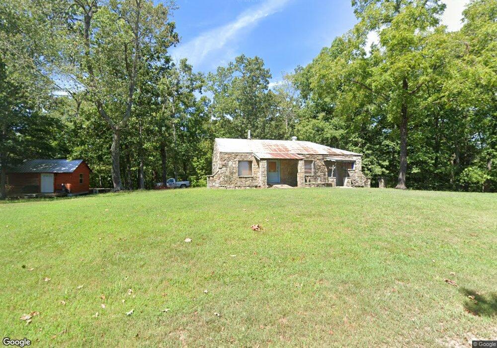
6070 Zack Ridge Rd Marshall, AR 72650
Estimated Value: $66,680 - $272,000
Studio
--
Bath
880
Sq Ft
$172/Sq Ft
Est. Value
About This Home
This home is located at 6070 Zack Ridge Rd, Marshall, AR 72650 and is currently estimated at $151,560, approximately $172 per square foot. 6070 Zack Ridge Rd is a home with nearby schools including Marshall Elementary School, Leslie Elementary School, and Marshall High School.
Ownership History
Date
Name
Owned For
Owner Type
Purchase Details
Closed on
Feb 6, 1992
Bought by
Halsted Mark E and Halsted Sara A
Current Estimated Value
Purchase Details
Closed on
Dec 1, 1991
Bought by
Breckenridge E Louise
Purchase Details
Closed on
Feb 24, 1982
Bought by
Breckenridge E Louise
Purchase Details
Closed on
Sep 6, 1979
Bought by
Breckenridge Breckenridge C and Breckenridge Louise
Purchase Details
Closed on
Sep 17, 1973
Bought by
Breckenridge Breckenridge C and Breckenridge Louise
Purchase Details
Closed on
Jul 9, 1973
Bought by
Breckenridge Breckenridge C and Breckenridge Louise
Purchase Details
Closed on
Apr 24, 1964
Bought by
Horton Dale
Create a Home Valuation Report for This Property
The Home Valuation Report is an in-depth analysis detailing your home's value as well as a comparison with similar homes in the area
Purchase History
| Date | Buyer | Sale Price | Title Company |
|---|---|---|---|
| Halsted Mark E | $9,300 | -- | |
| Breckenridge E Louise | -- | -- | |
| Breckenridge E Louise | -- | -- | |
| Breckenridge Breckenridge C | $1,000 | -- | |
| Breckenridge Breckenridge C | $1,000 | -- | |
| Breckenridge Breckenridge C | $1,000 | -- | |
| Horton Dale | -- | -- |
Source: Public Records
Tax History
| Year | Tax Paid | Tax Assessment Tax Assessment Total Assessment is a certain percentage of the fair market value that is determined by local assessors to be the total taxable value of land and additions on the property. | Land | Improvement |
|---|---|---|---|---|
| 2025 | $345 | $7,230 | $1,620 | $5,610 |
| 2024 | $345 | $7,230 | $1,620 | $5,610 |
| 2023 | $345 | $7,230 | $1,620 | $5,610 |
| 2022 | $345 | $7,230 | $1,620 | $5,610 |
| 2021 | $52 | $1,080 | $550 | $530 |
| 2020 | $52 | $1,080 | $550 | $530 |
| 2019 | $70 | $1,080 | $550 | $530 |
| 2018 | $70 | $1,080 | $550 | $530 |
| 2017 | $51 | $1,080 | $550 | $530 |
| 2016 | $50 | $1,080 | $550 | $530 |
| 2014 | $46 | $1,080 | $550 | $530 |
Source: Public Records
Map
Nearby Homes
- 6481 Zack Ridge Rd
- 3931 Zack Rd
- 905 Fallen Tree Rd
- 000 Fallen Tree Rd
- 0 Fallen Tree Rd
- 2026 Dry Creek Rd
- 74 Church St
- 4411 Red Bluff Rd
- 704 Osborne Rd
- 3227 Red Bluff Rd
- 1207 Red Bluff Rd
- 237 Pride and Joy Ln
- 237/236 Pride & Joy Ln
- 704 Osbourne Rd
- 305 Spirit Dr
- 1516 Mercy Ln
- 198 Mill Springs Rd
- 233 Piney Rd
- 014 Tomahawk Slab Rd
- Hwy 333 Lime Dr
Your Personal Tour Guide
Ask me questions while you tour the home.