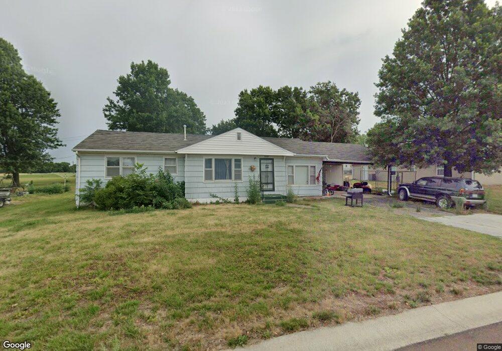
608 Mcgowan St Brookfield, MO 64628
Estimated Value: $99,534 - $132,000
2
Beds
1
Bath
1,194
Sq Ft
$97/Sq Ft
Est. Value
About This Home
This home is located at 608 Mcgowan St, Brookfield, MO 64628 and is currently estimated at $115,634, approximately $96 per square foot. 608 Mcgowan St is a home with nearby schools including Brookfield Elementary School, Brookfield Middle School, and Brookfield High School.
Ownership History
Date
Name
Owned For
Owner Type
Purchase Details
Closed on
Jan 5, 2024
Sold by
Black R W & L S Trust
Bought by
Jjb Rental Properties Llc
Current Estimated Value
Home Financials for this Owner
Home Financials are based on the most recent Mortgage that was taken out on this home.
Original Mortgage
$365,000
Interest Rate
5.87%
Mortgage Type
Construction
Purchase Details
Closed on
Jan 1, 2012
Sold by
Shultz Bonnie J
Bought by
Black Robin W and Black Linda S
Purchase Details
Closed on
Aug 11, 2008
Bought by
Black Linda Sue (Trust)
Create a Home Valuation Report for This Property
The Home Valuation Report is an in-depth analysis detailing your home's value as well as a comparison with similar homes in the area
Home Values in the Area
Average Home Value in this Area
Purchase History
| Date | Buyer | Sale Price | Title Company |
|---|---|---|---|
| Jjb Rental Properties Llc | $456,250 | -- | |
| Black Robin W | -- | -- | |
| Black Linda Sue (Trust) | $15,000 | -- |
Source: Public Records
Mortgage History
| Date | Status | Borrower | Loan Amount |
|---|---|---|---|
| Closed | Jjb Rental Properties Llc | $365,000 |
Source: Public Records
Tax History
| Year | Tax Paid | Tax Assessment Tax Assessment Total Assessment is a certain percentage of the fair market value that is determined by local assessors to be the total taxable value of land and additions on the property. | Land | Improvement |
|---|---|---|---|---|
| 2025 | $458 | $7,585 | $1,919 | $5,666 |
| 2024 | $5 | $7,315 | $1,919 | $5,396 |
| 2023 | $456 | $7,315 | $1,919 | $5,396 |
| 2022 | $452 | $7,220 | $1,919 | $5,301 |
| 2021 | $436 | $7,220 | $1,919 | $5,301 |
| 2020 | $453 | $7,220 | $1,919 | $5,301 |
| 2019 | $453 | $7,220 | $1,919 | $5,301 |
| 2018 | $445 | $7,125 | $1,919 | $5,206 |
| 2015 | -- | $7,125 | $2,318 | $4,807 |
| 2011 | -- | $37,500 | $12,200 | $25,300 |
Source: Public Records
Map
Nearby Homes
- 1011 Pettijohn St
- 610 Mcgowan St
- 605 Mcgowan St
- 603 Mcgowan St
- 612 Mcgowan St
- 615 Mcgowan St
- 601 Mcgowan St
- 614 Mcgowan St
- 522 Mcgowan St
- 1016 Pettijohn St
- 523 Mcgowan St
- 516 West Ave
- 518 Mcgowan St
- 1001 Gamble St
- 516 W Pratt St
- 608 W Dake St
- 519 W Pratt St
- 708 Mcgowan St
- 517 W Pratt St
- 630 W Dake St
Your Personal Tour Guide
Ask me questions while you tour the home.