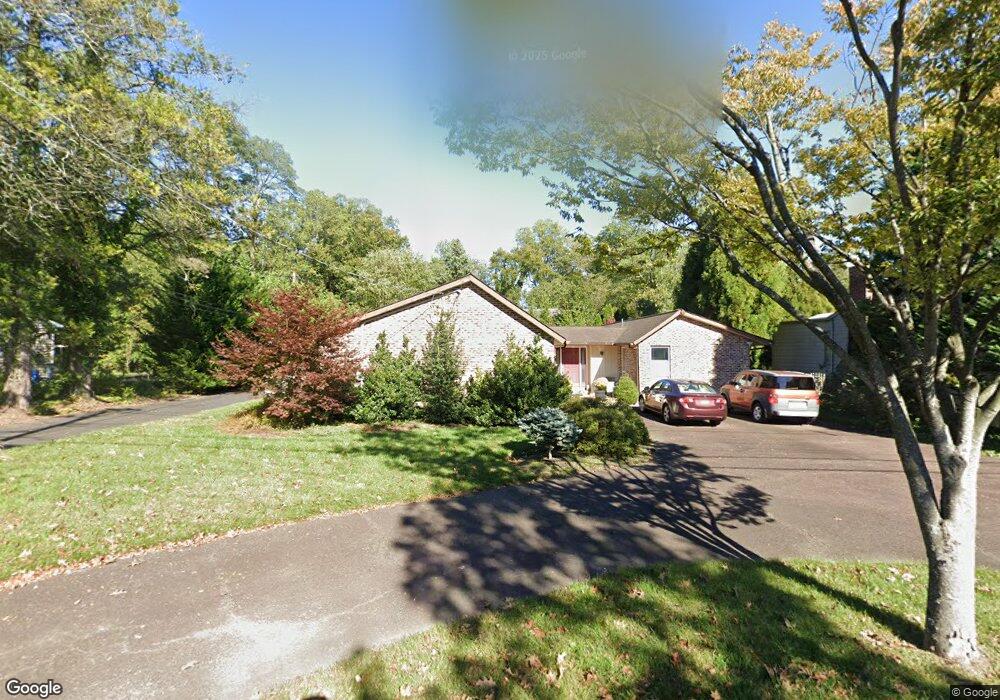
609 Center St Haddonfield, NJ 08033
Estimated Value: $1,096,035 - $1,460,000
Studio
--
Bath
2,836
Sq Ft
$457/Sq Ft
Est. Value
About This Home
This home is located at 609 Center St, Haddonfield, NJ 08033 and is currently estimated at $1,296,345, approximately $457 per square foot. 609 Center St is a home located in Camden County with nearby schools including Haddonfield Memorial High School, Haddonfield Friends School, and Christ the King Regional School.
Ownership History
Date
Name
Owned For
Owner Type
Purchase Details
Closed on
Aug 15, 2005
Sold by
Ciccarelli Robert V
Bought by
Quickel Stephen and Quickel Cheryl
Current Estimated Value
Home Financials for this Owner
Home Financials are based on the most recent Mortgage that was taken out on this home.
Original Mortgage
$335,000
Outstanding Balance
$177,673
Interest Rate
5.81%
Mortgage Type
Purchase Money Mortgage
Estimated Equity
$1,118,672
Create a Home Valuation Report for This Property
The Home Valuation Report is an in-depth analysis detailing your home's value as well as a comparison with similar homes in the area
Home Values in the Area
Average Home Value in this Area
Purchase History
We collect this data history from publicly available records. To have your information removed, we recommend requesting removal directly through your county’s website.
| Date | Buyer | Sale Price | Title Company |
|---|---|---|---|
| Quickel Stephen | $685,000 | -- |
Source: Public Records
Mortgage History
We collect this data history from publicly available records. To have your information removed, we recommend requesting removal directly through your county’s website.
| Date | Status | Borrower | Loan Amount |
|---|---|---|---|
| Open | Quickel Stephen | $335,000 |
Source: Public Records
Tax History
| Year | Tax Paid | Tax Assessment Tax Assessment Total Assessment is a certain percentage of the fair market value that is determined by local assessors to be the total taxable value of land and additions on the property. | Land | Improvement |
|---|---|---|---|---|
| 2025 | $19,890 | $600,000 | $220,800 | $379,200 |
| 2024 | $19,128 | $600,000 | $220,800 | $379,200 |
| 2023 | $19,128 | $600,000 | $220,800 | $379,200 |
| 2022 | $18,978 | $600,000 | $220,800 | $379,200 |
| 2021 | $18,882 | $600,000 | $220,800 | $379,200 |
| 2020 | $18,750 | $600,000 | $220,800 | $379,200 |
| 2019 | $186 | $600,000 | $220,800 | $379,200 |
| 2018 | $18,378 | $600,000 | $220,800 | $379,200 |
| 2017 | $17,940 | $600,000 | $220,800 | $379,200 |
| 2016 | $17,538 | $600,000 | $220,800 | $379,200 |
| 2015 | $17,052 | $600,000 | $220,800 | $379,200 |
| 2014 | $16,674 | $600,000 | $220,800 | $379,200 |
Source: Public Records
Map
Nearby Homes
- 414 Tavistock
- 343 Tavistock
- 320 Tavistock
- 404 Centre St
- 1115 Greenmount Rd
- 1141 Concord Dr
- 401 Spruce St
- 100 Jefferson Ave
- 109 Glenwood Rd
- 23 Mcphelin Ave
- 143 Tavistock
- 161 Gill Rd
- 323 Washington Ave
- 155 Tavistock
- 154 Tavistock
- 139 Treaty Elm Ln
- 201 Centre St
- 95 Lane of Acres
- 120 Glenwood Rd
- 107 Centre St
Your Personal Tour Guide
Ask me questions while you tour the home.