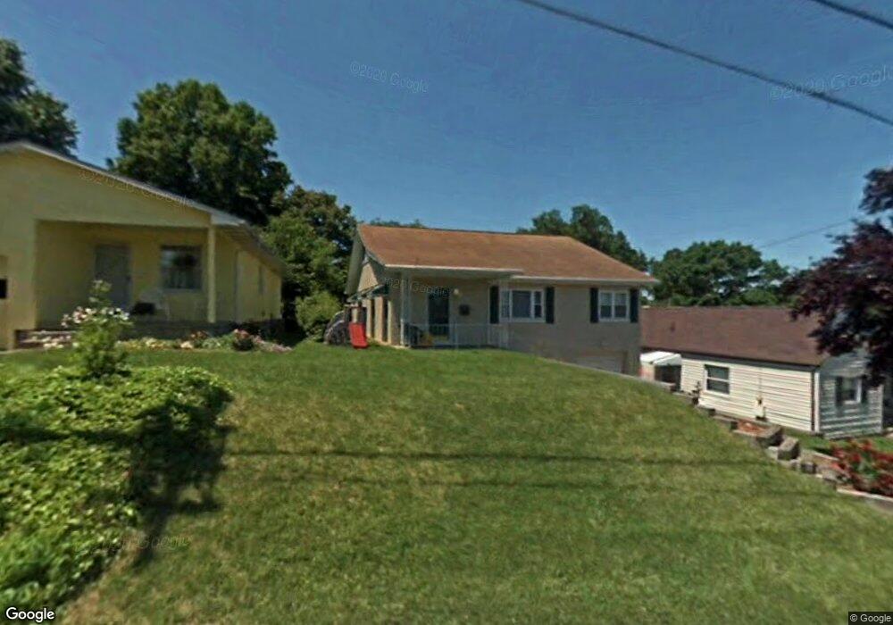
609 Cunningham St Saint Albans, WV 25177
Estimated Value: $145,000 - $187,326
3
Beds
2
Baths
2,332
Sq Ft
$71/Sq Ft
Est. Value
About This Home
This home is located at 609 Cunningham St, Saint Albans, WV 25177 and is currently estimated at $166,082, approximately $71 per square foot. 609 Cunningham St is a home located in Kanawha County with nearby schools including Central Elementary School, McKinley Middle School, and Saint Albans High School.
Ownership History
Date
Name
Owned For
Owner Type
Purchase Details
Closed on
Feb 19, 2004
Sold by
Ollis Robin
Bought by
Mccoy Kevin
Current Estimated Value
Home Financials for this Owner
Home Financials are based on the most recent Mortgage that was taken out on this home.
Original Mortgage
$97,000
Outstanding Balance
$44,575
Interest Rate
5.65%
Mortgage Type
New Conventional
Estimated Equity
$121,507
Create a Home Valuation Report for This Property
The Home Valuation Report is an in-depth analysis detailing your home's value as well as a comparison with similar homes in the area
Home Values in the Area
Average Home Value in this Area
Purchase History
| Date | Buyer | Sale Price | Title Company |
|---|---|---|---|
| Mccoy Kevin | $100,000 | -- |
Source: Public Records
Mortgage History
| Date | Status | Borrower | Loan Amount |
|---|---|---|---|
| Open | Mccoy Kevin | $97,000 |
Source: Public Records
Tax History
| Year | Tax Paid | Tax Assessment Tax Assessment Total Assessment is a certain percentage of the fair market value that is determined by local assessors to be the total taxable value of land and additions on the property. | Land | Improvement |
|---|---|---|---|---|
| 2025 | $1,070 | $65,460 | $10,560 | $54,900 |
| 2024 | $1,070 | $65,460 | $10,560 | $54,900 |
| 2023 | $1,024 | $62,640 | $10,560 | $52,080 |
| 2022 | $1,024 | $62,640 | $10,560 | $52,080 |
| 2021 | $955 | $58,440 | $10,560 | $47,880 |
| 2020 | $955 | $58,440 | $10,560 | $47,880 |
| 2019 | $967 | $59,160 | $10,560 | $48,600 |
| 2018 | $884 | $59,160 | $10,560 | $48,600 |
| 2017 | $896 | $59,820 | $10,560 | $49,260 |
| 2016 | $897 | $59,820 | $10,560 | $49,260 |
| 2015 | $906 | $60,480 | $10,560 | $49,920 |
| 2014 | $882 | $59,760 | $10,560 | $49,200 |
Source: Public Records
Map
Nearby Homes
- 704 Cunningham St
- 410 Abney St
- 698 Clark Dr
- 719 Washington St
- 1701 Jackson Ave
- 628 Carroll St
- 2030 Benedict Cir
- 401 Hudson St
- 1039 Kanawha Terrace
- 2125 Grant Ave
- 2200 Washington Ave
- 934 Park St
- 904 Lee St
- 2153 Cleveland Ave
- 1011 Northway Dr
- 1000 Elm St
- 1189 Hillcrest Dr
- 2237 Cleveland Ave
- 2305 Kanawha Terrace Unit 112
- 862 Hudson St
- 607 Cunningham St
- 611 Cunningham St
- 603 Cunningham St
- 615 Cunningham St
- 608 Hansford St
- 617 Cunningham St
- 606 Hansford St
- 606 Cunningham St
- 608 Cunningham St
- 601 Cunningham St
- 612 Hansford St
- 604 Hansford St
- 616 Hansford St
- 619 Cunningham St
- 612 Cunningham St
- 604 Cunningham St
- 1803 Washington Ave
- 616 Cunningham St
- 618 Hansford St
- 625 Cunningham St
Your Personal Tour Guide
Ask me questions while you tour the home.