3
Beds
1
Bath
1,482
Sq Ft
6,098
Sq Ft Lot
About This Home
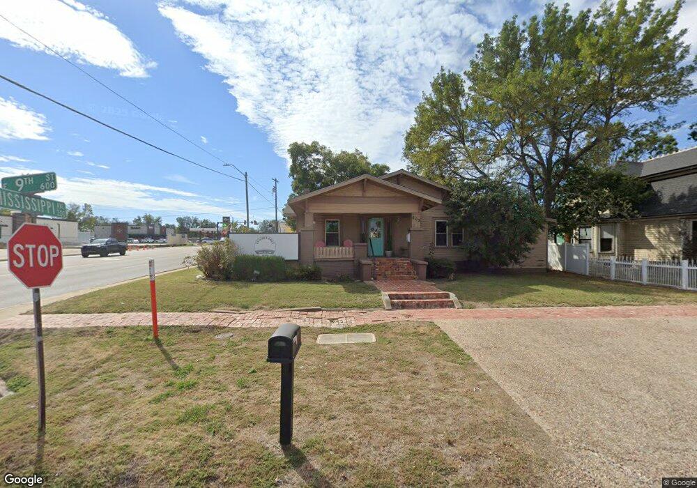
This home is located at 609 E 9th St, Ada, OK 74820. 609 E 9th St is a home located in Pontotoc County with nearby schools including Ada Early Childhood Center (AECC), Hayes Elementary School, and Washington Elementary School.
Ownership History
Date
Name
Owned For
Owner Type
Purchase Details
Closed on
Jul 18, 2019
Sold by
Boothill Properties Llc
Bought by
Tltc Llc
Home Financials for this Owner
Home Financials are based on the most recent Mortgage that was taken out on this home.
Original Mortgage
$127,937
Outstanding Balance
$53,769
Interest Rate
3.82%
Mortgage Type
Commercial
Purchase Details
Closed on
May 1, 2015
Sold by
Bennett William Joel
Bought by
Boothill Properties Llc
Purchase Details
Closed on
Apr 5, 1995
Sold by
Robert Frances and Robert Rumley
Bought by
Donna Dennis and Donna Bailey
Create a Home Valuation Report for This Property
The Home Valuation Report is an in-depth analysis detailing your home's value as well as a comparison with similar homes in the area
Purchase History
| Date | Buyer | Sale Price | Title Company |
|---|---|---|---|
| Tltc Llc | $125,000 | None Available | |
| Boothill Properties Llc | $47,500 | None Available | |
| Donna Dennis | $58,500 | -- |
Source: Public Records
Mortgage History
| Date | Status | Borrower | Loan Amount |
|---|---|---|---|
| Open | Tltc Llc | $127,937 |
Source: Public Records
Tax History
| Year | Tax Paid | Tax Assessment Tax Assessment Total Assessment is a certain percentage of the fair market value that is determined by local assessors to be the total taxable value of land and additions on the property. | Land | Improvement |
|---|---|---|---|---|
| 2025 | $1,531 | $14,700 | $10,080 | $4,620 |
| 2024 | $1,531 | $14,700 | $10,080 | $4,620 |
| 2023 | $1,531 | $14,700 | $10,080 | $4,620 |
| 2022 | $1,540 | $14,701 | $10,080 | $4,621 |
| 2021 | $1,373 | $14,701 | $10,080 | $4,621 |
| 2020 | $1,439 | $14,988 | $10,080 | $4,908 |
| 2019 | $789 | $8,209 | $3,300 | $4,909 |
| 2018 | $765 | $8,288 | $3,300 | $4,988 |
| 2017 | $681 | $7,894 | $3,300 | $4,594 |
| 2016 | $650 | $7,518 | $3,300 | $4,218 |
| 2015 | $649 | $7,390 | $3,300 | $4,090 |
| 2014 | $639 | $7,800 | $3,300 | $4,500 |
Source: Public Records
Map
Nearby Homes
- 402 E 9th St
- 742 E 8th St
- 314 N Hope St
- 517 E 12th St
- 727 E 6th St
- 512 N Francis St
- 519 N Highland St
- 319 E 13th St
- 420 S Center Ave
- 823 E Corona St
- 1312 E 9th St
- 0 Arlington St
- 300 E 17th St
- 130 E 16th St
- 1215 E Beverly St
- 804 E Gardena St
- 1205 Legacy Dr
- 1420 Northcrest Dr
- 1218 Legacy Dr
- 219 W 4th St
Your Personal Tour Guide
Ask me questions while you tour the home.