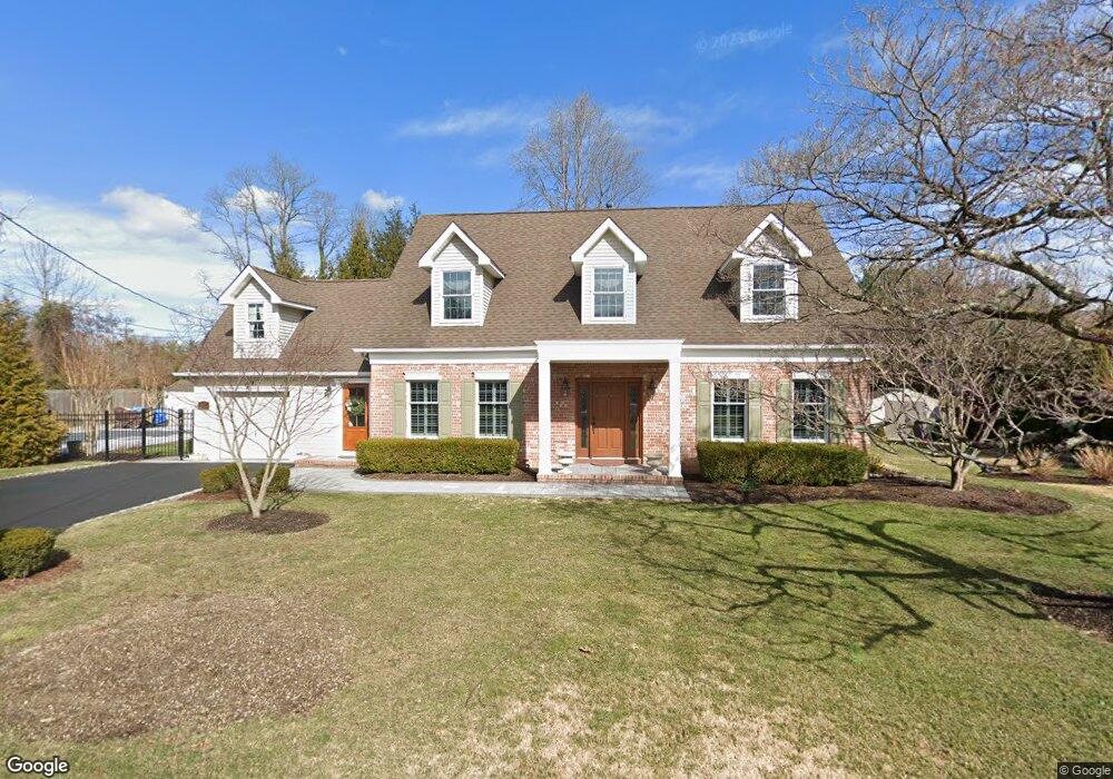
610 Locust Rd Brielle, NJ 08730
Estimated Value: $1,516,000 - $1,680,000
About This Home
This home is located at 610 Locust Rd, Brielle, NJ 08730 and is currently estimated at $1,579,561, approximately $511 per square foot. 610 Locust Rd is a home located in Monmouth County with nearby schools including Brielle Elementary School and St. Peter School.
Ownership History
We collect this data history from publicly available records. To have your information removed, we recommend requesting removal directly through your county’s website.
Purchase Details
Home Financials for this Owner
Home Financials are based on the most recent Mortgage that was taken out on this home.Home Values in the Area
Average Home Value in this Area
Purchase History
We collect this data history from publicly available records. To have your information removed, we recommend requesting removal directly through your county’s website.
| Date | Buyer | Sale Price | Title Company |
|---|---|---|---|
| $290,000 | -- |
Mortgage History
We collect this data history from publicly available records. To have your information removed, we recommend requesting removal directly through your county’s website.
| Date | Status | Borrower | Loan Amount |
|---|---|---|---|
| Open | $100,000 |
Tax History
We collect this data history from publicly available records. To have your information removed, we recommend requesting removal directly through your county’s website.
| Year | Tax Paid | Tax Assessment Tax Assessment Total Assessment is a certain percentage of the fair market value that is determined by local assessors to be the total taxable value of land and additions on the property. | Land | Improvement |
|---|---|---|---|---|
| 2025 | $14,033 | $1,254,100 | $742,700 | $511,400 |
| 2024 | $12,849 | $1,130,800 | $589,200 | $541,600 |
| 2023 | $12,849 | $999,900 | $478,500 | $521,400 |
| 2022 | $12,243 | $949,900 | $453,500 | $496,400 |
| 2021 | $12,243 | $838,100 | $403,500 | $434,600 |
| 2020 | $12,741 | $778,300 | $353,500 | $424,800 |
| 2019 | $12,112 | $750,900 | $328,500 | $422,400 |
| 2018 | $11,714 | $716,900 | $328,500 | $388,400 |
| 2017 | $11,661 | $705,000 | $328,500 | $376,500 |
| 2016 | $11,483 | $695,500 | $328,500 | $367,000 |
| 2015 | $11,292 | $679,000 | $328,500 | $350,500 |
| 2014 | $10,068 | $646,200 | $420,200 | $226,000 |
Map
- 612 Union Ave
- 105 Ashley Ave
- 123 Ashley Ave Unit 123
- 642 Rankin Rd
- 619 Bradley Ave
- 543 Harris Ave
- 608 Cedarcrest Dr
- 602 Homestead Rd
- 5 Berkeley Square
- 619 Park Ave
- 308 South St
- 323-325 Fisk Ave
- 640 Park Ave
- 33 Maple Ln Unit B
- 301 Old Bridge Rd
- 400 Lenape Trail
- 306 Fisk Ave
- 907 Riverview Dr
- 432 Oval Rd
- 1307 W Union Ln Unit A4
- 609 Higgins Ave Unit . D
- 609 Higgins Ave Unit B
- 609 Higgins Ave Unit 4
- 609 Higgins Ave Unit 2B
- 609 Higgins Ave Unit 3
- 609 Higgins Ave
- 609 Higgins Ave Unit 1
- 611 Higgins Ave
- 605 Sandy Ct
- 603 Sandy Ct
- 608 Locust Rd
- 601 Sandy Ct
- 606 Locust Rd
- 715 Union Ave Unit 7
- 715 Union Ave Unit 10
- 715 Union Ave Unit 6, 7
- 715 Union Ave Unit F & S
- 715 Union Ave Unit 8
- 715 Union Ave
- 715 Union Ave Unit K, H
Ask me questions while you tour the home.