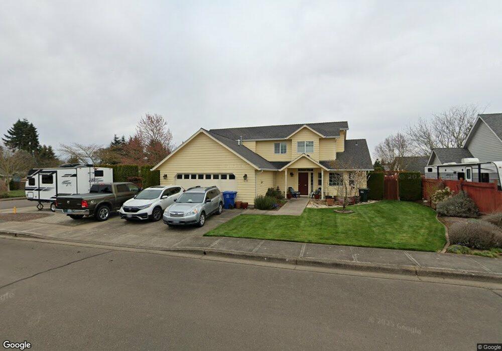
611 Alder Ct Jefferson, OR 97352
Estimated Value: $438,000 - $487,000
1
Bed
3
Baths
1,754
Sq Ft
$268/Sq Ft
Est. Value
About This Home
This home is located at 611 Alder Ct, Jefferson, OR 97352 and is currently estimated at $469,411, approximately $267 per square foot. 611 Alder Ct is a home located in Marion County with nearby schools including Jefferson Elementary School, Jefferson Middle School, and Jefferson High School.
Ownership History
Date
Name
Owned For
Owner Type
Purchase Details
Closed on
Aug 6, 2001
Sold by
Marcec Hamby Corp
Bought by
Leas Mark E and Leas Susan M
Current Estimated Value
Home Financials for this Owner
Home Financials are based on the most recent Mortgage that was taken out on this home.
Original Mortgage
$132,000
Interest Rate
7.1%
Mortgage Type
Purchase Money Mortgage
Purchase Details
Closed on
Jan 25, 2001
Sold by
Hamby F Ellis and Hamby Blanch Joan
Bought by
Marcec Hamby Corp
Create a Home Valuation Report for This Property
The Home Valuation Report is an in-depth analysis detailing your home's value as well as a comparison with similar homes in the area
Home Values in the Area
Average Home Value in this Area
Purchase History
| Date | Buyer | Sale Price | Title Company |
|---|---|---|---|
| Leas Mark E | $165,000 | Oregon Title Insurance Co | |
| Marcec Hamby Corp | -- | -- |
Source: Public Records
Mortgage History
| Date | Status | Borrower | Loan Amount |
|---|---|---|---|
| Previous Owner | Leas Mark E | $132,000 |
Source: Public Records
Tax History
| Year | Tax Paid | Tax Assessment Tax Assessment Total Assessment is a certain percentage of the fair market value that is determined by local assessors to be the total taxable value of land and additions on the property. | Land | Improvement |
|---|---|---|---|---|
| 2025 | $3,813 | $260,300 | -- | -- |
| 2024 | $3,813 | $252,720 | -- | -- |
| 2023 | $3,596 | $245,360 | $0 | $0 |
| 2022 | $3,385 | $238,220 | $0 | $0 |
| 2021 | $3,283 | $231,290 | $0 | $0 |
| 2020 | $3,188 | $224,560 | $0 | $0 |
| 2019 | $3,112 | $218,020 | $0 | $0 |
| 2018 | $3,062 | $0 | $0 | $0 |
| 2017 | $2,965 | $0 | $0 | $0 |
| 2016 | $2,591 | $0 | $0 | $0 |
| 2015 | $2,519 | $0 | $0 | $0 |
| 2014 | $2,415 | $0 | $0 | $0 |
Source: Public Records
Map
Nearby Homes
- 508 High St
- 634 S Sunrise Dr
- 773 S Grice Loop
- 219 Columbia St
- 651 Loree Place
- 184 Greenwood Dr
- 137 Tanglewood (-141) Dr
- 0 Lot Union St
- LOT Union St
- 3179 Jefferson Scio Dr SE
- 554 S Main St
- 844 Hazel St
- 257 N 6th St
- 205 N 3rd St
- 941 N 2nd St
- Lot 200 Bates St
- 972 N 2nd St Unit 84
- 972 N 2nd St
- 17666 Emerald Green Ln SE
- 38742 Scravel Hill Rd NE
Your Personal Tour Guide
Ask me questions while you tour the home.