Estimated Value: $324,000 - $382,252
3
Beds
2
Baths
1,736
Sq Ft
$205/Sq Ft
Est. Value
About This Home
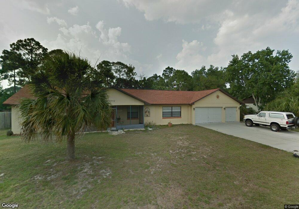
This home is located at 6112 Corning Rd, Cocoa, FL 32927 and is currently estimated at $355,563, approximately $204 per square foot. 6112 Corning Rd is a home located in Brevard County with nearby schools including Enterprise Elementary School, Space Coast Junior/Senior High School, and East Atlantic Prep of Brevard County.
Ownership History
Date
Name
Owned For
Owner Type
Purchase Details
Closed on
Feb 18, 2005
Sold by
Harris Paul A and Harris Madeline Maureen
Bought by
Baumann Lorenz J and Baumann Mary
Current Estimated Value
Home Financials for this Owner
Home Financials are based on the most recent Mortgage that was taken out on this home.
Original Mortgage
$128,000
Outstanding Balance
$64,417
Interest Rate
5.6%
Estimated Equity
$291,146
Create a Home Valuation Report for This Property
The Home Valuation Report is an in-depth analysis detailing your home's value as well as a comparison with similar homes in the area
Home Values in the Area
Average Home Value in this Area
Purchase History
| Date | Buyer | Sale Price | Title Company |
|---|---|---|---|
| Baumann Lorenz J | $160,000 | International Title & Escrow |
Source: Public Records
Mortgage History
| Date | Status | Borrower | Loan Amount |
|---|---|---|---|
| Open | Baumann Lorenz J | $128,000 | |
| Closed | Baumann Lorenz J | $32,000 |
Source: Public Records
Tax History
| Year | Tax Paid | Tax Assessment Tax Assessment Total Assessment is a certain percentage of the fair market value that is determined by local assessors to be the total taxable value of land and additions on the property. | Land | Improvement |
|---|---|---|---|---|
| 2025 | $1,797 | $134,400 | -- | -- |
| 2024 | $1,758 | $130,620 | -- | -- |
| 2023 | $1,758 | $126,820 | $0 | $0 |
| 2022 | $1,642 | $123,130 | $0 | $0 |
| 2021 | $1,654 | $119,550 | $0 | $0 |
| 2020 | $1,595 | $117,900 | $0 | $0 |
| 2019 | $1,534 | $115,250 | $0 | $0 |
| 2018 | $1,531 | $113,110 | $0 | $0 |
| 2017 | $1,532 | $110,790 | $0 | $0 |
| 2016 | $1,541 | $108,520 | $27,000 | $81,520 |
| 2015 | $1,567 | $107,770 | $22,500 | $85,270 |
| 2014 | $1,571 | $106,920 | $16,500 | $90,420 |
Source: Public Records
Map
Nearby Homes
- 6150 Baltimore Ave
- 00000 Golfview Ave
- 6230 Balsam St
- 6085 Edison St
- 6180 Balboa St
- 6215 Balboa St
- 6220 Golfview Ave
- 5812 Homestead Ave
- 6250 Ainsworth Rd
- 6510 Aspen Ln
- 23-35-21-JX-B-2 Aruin St
- 6460 Homestead Ave
- 0 Aruin St Unit 1222557
- 6460 Ainsworth Rd
- 6545 Addie Ave
- 6490 Addax Ave
- 6115 Allmont St
- 6135 Allmont St
- 5721 Beaverbrook St
- 5680 Banos Ave
Your Personal Tour Guide
Ask me questions while you tour the home.