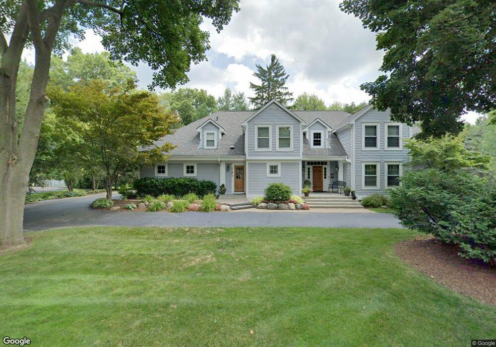
6123 E Surrey Rd Bloomfield Hills, MI 48301
Estimated Value: $918,000 - $1,272,000
4
Beds
4
Baths
4,207
Sq Ft
$264/Sq Ft
Est. Value
About This Home
This home is located at 6123 E Surrey Rd, Bloomfield Hills, MI 48301 and is currently estimated at $1,109,105, approximately $263 per square foot. 6123 E Surrey Rd is a home located in Oakland County with nearby schools including Conant Elementary School, South Hills Middle School, and Bloomfield Hills High School.
Ownership History
Date
Name
Owned For
Owner Type
Purchase Details
Closed on
Sep 15, 2021
Sold by
Furlong Dennis W and Kresge Cynthia L
Bought by
Furlong Dennis William and Kresge Cynthia Lynn
Current Estimated Value
Create a Home Valuation Report for This Property
The Home Valuation Report is an in-depth analysis detailing your home's value as well as a comparison with similar homes in the area
Home Values in the Area
Average Home Value in this Area
Purchase History
| Date | Buyer | Sale Price | Title Company |
|---|---|---|---|
| Furlong Dennis William | -- | Land Title |
Source: Public Records
Tax History
| Year | Tax Paid | Tax Assessment Tax Assessment Total Assessment is a certain percentage of the fair market value that is determined by local assessors to be the total taxable value of land and additions on the property. | Land | Improvement |
|---|---|---|---|---|
| 2025 | $13,450 | $546,030 | $72,070 | $473,960 |
| 2024 | $6,776 | $546,030 | $0 | $0 |
| 2023 | $6,558 | $520,380 | $0 | $0 |
| 2022 | $12,323 | $454,240 | $0 | $0 |
| 2021 | $12,235 | $469,180 | $0 | $0 |
| 2020 | $5,998 | $464,170 | $0 | $0 |
| 2019 | $11,513 | $424,890 | $0 | $0 |
| 2018 | $11,565 | $415,230 | $0 | $0 |
| 2017 | $11,482 | $403,150 | $0 | $0 |
| 2016 | $11,504 | $387,790 | $0 | $0 |
| 2015 | -- | $370,480 | $0 | $0 |
| 2014 | -- | $322,220 | $0 | $0 |
| 2011 | -- | $269,400 | $0 | $0 |
Source: Public Records
Map
Nearby Homes
- 6050 W Surrey Rd
- 5904 Wing Lake Rd
- 5567 Westwood Ln
- 6660 Woodbank Dr
- 4045 W Maple Rd Unit 101
- 4456 W Maple Rd
- 4049 W Maple Rd Unit A205
- 2696 John Bartley Cir
- 6775 Cedarbrook Dr
- 5761 Snowshoe Cir
- 6701 Franklin Rd
- 6850 White Pine Dr
- 4603 Hedgewood Dr
- 5738 Pebbleshire Rd
- 5143 Woodlands Dr
- 5129 Woodlands Ln
- 0000 Mark Hopkins Rd
- 7118 Cathedral Dr
- 6130 Idlewyle Rd
- 5100 Kings Gate Way
- 6105 E Surrey Rd
- 6155 E Surrey Rd
- 6130 W Surrey Rd
- 6100 W Surrey Rd
- 6025 E Surrey Rd
- 6175 E Surrey Rd
- 6148 Lantern Ln
- 6150 W Surrey Rd
- 6154 Lantern Ln
- 6142 Lantern Ln
- 6020 N Cross St
- 6080 N Cross St
- 6160 W Surrey Rd
- 6185 E Surrey Rd
- 6015 E Surrey Rd
- 6160 Lantern Ln
- 6136 Lantern Ln
- 4185 Sandy Ln
- 6195 E Surrey Rd
- 4205 Sandy Ln
Your Personal Tour Guide
Ask me questions while you tour the home.