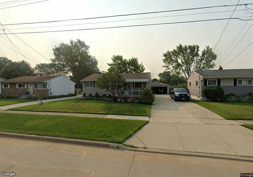
6129 Michael Dr Brookpark, OH 44142
Estimated Value: $199,000 - $224,000
About This Home
This home is located at 6129 Michael Dr, Brookpark, OH 44142 and is currently estimated at $213,340, approximately $224 per square foot. 6129 Michael Dr is a home located in Cuyahoga County with nearby schools including Berea-Midpark Middle School, Berea-Midpark High School, and Huber Heights Preparatory Academy Parma Academy.
Ownership History
We collect this data history from publicly available records. To have your information removed, we recommend requesting removal directly through your county’s website.
Purchase Details
Purchase Details
Purchase Details
Home Values in the Area
Average Home Value in this Area
Purchase History
We collect this data history from publicly available records. To have your information removed, we recommend requesting removal directly through your county’s website.
| Date | Buyer | Sale Price | Title Company |
|---|---|---|---|
| $49,000 | -- | ||
| $30,500 | -- | ||
| -- | -- |
Tax History
We collect this data history from publicly available records. To have your information removed, we recommend requesting removal directly through your county’s website.
| Year | Tax Paid | Tax Assessment Tax Assessment Total Assessment is a certain percentage of the fair market value that is determined by local assessors to be the total taxable value of land and additions on the property. | Land | Improvement |
|---|---|---|---|---|
| 2025 | $2,892 | $57,680 | $11,970 | $45,710 |
| 2024 | $2,909 | $57,680 | $11,970 | $45,710 |
| 2023 | $3,202 | $51,420 | $10,220 | $41,200 |
| 2022 | $3,030 | $50,090 | $10,220 | $39,870 |
| 2021 | $3,012 | $50,090 | $10,220 | $39,870 |
| 2020 | $2,716 | $39,760 | $8,120 | $31,640 |
| 2019 | $2,635 | $113,600 | $23,200 | $90,400 |
| 2018 | $2,624 | $39,760 | $8,120 | $31,640 |
| 2017 | $2,569 | $35,950 | $7,600 | $28,350 |
| 2016 | $2,548 | $35,950 | $7,600 | $28,350 |
| 2015 | $2,391 | $35,950 | $7,600 | $28,350 |
| 2014 | $2,391 | $35,950 | $7,600 | $28,350 |
Map
- 14291 Gallatin Blvd
- 5882 Middlebrook Blvd
- 6130 Smith Rd
- 13495 Donald Dr
- 15424 Holland Rd
- 13548 Holland Rd
- 15540 Paulding Blvd
- 15500 Richard Dr
- 6379 Edgehurst Dr
- 6444 Schaaf Dr
- 15624 Hocking Blvd
- 15460 Rademaker Dr
- 6127 W 130th St
- 5818 Smith Rd
- 6447 Sandfield Dr
- 6377 Ledgebrook Dr
- 16124 Holland Rd
- 15473 Hummel Rd
- 15497 Hummel Rd
- 13467 Belfair Dr
- 6135 Michael Dr
- 6127 Michael Dr
- 6145 Michael Dr
- 6125 Michael Dr
- 6155 Michael Dr
- 6123 Michael Dr
- 6130 Michael Dr
- 6161 Michael Dr
- 6140 Michael Dr
- 6118 Michael Dr
- 6116 Michael Dr
- 6150 Michael Dr
- 6068 Middlebrook Blvd
- 6165 Michael Dr
- 14545 Sylvia Dr
- 6114 Michael Dr
- 14570 Greystone Dr
- 6119 Michael Dr
- 6175 Michael Dr
- 6060 Middlebrook Blvd
Ask me questions while you tour the home.