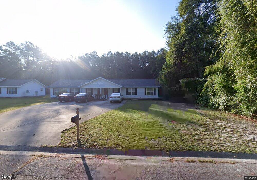
614 Walnut St Waycross, GA 31501
Estimated Value: $194,000 - $278,865
3
Beds
4
Baths
2,268
Sq Ft
$98/Sq Ft
Est. Value
About This Home
This home is located at 614 Walnut St, Waycross, GA 31501 and is currently estimated at $221,966, approximately $97 per square foot. 614 Walnut St is a home located in Ware County with nearby schools including Williams Heights Elementary School, Waycross Middle School, and Ware County High School.
Ownership History
Date
Name
Owned For
Owner Type
Purchase Details
Closed on
Feb 18, 2005
Sold by
Hendrix Joe
Bought by
Walden Thomas E and Walden Phyllis Diane
Current Estimated Value
Purchase Details
Closed on
Jul 30, 2002
Sold by
Hendrix Joe and Hendrix Sherry
Bought by
Hendrix Joe and Hendrix Sherry
Purchase Details
Closed on
Oct 17, 2000
Sold by
Lott J Dan
Bought by
Hendrix Joe and Hendrix Sherry
Create a Home Valuation Report for This Property
The Home Valuation Report is an in-depth analysis detailing your home's value as well as a comparison with similar homes in the area
Purchase History
| Date | Buyer | Sale Price | Title Company |
|---|---|---|---|
| Walden Thomas E | $9,500 | -- | |
| Hendrix Joe | -- | -- | |
| Hendrix Joe | $15,000 | -- |
Source: Public Records
Tax History
| Year | Tax Paid | Tax Assessment Tax Assessment Total Assessment is a certain percentage of the fair market value that is determined by local assessors to be the total taxable value of land and additions on the property. | Land | Improvement |
|---|---|---|---|---|
| 2025 | $3,190 | $94,421 | $7,000 | $87,421 |
| 2024 | $3,190 | $103,912 | $7,000 | $96,912 |
| 2023 | $2,241 | $72,518 | $760 | $71,758 |
| 2022 | $2,890 | $72,518 | $760 | $71,758 |
| 2021 | $2,546 | $58,890 | $760 | $58,130 |
| 2020 | $2,532 | $58,089 | $760 | $57,329 |
| 2019 | $2,143 | $48,467 | $760 | $47,707 |
| 2018 | $2,074 | $46,463 | $760 | $45,703 |
| 2017 | $2,026 | $46,463 | $760 | $45,703 |
| 2016 | $2,026 | $46,463 | $760 | $45,703 |
| 2015 | $2,040 | $46,462 | $760 | $45,703 |
| 2014 | $2,038 | $46,463 | $760 | $45,703 |
| 2013 | -- | $52,470 | $760 | $51,710 |
Source: Public Records
Map
Nearby Homes
- 619 Oakwood Ave
- 810 Saint Marys Dr
- 713 Magnolia Dr
- 808 Satilla Blvd
- 1100 Atlantic Ave
- 914 Baltimore Ave
- 1205 Dean Dr
- 0 S City Blvd
- 1001 Baltimore Ave
- 808 Euclid Ave
- 901 City Blvd
- 0 Saint Marys Dr Unit (TRACT 2 0.25 ACRES)
- 1004 Hill St
- 707 Euclid Ave
- 1100 Euclid Ave
- 1304 Shawnee Dr
- 1003 Scruggs St
- 1500 Saint Marys Dr
- 1501 Satilla Blvd
- 807 College St
- 700 Walnut St
- 616 Oakwood Ave
- 700 Oakwood Ave
- 707 Walnut St
- 612 Oakwood Ave
- 706 Oakwood Ave
- 601 Walnut St
- 708 Oakwood Ave
- 802 Florence St
- 801 Florence St
- 617 Oakwood Ave
- 608 Oakwood Ave
- 814 Central Ave
- 613 Oakwood Ave
- 802 Vine St
- 706 St Mary's Dr
- 706 Saint Marys Dr
- 622 Saint Marys Dr
- 620 Saint Marys Dr
- 802 Central Ave
Your Personal Tour Guide
Ask me questions while you tour the home.