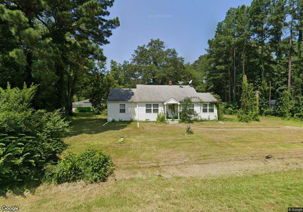
6147 Main St Queenstown, MD 21658
Estimated Value: $290,000 - $336,000
Studio
1
Bath
1,172
Sq Ft
$269/Sq Ft
Est. Value
About This Home
This home is located at 6147 Main St, Queenstown, MD 21658 and is currently estimated at $315,371, approximately $269 per square foot. 6147 Main St is a home located in Queen Anne's County with nearby schools including Grasonville Elementary School, Stevensville Middle School, and Kent Island High School.
Ownership History
Date
Name
Owned For
Owner Type
Purchase Details
Closed on
Dec 28, 2020
Sold by
Inselman Darryle F and Inselman Dale R
Bought by
Inselman Darryle Frederick and Inselman Darryle Frederick
Current Estimated Value
Purchase Details
Closed on
May 19, 1993
Sold by
Caporin R A
Bought by
Inselman Darryle F
Home Financials for this Owner
Home Financials are based on the most recent Mortgage that was taken out on this home.
Original Mortgage
$83,000
Interest Rate
7.54%
Purchase Details
Closed on
May 29, 1986
Sold by
Thompson James E and Thompson Betty L
Bought by
Caporin Robert A
Create a Home Valuation Report for This Property
The Home Valuation Report is an in-depth analysis detailing your home's value as well as a comparison with similar homes in the area
Home Values in the Area
Average Home Value in this Area
Purchase History
We collect this data history from publicly available records. To have your information removed, we recommend requesting removal directly through your county’s website.
| Date | Buyer | Sale Price | Title Company |
|---|---|---|---|
| Inselman Darryle Frederick | -- | None Available | |
| Inselman Darryle F | $83,000 | -- | |
| Caporin Robert A | $74,500 | -- |
Source: Public Records
Mortgage History
We collect this data history from publicly available records. To have your information removed, we recommend requesting removal directly through your county’s website.
| Date | Status | Borrower | Loan Amount |
|---|---|---|---|
| Closed | Inselman Darryle F | $83,000 |
Source: Public Records
Tax History
| Year | Tax Paid | Tax Assessment Tax Assessment Total Assessment is a certain percentage of the fair market value that is determined by local assessors to be the total taxable value of land and additions on the property. | Land | Improvement |
|---|---|---|---|---|
| 2025 | $2,300 | $237,800 | $0 | $0 |
| 2024 | $2,181 | $225,200 | $125,300 | $99,900 |
| 2023 | $2,120 | $218,733 | $0 | $0 |
| 2022 | $2,060 | $212,267 | $0 | $0 |
| 2021 | $2,034 | $205,800 | $100,300 | $105,500 |
| 2020 | $1,948 | $196,833 | $0 | $0 |
| 2019 | $1,862 | $187,867 | $0 | $0 |
| 2018 | $1,776 | $178,900 | $90,300 | $88,600 |
| 2017 | $1,728 | $173,900 | $0 | $0 |
| 2016 | -- | $168,900 | $0 | $0 |
| 2015 | $1,834 | $163,900 | $0 | $0 |
| 2014 | $1,834 | $163,900 | $0 | $0 |
Source: Public Records
Map
Nearby Homes
Your Personal Tour Guide
Ask me questions while you tour the home.