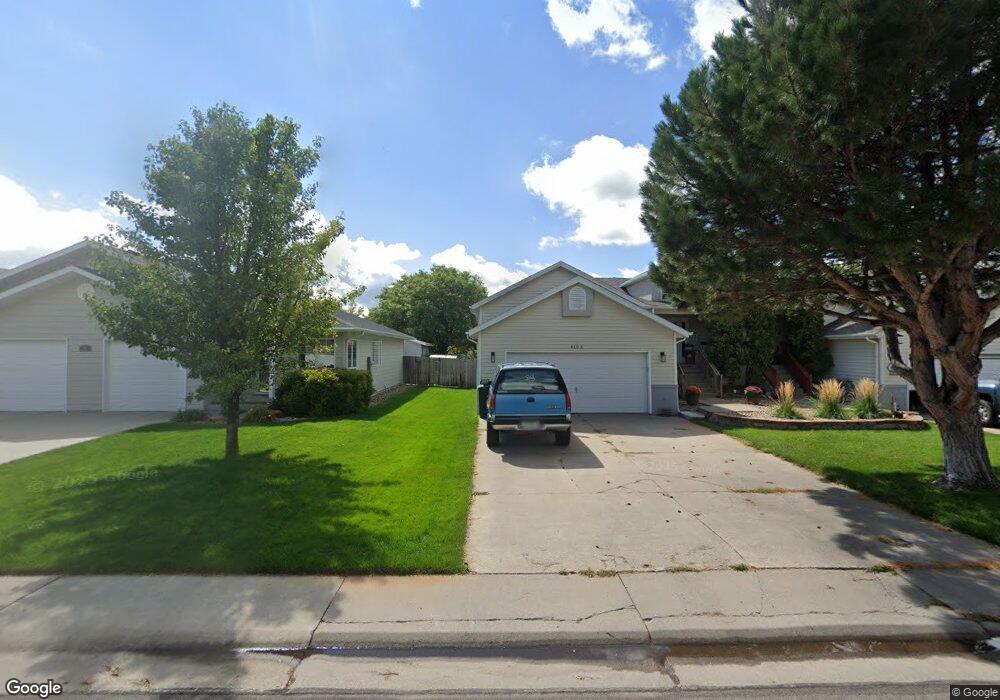
615 Jay Dr Sterling, CO 80751
Estimated Value: $287,000 - $322,000
1
Bed
2
Baths
1,034
Sq Ft
$289/Sq Ft
Est. Value
About This Home
This home is located at 615 Jay Dr, Sterling, CO 80751 and is currently estimated at $298,950, approximately $289 per square foot. 615 Jay Dr is a home located in Logan County with nearby schools including Ayres Elementary School, Campbell Elementary School, and Sterling Middle School.
Ownership History
Date
Name
Owned For
Owner Type
Purchase Details
Closed on
Nov 9, 2021
Sold by
Heimann Justin R and Heimann Jennifer L
Bought by
Neff Carol and Lieberknecht Mark
Current Estimated Value
Purchase Details
Closed on
Oct 30, 2018
Sold by
Hasan Fareed N and Hasan Melinda C
Bought by
Heimann Justin R and Helmann Hennifer L
Home Financials for this Owner
Home Financials are based on the most recent Mortgage that was taken out on this home.
Original Mortgage
$140,250
Interest Rate
4.7%
Mortgage Type
New Conventional
Purchase Details
Closed on
Sep 27, 2013
Sold by
Klug Dale and Klug Mary
Bought by
Hasan Fareed N and Hasan Melinda C
Home Financials for this Owner
Home Financials are based on the most recent Mortgage that was taken out on this home.
Original Mortgage
$127,551
Interest Rate
4.54%
Mortgage Type
New Conventional
Create a Home Valuation Report for This Property
The Home Valuation Report is an in-depth analysis detailing your home's value as well as a comparison with similar homes in the area
Purchase History
| Date | Buyer | Sale Price | Title Company |
|---|---|---|---|
| Neff Carol | $250,000 | Stewart Title | |
| Heimann Justin R | $165,000 | Stewart Title | |
| Hasan Fareed N | $125,000 | Stewart Title |
Source: Public Records
Mortgage History
| Date | Status | Borrower | Loan Amount |
|---|---|---|---|
| Previous Owner | Heimann Justin R | $140,250 | |
| Previous Owner | Hasan Fareed N | $127,551 |
Source: Public Records
Tax History
| Year | Tax Paid | Tax Assessment Tax Assessment Total Assessment is a certain percentage of the fair market value that is determined by local assessors to be the total taxable value of land and additions on the property. | Land | Improvement |
|---|---|---|---|---|
| 2025 | $1,467 | $17,495 | $0 | $0 |
| 2024 | $1,112 | $18,280 | $0 | $0 |
| 2023 | $1,112 | $18,280 | $0 | $0 |
| 2022 | $1,189 | $14,110 | $870 | $13,240 |
| 2021 | $1,162 | $14,510 | $890 | $13,620 |
| 2020 | $1,138 | $27,020 | $890 | $26,130 |
| 2019 | $1,106 | $26,160 | $890 | $25,270 |
| 2018 | $1,066 | $12,590 | $790 | $11,800 |
| 2017 | $1,049 | $61,200 | $3,850 | $57,350 |
| 2015 | $1,028 | $55,100 | $3,500 | $51,600 |
| 2014 | $1,028 | $52,100 | $4,260 | $47,840 |
| 2013 | $1,028 | $52,100 | $4,260 | $47,840 |
Source: Public Records
Map
Nearby Homes
- 504 Lily Ln
- 1617 Zachary Dr
- 404-406 Kochia Way
- 804 Nicole Rd
- 508 Fairhurst St
- 909 Fairhurst St
- 19140 Chambers Dr
- 714 Delmar St
- 1010 Fairhurst St
- 309 Delmar St
- 1013 S 10th Ave
- 603 Park St Unit 106
- 302 Beattie St
- 530 Taylor St
- 905 S 2nd Ave
- 401 Park St Unit 403
- 228 Taylor St Unit 230
- 704 S 3rd Ave
- 709 S 2nd Ave
- 131 Park St Unit A, B, C
- 615 Jay Dr
- 615 Jay Dr Unit A
- 615 Jay Dr Unit B
- 615 Jay Dr
- 621 Jay Dr
- 609 Jay Dr
- 616 Kiwi Rd
- 622 Kiwi Rd
- 610 Kiwi Rd
- 629 Jay Dr
- 1702 S 6th Ave
- 616 Jay Dr Unit A,B,C,D,E
- 628 Kiwi Rd
- 622 Jay Dr Unit 1,2,3,4
- 604 Kiwi Rd
- 1621 Pheasant Ridge Unit 1625
- 1710 Pheasant Ridge
- 615 Kiwi Rd
- 621 Kiwi Rd
- 1704 Pheasant Ridge
Your Personal Tour Guide
Ask me questions while you tour the home.