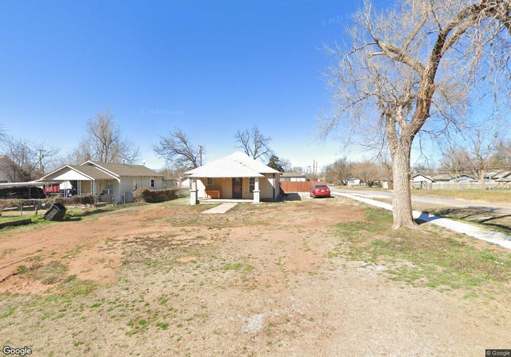
616 E Anderson St Apache, OK 73006
Estimated Value: $39,525 - $91,000
1
Bed
1
Bath
938
Sq Ft
$69/Sq Ft
Est. Value
About This Home
This home is located at 616 E Anderson St, Apache, OK 73006 and is currently estimated at $64,842, approximately $69 per square foot. 616 E Anderson St is a home with nearby schools including Apache Elementary School, Apache Middle School, and Apache High School.
Ownership History
Date
Name
Owned For
Owner Type
Purchase Details
Closed on
Feb 22, 2021
Sold by
Mcbride Robert W and Mcbride Debbie
Bought by
Hrbacek Keagen C
Current Estimated Value
Purchase Details
Closed on
Jun 15, 2018
Sold by
Upton Bulah Christine
Bought by
Mcbride Robert W and Mcbride Debbie
Purchase Details
Closed on
Sep 3, 2014
Bought by
Uptonjoe & Christine Tru
Purchase Details
Closed on
Nov 16, 2001
Purchase Details
Closed on
Jan 25, 1994
Purchase Details
Closed on
Feb 1, 1988
Create a Home Valuation Report for This Property
The Home Valuation Report is an in-depth analysis detailing your home's value as well as a comparison with similar homes in the area
Purchase History
We collect this data history from publicly available records. To have your information removed, we recommend requesting removal directly through your county’s website.
| Date | Buyer | Sale Price | Title Company |
|---|---|---|---|
| Hrbacek Keagen C | $12,000 | None Available | |
| Mcbride Robert W | $7,500 | None Available | |
| Uptonjoe & Christine Tru | -- | -- | |
| -- | $8,500 | -- | |
| -- | $8,300 | -- | |
| -- | $6,500 | -- |
Source: Public Records
Tax History
| Year | Tax Paid | Tax Assessment Tax Assessment Total Assessment is a certain percentage of the fair market value that is determined by local assessors to be the total taxable value of land and additions on the property. | Land | Improvement |
|---|---|---|---|---|
| 2025 | $145 | $1,528 | $256 | $1,272 |
| 2024 | $145 | $1,455 | $244 | $1,211 |
| 2023 | $142 | $1,386 | $238 | $1,148 |
| 2022 | $121 | $1,320 | $233 | $1,087 |
| 2021 | $105 | $910 | $141 | $769 |
| 2020 | $87 | $866 | $132 | $734 |
| 2019 | $84 | $825 | $123 | $702 |
| 2018 | $244 | $825 | $123 | $702 |
| 2017 | $220 | $2,106 | $346 | $1,760 |
| 2016 | $214 | $2,006 | $346 | $1,659 |
| 2015 | $152 | $1,910 | $346 | $1,564 |
| 2014 | $150 | $1,819 | $346 | $1,473 |
Source: Public Records
Map
Nearby Homes
- TBD U S Highway 62
- 223 Oak St
- 401 S Coblake St
- TBD NE King Rd
- 1100 NE King Rd
- 207 N Hillside Rd
- 175 Whippoorwill St
- 116 N Lakeside Dr
- 124 Ellsworth Dr
- 115 N Brookdale
- TBD Hilltop Rd
- 133 S Hillside Rd
- 13145 NE Clearwater Cir
- 40001 U S 281
- 21168 County Road 1480
- 14320 NE 75th St
- 67 Ash Ave
- 108 London Dr
- 5812 NE Cornwallis Dr
- 5854 NE Cornwallis Dr
- 218 E Anderson St
- 223 N Walnut St
- 210 E Anderson St
- 219 E Wallace Ave
- 215 E Wallace Ave
- 212 E Anderson St
- 224 N Walnut St
- 211 E Wallace Ave
- 303 E Wallace Ave
- 201 Wallace Ave
- 216 N Oak St
- 309 E Wallace Ave
- 316 E Anderson St
- 201 E Wallace Ave
- 311 E Wallace Ave
- 209 E Anderson St
- 215 E Anderson Ave
- 48091 County Street 2580
- 318 E Anderson St
- 220 E Wallace Ave
Your Personal Tour Guide
Ask me questions while you tour the home.