Estimated Value: $347,749 - $414,000
4
Beds
3
Baths
2,520
Sq Ft
$151/Sq Ft
Est. Value
About This Home
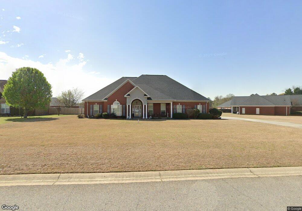
This home is located at 616 Rowland Cir, Byron, GA 31008 and is currently estimated at $380,187, approximately $150 per square foot. 616 Rowland Cir is a home located in Peach County with nearby schools including Kay Road Elementary School, Fort Valley Middle School, and Peach County High School.
Ownership History
Date
Name
Owned For
Owner Type
Purchase Details
Closed on
Jan 7, 2005
Sold by
Freeman Stokes Properties
Bought by
Andrews Walldon
Current Estimated Value
Home Financials for this Owner
Home Financials are based on the most recent Mortgage that was taken out on this home.
Original Mortgage
$34,200
Interest Rate
5.61%
Mortgage Type
New Conventional
Purchase Details
Closed on
Oct 29, 2004
Sold by
Stokes Freeman S
Bought by
Freeman Stokes Properties Llc
Purchase Details
Closed on
Mar 9, 2004
Sold by
Southern Star Properties Inc
Bought by
Stokes Freeman S
Purchase Details
Closed on
Apr 19, 1999
Bought by
Southern Star Properties Inc
Create a Home Valuation Report for This Property
The Home Valuation Report is an in-depth analysis detailing your home's value as well as a comparison with similar homes in the area
Home Values in the Area
Average Home Value in this Area
Purchase History
| Date | Buyer | Sale Price | Title Company |
|---|---|---|---|
| Andrews Walldon | $228,000 | -- | |
| Freeman Stokes Properties Llc | -- | -- | |
| Stokes Freeman S | $25,000 | -- | |
| Southern Star Properties Inc | -- | -- |
Source: Public Records
Mortgage History
| Date | Status | Borrower | Loan Amount |
|---|---|---|---|
| Closed | Andrews Walldon | $34,200 | |
| Open | Andrews Walldon | $182,400 |
Source: Public Records
Tax History
| Year | Tax Paid | Tax Assessment Tax Assessment Total Assessment is a certain percentage of the fair market value that is determined by local assessors to be the total taxable value of land and additions on the property. | Land | Improvement |
|---|---|---|---|---|
| 2025 | $204 | $121,560 | $12,400 | $109,160 |
| 2024 | $228 | $117,920 | $12,800 | $105,120 |
| 2023 | $341 | $115,080 | $12,800 | $102,280 |
| 2022 | $320 | $106,080 | $12,800 | $93,280 |
| 2021 | $204 | $91,160 | $12,800 | $78,360 |
| 2020 | $221 | $90,920 | $12,800 | $78,120 |
| 2019 | $371 | $90,960 | $12,800 | $78,160 |
| 2018 | $516 | $90,960 | $12,800 | $78,160 |
| 2017 | $637 | $90,960 | $12,800 | $78,160 |
| 2016 | $746 | $90,960 | $12,800 | $78,160 |
| 2015 | $852 | $90,960 | $12,800 | $78,160 |
| 2014 | $945 | $90,960 | $12,800 | $78,160 |
| 2013 | -- | $90,960 | $12,800 | $78,160 |
Source: Public Records
Map
Nearby Homes
- 161 Rowland Cir
- 124 Hawks Ridge Trace
- 109 Red Tail Cir
- 171 Hawks Ridge Trace
- 0 Barker Rd Unit 243030
- 0 Barker Rd Unit 14258525
- 0 Barker Rd Unit 175053
- 571 Barker Rd
- 112 Early Dr
- 117 Early Dr
- 165 Early Dr
- 147 Early Dr
- 124 Early Dr
- 120 Early Dr
- 116 Early Dr
- 907 Cliett Rd
- 800 John E Sullivan Rd
- 144 Summit Dr
- 119 Early Dr
- 450 Jones Rd
- 6 Rowland Cir
- 562 Rowland Cir
- 0 Rowland Cir Unit 221960
- 28B Rowland Cir
- 14A Rowland Cir
- 13A Rowland Cir
- 15A Rowland Cir
- 0 Rowland Cir Unit Lot 33B 8905473
- 0 Rowland Cir Unit Lot 32B 8905418
- 552 Rowland Cir
- 96 Joseph Place
- 12 Rowland Cir
- 635 Rowland Cir
- 615 Rowland Cir
- 0 Lot 18 Rowland Cir Unit 225243
- 520 Rowland Cir
- 607 Rowland Cir
- 603 Rowland Cir
- 77 Joseph Place
- 32 Rowland Cir
Your Personal Tour Guide
Ask me questions while you tour the home.