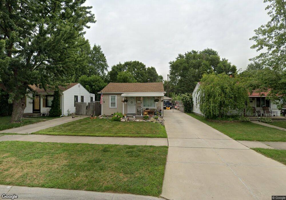
6179 Harold St Taylor, MI 48180
Estimated Value: $131,214 - $147,000
About This Home
This home is located at 6179 Harold St, Taylor, MI 48180 and is currently estimated at $138,554, approximately $149 per square foot. 6179 Harold St is a home located in Wayne County with nearby schools including Clarence Randall Elementary School, Hoover Middle School, and Taylor High School.
Ownership History
We collect this data history from publicly available records. To have your information removed, we recommend requesting removal directly through your county’s website.
Purchase Details
Purchase Details
Purchase Details
Purchase Details
Home Values in the Area
Average Home Value in this Area
Purchase History
We collect this data history from publicly available records. To have your information removed, we recommend requesting removal directly through your county’s website.
| Date | Buyer | Sale Price | Title Company |
|---|---|---|---|
| $12,050 | None Available | ||
| -- | None Available | ||
| $81,164 | None Available | ||
| $17,210 | -- |
Tax History
We collect this data history from publicly available records. To have your information removed, we recommend requesting removal directly through your county’s website.
| Year | Tax Paid | Tax Assessment Tax Assessment Total Assessment is a certain percentage of the fair market value that is determined by local assessors to be the total taxable value of land and additions on the property. | Land | Improvement |
|---|---|---|---|---|
| 2025 | $1,478 | $58,700 | $0 | $0 |
| 2024 | $1,435 | $53,500 | $0 | $0 |
| 2023 | $2,240 | $45,500 | $0 | $0 |
| 2022 | $1,350 | $42,300 | $0 | $0 |
| 2021 | $1,450 | $35,800 | $0 | $0 |
| 2020 | $1,434 | $30,600 | $0 | $0 |
| 2019 | $142,285 | $26,600 | $0 | $0 |
| 2018 | $1,185 | $21,200 | $0 | $0 |
| 2017 | $463 | $20,800 | $0 | $0 |
| 2016 | $1,398 | $20,200 | $0 | $0 |
| 2015 | $1,880 | $18,800 | $0 | $0 |
| 2013 | $2,090 | $21,700 | $0 | $0 |
| 2012 | $920 | $21,400 | $7,600 | $13,800 |
Map
- 6041 Fellrath St
- 6363 Mcguire St
- 5961 Marvin St
- 6305 Beech Daly Rd
- 5957 John Daly St
- 5852 Beech Daly Rd
- 5990 Janet St
- 6322 Princess St
- 6198 Princess St
- 6144 Princess St
- 5904 Janet St
- 6024 Wilkie St
- 5996 Princess St
- 6338 Hazel St
- 25611 van Born Rd
- 25850 Hanover St
- 25965 Currier St
- 5885 Sylvia St
- 26115 Powers Ave
- 000 Currier St
- 6305 Harold St
- 6315 Harold St
- 6325 Harold St
- 6197 Harold St
- 6333 Harold St
- 6304 Fellrath St
- 6316 Fellrath St
- 6187 Harold St
- 6324 Fellrath St
- 6339 Harold St
- 6196 Fellrath St
- 6332 Fellrath St
- 6304 Harold St
- 6316 Harold St
- 6186 Fellrath St
- 6345 Harold St
- 6196 Harold St
- 6336 Harold St
- 6169 Harold St
- 6186 Harold St
Ask me questions while you tour the home.