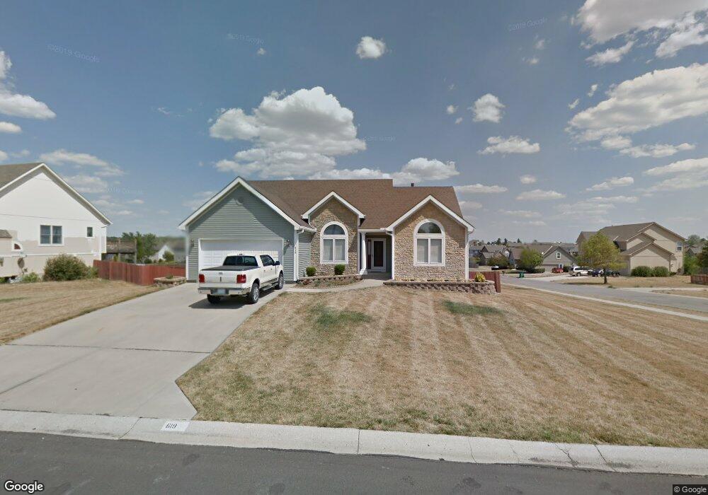
619 Cedar Ridge Dr Raymore, MO 64083
Estimated Value: $350,000 - $396,000
About This Home
This home is located at 619 Cedar Ridge Dr, Raymore, MO 64083 and is currently estimated at $377,724, approximately $235 per square foot. 619 Cedar Ridge Dr is a home located in Cass County with nearby schools including Stonegate Elementary School, Raymore-Peculiar South Middle School, and Raymore-Peculiar Senior High School.
Ownership History
We collect this data history from publicly available records. To have your information removed, we recommend requesting removal directly through your county’s website.
Purchase Details
Home Financials for this Owner
Home Financials are based on the most recent Mortgage that was taken out on this home.Purchase Details
Home Financials for this Owner
Home Financials are based on the most recent Mortgage that was taken out on this home.Purchase Details
Home Values in the Area
Average Home Value in this Area
Purchase History
We collect this data history from publicly available records. To have your information removed, we recommend requesting removal directly through your county’s website.
| Date | Buyer | Sale Price | Title Company |
|---|---|---|---|
| -- | -- | ||
| -- | -- | ||
| $204,850 | -- |
Mortgage History
We collect this data history from publicly available records. To have your information removed, we recommend requesting removal directly through your county’s website.
| Date | Status | Borrower | Loan Amount |
|---|---|---|---|
| Closed | $50,000 |
Tax History
We collect this data history from publicly available records. To have your information removed, we recommend requesting removal directly through your county’s website.
| Year | Tax Paid | Tax Assessment Tax Assessment Total Assessment is a certain percentage of the fair market value that is determined by local assessors to be the total taxable value of land and additions on the property. | Land | Improvement |
|---|---|---|---|---|
| 2025 | $3,648 | $50,170 | $9,990 | $40,180 |
| 2024 | $3,648 | $44,880 | $9,080 | $35,800 |
| 2023 | $3,648 | $44,880 | $9,080 | $35,800 |
| 2022 | $3,328 | $40,680 | $9,080 | $31,600 |
| 2021 | $3,329 | $40,680 | $9,080 | $31,600 |
| 2020 | $3,275 | $39,320 | $9,080 | $30,240 |
| 2019 | $3,162 | $39,320 | $9,080 | $30,240 |
| 2018 | $2,898 | $34,800 | $7,510 | $27,290 |
| 2017 | $2,660 | $34,800 | $7,510 | $27,290 |
| 2016 | $2,660 | $33,160 | $7,510 | $25,650 |
| 2015 | $2,662 | $33,160 | $7,510 | $25,650 |
| 2014 | $2,663 | $33,160 | $7,510 | $25,650 |
| 2013 | -- | $33,160 | $7,510 | $25,650 |
Map
- 1506 Horseshoe Dr
- 1408 Cedar Ridge Cir
- 1401 Rylee Ct
- 1519 Bridlewood Ln
- 523 Brookwood Ln
- 830 Cedar Ridge Dr
- 603 Mayberry Ct
- 1016 Carlisle Dr
- 1016 Bristol Dr
- 901 W Lucy Webb Rd
- 727 Country Ln
- 414 Eagle Glen Dr
- 1717 Longhorn Ln
- 1817 Prairie Grass Dr
- 500 Bayview Dr
- 417 S Lakeshore Dr
- 1300 Aberdeen Cir
- 1501 Johnston Dr
- 604 S Sunset Ln
- 1503 Haystack Rd
- 617 Cedar Ridge Dr
- 1402 Pembrocke Dr
- 703 Cedar Ridge Dr
- 615 Cedar Ridge Dr
- 1403 Pembrocke Dr
- 618 Cedar Ridge Dr
- 700 Cedar Ridge Dr
- 616 Roanke Dr
- 618 Roanke Dr
- 616 Cedar Ridge Dr
- 613 Cedar Ridge Dr
- 705 Cedar Ridge Dr
- 702 Cedar Ridge Dr
- 614 Roanke Dr
- 1401 Pembrocke Dr
- 614 Cedar Ridge Dr
- 612 Cedar Ridge Dr
- 1402 Essex Ct
- 704 Cedar Ridge Dr
- 611 Cedar Ridge Dr
Ask me questions while you tour the home.