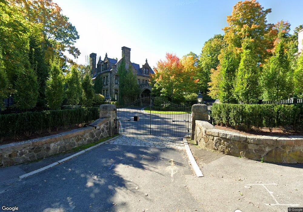
62 Buckminster Rd Brookline, MA 02445
Brookline Village NeighborhoodEstimated Value: $6,066,000 - $9,065,000
11
Beds
5
Baths
11,147
Sq Ft
$634/Sq Ft
Est. Value
About This Home
This home is located at 62 Buckminster Rd, Brookline, MA 02445 and is currently estimated at $7,069,383, approximately $634 per square foot. 62 Buckminster Rd is a home located in Norfolk County with nearby schools including John D. Runkle School, Brookline High School, and Maimonides School.
Ownership History
Date
Name
Owned For
Owner Type
Purchase Details
Closed on
Nov 13, 2012
Sold by
Arcari Giuseppe
Bought by
Giuseppe Arcari Ret
Current Estimated Value
Purchase Details
Closed on
Nov 26, 2008
Sold by
Kushi Michio
Bought by
Arcari Giuseppe A
Create a Home Valuation Report for This Property
The Home Valuation Report is an in-depth analysis detailing your home's value as well as a comparison with similar homes in the area
Home Values in the Area
Average Home Value in this Area
Purchase History
We collect this data history from publicly available records. To have your information removed, we recommend requesting removal directly through your county’s website.
| Date | Buyer | Sale Price | Title Company |
|---|---|---|---|
| Giuseppe Arcari Ret | -- | -- | |
| Arcari Giuseppe A | $2,700,000 | -- |
Source: Public Records
Tax History
| Year | Tax Paid | Tax Assessment Tax Assessment Total Assessment is a certain percentage of the fair market value that is determined by local assessors to be the total taxable value of land and additions on the property. | Land | Improvement |
|---|---|---|---|---|
| 2025 | $77,830 | $7,885,500 | $2,704,100 | $5,181,400 |
| 2024 | $74,851 | $7,661,300 | $2,600,000 | $5,061,300 |
| 2023 | $67,054 | $6,725,600 | $1,857,600 | $4,868,000 |
| 2022 | $65,270 | $6,405,300 | $1,769,100 | $4,636,200 |
| 2021 | $60,358 | $6,159,000 | $1,701,100 | $4,457,900 |
| 2020 | $56,248 | $5,952,200 | $1,546,400 | $4,405,800 |
| 2019 | $53,117 | $5,668,800 | $1,472,800 | $4,196,000 |
| 2018 | $55,904 | $5,909,500 | $1,519,800 | $4,389,700 |
| 2017 | $55,081 | $5,575,000 | $1,433,800 | $4,141,200 |
| 2016 | $53,964 | $5,178,900 | $1,340,000 | $3,838,900 |
| 2015 | $51,692 | $4,840,100 | $1,252,300 | $3,587,800 |
| 2014 | $52,331 | $4,594,500 | $1,138,600 | $3,455,900 |
Source: Public Records
Map
Nearby Homes
- 50 Sumner Rd
- 54 Clark Rd
- 428 Boylston St
- 55 Leicester St
- 16 Kennard Rd
- 68 Dudley St
- 120 Seaver St Unit C-102
- 120 Seaver St Unit B204
- 140 Dudley St
- 1 Chestnut Place
- 184 Rawson Rd
- 75 Lee St
- 17 Chesham Rd
- 90 Addington Rd Unit 1
- 22 Chestnut Place Unit 210
- 18 Chestnut Place
- 40 Heath Hill
- 68 Chestnut St Unit 2
- 84 Winthrop Rd Unit 1
- 84 Winthrop Rd
- 54 Buckminster Rd
- 70 Buckminster Rd
- 20 Sumner Rd
- 42 Buckminster Rd
- 76 Buckminster Rd
- 63 Buckminster Rd
- 14 Sumner Rd
- 82 Buckminster Rd
- 49 Buckminster Rd
- 67 Buckminster Rd
- 36 Sumner Rd
- 39 Buckminster Rd
- 23 Sumner Rd Unit 1
- 23 Sumner Rd Unit 4
- 23 Sumner Rd Unit 3
- 23 Sumner Rd Unit 2
- 31 Sumner Rd
- 79 Buckminster Rd
- 503 Boylston St Unit 1
- 503 Boylston St Unit 6
Your Personal Tour Guide
Ask me questions while you tour the home.