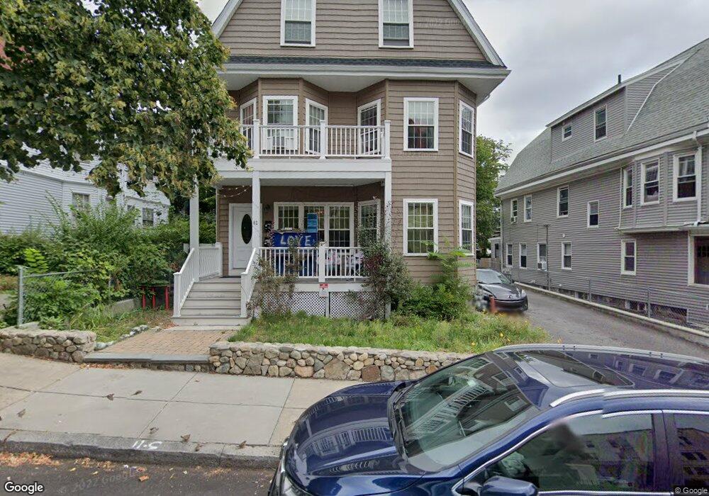
62 Quint Ave Allston, MA 02134
Commonwealth NeighborhoodEstimated Value: $1,805,000 - $2,341,000
8
Beds
4
Baths
3,328
Sq Ft
$613/Sq Ft
Est. Value
About This Home
This home is located at 62 Quint Ave, Allston, MA 02134 and is currently estimated at $2,039,390, approximately $612 per square foot. 62 Quint Ave is a home located in Suffolk County with nearby schools including Match Charter Public School, German International School Boston, and St Joseph Preparatory High School.
Ownership History
Date
Name
Owned For
Owner Type
Purchase Details
Closed on
Jan 26, 2021
Sold by
Toufas Theodoros G
Bought by
Toufas Andrew
Current Estimated Value
Purchase Details
Closed on
Dec 17, 2013
Sold by
Toufas Theodores G and Toufas Dionisios G
Bought by
Toufas Theodoros G
Purchase Details
Closed on
Aug 30, 2001
Sold by
Zamakis Aristides and Zamakis Stavroula
Bought by
Toufas Dionisios G and Toufas Theodoros G
Create a Home Valuation Report for This Property
The Home Valuation Report is an in-depth analysis detailing your home's value as well as a comparison with similar homes in the area
Home Values in the Area
Average Home Value in this Area
Purchase History
| Date | Buyer | Sale Price | Title Company |
|---|---|---|---|
| Toufas Andrew | -- | None Available | |
| Toufas Theodoros G | -- | -- | |
| Toufas Dionisios G | $400,000 | -- |
Source: Public Records
Mortgage History
| Date | Status | Borrower | Loan Amount |
|---|---|---|---|
| Previous Owner | Toufas Dionisios G | $120,000 | |
| Previous Owner | Toufas Dionisios G | $135,000 |
Source: Public Records
Tax History
| Year | Tax Paid | Tax Assessment Tax Assessment Total Assessment is a certain percentage of the fair market value that is determined by local assessors to be the total taxable value of land and additions on the property. | Land | Improvement |
|---|---|---|---|---|
| 2025 | $18,888 | $1,631,100 | $602,500 | $1,028,600 |
| 2024 | $17,615 | $1,616,100 | $497,900 | $1,118,200 |
| 2023 | $17,357 | $1,616,100 | $497,900 | $1,118,200 |
| 2022 | $15,984 | $1,469,100 | $452,600 | $1,016,500 |
| 2021 | $15,675 | $1,469,100 | $452,600 | $1,016,500 |
| 2020 | $14,739 | $1,395,700 | $397,300 | $998,400 |
| 2019 | $14,304 | $1,357,100 | $312,500 | $1,044,600 |
| 2018 | $13,415 | $1,280,100 | $312,500 | $967,600 |
| 2017 | $11,941 | $1,127,600 | $312,500 | $815,100 |
| 2016 | $7,572 | $688,400 | $312,500 | $375,900 |
| 2015 | $2,705 | $223,400 | $194,600 | $28,800 |
| 2014 | $3,259 | $259,040 | $79,440 | $179,600 |
Source: Public Records
Map
Nearby Homes
- 17 Radcliffe Rd Unit 10
- 39 Glenville Ave Unit 71
- 43 Glenville Ave Unit 11
- 30 Glenville Ave Unit 1
- 83 Glenville Ave
- 18 Glenville Ave Unit 3A
- 1263 Commonwealth Ave Unit 4
- 78 Glenville Ave Unit 7
- 1304 Commonwealth Ave Unit 5
- 130 Glenville Ave
- 84 Linden St
- 85 Brainerd Rd Unit 302
- 85 Brainerd Rd Unit TH7
- 39 Verndale St Unit 39
- 16-22 Reedsdale St
- 1409 Commonwealth Ave Unit 301
- 10 Scottfield Rd Unit 2
- 24 Chester St
- 1408 Commonwealth Ave Unit 14
- 88 Gordon St Unit 304
- 62 Quint Ave
- 62 Quint Ave Unit 1
- 62 Quint Ave Unit 2
- 22 Parkvale Ave Unit 5
- 22 Parkvale Ave Unit 4
- 58 Quint Ave
- 66 Quint Ave
- 66 Quint Ave Unit 3
- 66 Quint Ave
- 66 Quint Ave Unit 1
- 66 Quint Ave Unit 2
- 67 Quint Ave
- 54 Quint Ave
- 54 Quint Ave Unit 1
- 70 Quint Ave
- 70 Quint Ave Unit 3
- 70 Quint Ave
- 70 Quint Ave
- 70 Quint Ave Unit 3C
- 70 Quint Ave Unit Ez
Your Personal Tour Guide
Ask me questions while you tour the home.