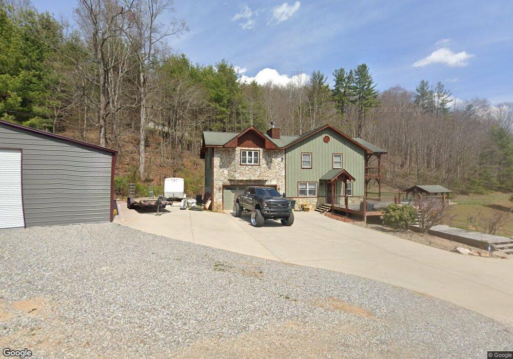
620 Red Maple Dr Waynesville, NC 28785
Estimated Value: $707,667 - $1,109,000
3
Beds
4
Baths
1,064
Sq Ft
$795/Sq Ft
Est. Value
About This Home
This home is located at 620 Red Maple Dr, Waynesville, NC 28785 and is currently estimated at $845,917, approximately $795 per square foot. 620 Red Maple Dr is a home located in Haywood County with nearby schools including Jonathan Valley Elementary School, Waynesville Middle, and Tuscola High.
Ownership History
Date
Name
Owned For
Owner Type
Purchase Details
Closed on
May 5, 2023
Sold by
Kerslake Jason
Bought by
Kerslake Jason
Current Estimated Value
Purchase Details
Closed on
Sep 1, 2006
Sold by
Triassi Salvatore R and Triassi Virginia K
Bought by
Kerslake Jason and Kerslake Rebecca
Home Financials for this Owner
Home Financials are based on the most recent Mortgage that was taken out on this home.
Original Mortgage
$24,000
Interest Rate
6.73%
Mortgage Type
Seller Take Back
Purchase Details
Closed on
Jun 2, 2004
Bought by
Kerslake Jason and Kerslake Rebecca
Create a Home Valuation Report for This Property
The Home Valuation Report is an in-depth analysis detailing your home's value as well as a comparison with similar homes in the area
Purchase History
| Date | Buyer | Sale Price | Title Company |
|---|---|---|---|
| Kerslake Jason | -- | None Listed On Document | |
| Kerslake Jason | $25,000 | None Available | |
| Kerslake Jason | $200,000 | -- |
Source: Public Records
Mortgage History
| Date | Status | Borrower | Loan Amount |
|---|---|---|---|
| Previous Owner | Kerslake Jason | $24,000 |
Source: Public Records
Tax History
| Year | Tax Paid | Tax Assessment Tax Assessment Total Assessment is a certain percentage of the fair market value that is determined by local assessors to be the total taxable value of land and additions on the property. | Land | Improvement |
|---|---|---|---|---|
| 2025 | -- | $514,300 | $40,100 | $474,200 |
| 2024 | $34 | $515,100 | $40,100 | $475,000 |
| 2023 | $3,114 | $515,100 | $40,100 | $475,000 |
| 2022 | $3,114 | $488,400 | $40,100 | $448,300 |
| 2021 | $3,114 | $488,400 | $40,100 | $448,300 |
| 2020 | $2,640 | $378,800 | $26,700 | $352,100 |
| 2019 | $2,645 | $378,800 | $26,700 | $352,100 |
| 2018 | $2,645 | $378,800 | $26,700 | $352,100 |
| 2017 | $2,645 | $378,800 | $0 | $0 |
| 2016 | $2,713 | $400,700 | $0 | $0 |
| 2015 | $2,713 | $400,700 | $0 | $0 |
| 2014 | $2,541 | $400,700 | $0 | $0 |
Source: Public Records
Map
Nearby Homes
- 132 Fields Dr
- 481 Sugar Mountain Rd
- 00 Upward Way Unit 1
- Lot 24 Covered Bridge Trail Unit 24
- 1045 Upward Way
- Lot 3 Turtle Rock Ln
- Lot 1 Turtle Rock Ln
- 170 Cradling Cove
- 0 Asa Trail
- Lot 23 Asa Trail
- 0 Cradling Cove Unit 3
- 00 Neds Branch Rd
- 371 Ned Cove Rd
- 1002 Ned Cove Rd
- 120 Mountain Mist Ln
- 00 Purple Martin Ln
- 123 Live Oak Loop
- 123 Live Oak Loop Unit 29
- 4 Roaring Creek Ln
- 307 Roaring Creek Ln
- 641 Red Maple Dr
- 6 Pilgrim Ln
- 6 Pilgrim Ln Unit 18
- 44 Pilgrim Ln
- 651 Red Maple Dr
- 563 Red Maple Dr
- 822 Fields Dr
- 77 Fields Dr
- 899 Fields Dr
- 67 Fields Dr
- 534 Red Maple Dr
- 613 Red Maple Dr
- 726 Red Maple Dr
- 109 Fields Dr
- 585 Red Maple Dr
- 537 Red Maple Dr
- 758 Red Maple Dr
- LOT#1 Fields Dr
- 0 Fields Dr
- 136 Molasses Way
Your Personal Tour Guide
Ask me questions while you tour the home.