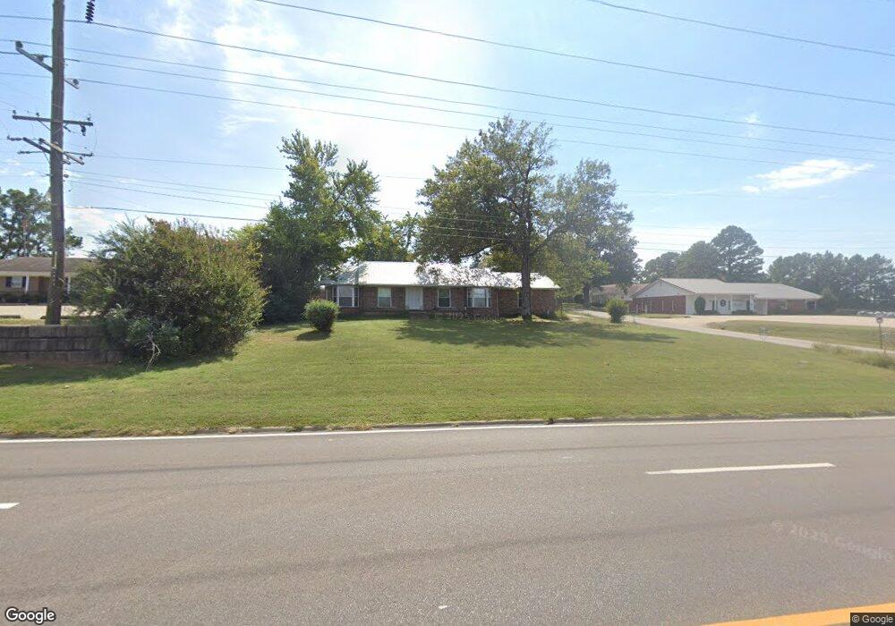
6200 Zero St Fort Smith, AR 72903
Estimated Value: $288,000 - $296,000
Studio
2
Baths
1,708
Sq Ft
$171/Sq Ft
Est. Value
About This Home
This home is located at 6200 Zero St, Fort Smith, AR 72903 and is currently estimated at $292,829, approximately $171 per square foot. 6200 Zero St is a home located in Sebastian County with nearby schools including Raymond F. Orr Elementary School, L.A. Chaffin Junior High School, and Southside High School.
Ownership History
Date
Name
Owned For
Owner Type
Purchase Details
Closed on
Mar 30, 2017
Sold by
Ulj Llc
Bought by
Botello Chad A
Current Estimated Value
Home Financials for this Owner
Home Financials are based on the most recent Mortgage that was taken out on this home.
Original Mortgage
$123,025
Outstanding Balance
$101,688
Interest Rate
4.14%
Estimated Equity
$191,141
Purchase Details
Closed on
Sep 15, 1998
Bought by
Johnson Ulla Lou Living Trust
Purchase Details
Closed on
Jun 12, 1995
Bought by
Burlison Larry J
Purchase Details
Closed on
Oct 5, 1983
Bought by
Jeffcoat Vivian
Create a Home Valuation Report for This Property
The Home Valuation Report is an in-depth analysis detailing your home's value as well as a comparison with similar homes in the area
Home Values in the Area
Average Home Value in this Area
Purchase History
| Date | Buyer | Sale Price | Title Company |
|---|---|---|---|
| Botello Chad A | $130,000 | -- | |
| Botello Chad A | $130,000 | -- | |
| Johnson Ulla Lou Living Trust | $85,000 | -- | |
| Johnson Ulla Lou Living Trust | $85,000 | -- | |
| Burlison Larry J | $85,000 | -- | |
| Burlison Larry J | $85,000 | -- | |
| Jeffcoat Vivian | $32,000 | -- | |
| Jeffcoat Vivian | $32,000 | -- |
Source: Public Records
Mortgage History
| Date | Status | Borrower | Loan Amount |
|---|---|---|---|
| Open | Botello Chad A | $123,025 | |
| Closed | Botello Chad A | -- |
Source: Public Records
Tax History
| Year | Tax Paid | Tax Assessment Tax Assessment Total Assessment is a certain percentage of the fair market value that is determined by local assessors to be the total taxable value of land and additions on the property. | Land | Improvement |
|---|---|---|---|---|
| 2025 | $1,339 | $40,287 | $5,500 | $34,787 |
| 2024 | $1,153 | $21,960 | $3,600 | $18,360 |
| 2023 | $850 | $21,960 | $3,600 | $18,360 |
| 2022 | $900 | $21,960 | $3,600 | $18,360 |
| 2021 | $900 | $21,960 | $3,600 | $18,360 |
| 2020 | $900 | $21,960 | $3,600 | $18,360 |
| 2019 | $849 | $21,080 | $3,600 | $17,480 |
| 2018 | $874 | $21,080 | $3,600 | $17,480 |
| 2017 | $1,107 | $21,080 | $3,600 | $17,480 |
| 2016 | $1,107 | $21,080 | $3,600 | $17,480 |
| 2015 | $1,107 | $21,080 | $3,600 | $17,480 |
| 2014 | $1,264 | $24,080 | $4,240 | $19,840 |
Source: Public Records
Map
Nearby Homes
- 6200 S Zero St
- 6300 Galven Way
- 5412 Hedwig Way
- 7401 S Zero St
- 6900 Red Bud Dr
- 5710 Geren Rd
- 7201 Red Pine Dr
- 6924 Stonebrook Dr
- 7215 Red Pine Dr
- 7008 Stonebrook Dr
- 6917 Milan Way
- 6923 Stonebrook Dr
- 6911 Naples Way
- 7904 Rome Way
- 6914 Woodhaven Cir
- 8627 Reata St
- 8723 Reata St
- 4927 Hardscrabble Way
- 8812 Skypark Dr
- 4221 Stonehouse Rd
- 6220 Zero St
- 6300 Zero St
- 6109 Old Greenwood Rd
- 6201 S Zero St
- 6115 Old Greenwood Rd
- 6100 S Zero St
- 6110 Old Greenwood Rd
- 6401 Zero St
- 5440 S 66th St
- 6515 S Zero St
- 5901 S Zero St
- 5815 S Zero St
- 5600 S 66th St
- 6201 Crimson Ave
- 6209 Crimson Ave
- 6215 Crimson Ave
- 6301 Crimson Ave
- 6309 Crimson Ave
- 6315 Crimson Ave
- 6401 Crimson Ave
Your Personal Tour Guide
Ask me questions while you tour the home.