Estimated Value: $307,000 - $352,000
3
Beds
2
Baths
1,620
Sq Ft
$204/Sq Ft
Est. Value
About This Home
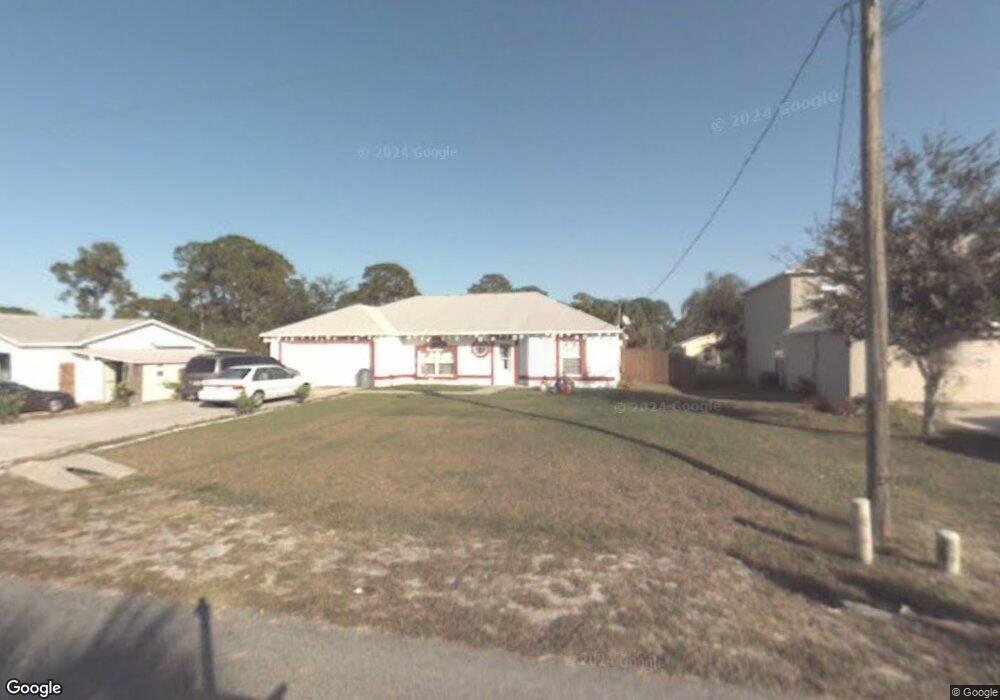
This home is located at 6217 E Baker Cir, Cocoa, FL 32927 and is currently estimated at $330,754, approximately $204 per square foot. 6217 E Baker Cir is a home located in Brevard County with nearby schools including Challenger 7 Elementary School, Space Coast Junior/Senior High School, and Sculptor Charter School.
Ownership History
Date
Name
Owned For
Owner Type
Purchase Details
Closed on
Dec 30, 1998
Sold by
Maronda Homes Inc Fl
Bought by
Bethis Washington Shannon L and Bethis Washington
Current Estimated Value
Home Financials for this Owner
Home Financials are based on the most recent Mortgage that was taken out on this home.
Original Mortgage
$93,609
Outstanding Balance
$21,918
Interest Rate
6.87%
Estimated Equity
$308,836
Purchase Details
Closed on
Apr 23, 1998
Sold by
Austing Stewart E and Austing Gregory E
Bought by
Maronda Homes Inc Fl
Create a Home Valuation Report for This Property
The Home Valuation Report is an in-depth analysis detailing your home's value as well as a comparison with similar homes in the area
Home Values in the Area
Average Home Value in this Area
Purchase History
| Date | Buyer | Sale Price | Title Company |
|---|---|---|---|
| Bethis Washington Shannon L | $93,800 | -- | |
| Maronda Homes Inc Fl | $15,000 | -- |
Source: Public Records
Mortgage History
| Date | Status | Borrower | Loan Amount |
|---|---|---|---|
| Open | Bethis Washington Shannon L | $93,609 |
Source: Public Records
Tax History
| Year | Tax Paid | Tax Assessment Tax Assessment Total Assessment is a certain percentage of the fair market value that is determined by local assessors to be the total taxable value of land and additions on the property. | Land | Improvement |
|---|---|---|---|---|
| 2025 | $1,428 | $104,070 | -- | -- |
| 2024 | $1,390 | $101,140 | -- | -- |
| 2023 | $1,390 | $98,200 | $0 | $0 |
| 2022 | $1,296 | $95,340 | $0 | $0 |
| 2021 | $1,292 | $92,570 | $0 | $0 |
| 2020 | $1,229 | $91,300 | $0 | $0 |
| 2019 | $1,164 | $89,250 | $0 | $0 |
| 2018 | $1,156 | $87,590 | $0 | $0 |
| 2017 | $1,148 | $85,790 | $0 | $0 |
| 2016 | $1,147 | $84,030 | $18,000 | $66,030 |
| 2015 | $1,158 | $83,450 | $15,000 | $68,450 |
| 2014 | $1,159 | $82,790 | $11,000 | $71,790 |
Source: Public Records
Map
Nearby Homes
- 6310 Depot Ave
- 4721 Fairsun St
- 4975 Fay Blvd
- 0000 Grissom Pkwy
- 6375 Cable Ave
- 6398 Cable Ave
- 6240 Grissom Pkwy
- 6162 Rena Ave
- 4590 Ponds Dr
- 4715 Greenhill St
- 4790 Greenhill St
- 0000 Unknown St
- 6620 Grissom Pkwy
- 6094 Cardiff Ave
- 4470 Ponds Dr
- 4485 Fay Blvd
- 00 Unknown
- 5220 Holden Rd
- 4390 Ponds Dr
- 4440 Fay Blvd
- 6215 E Baker Cir
- 6219 E Baker Cir
- 6342 Depot Ave
- 6221 E Baker Cir
- 6218 E Baker Cir
- 6220 E Baker Cir
- 6216 E Baker Cir
- 6334 Depot Ave
- 6366 Depot Ave
- 6214 E Baker Cir
- 6223 E Baker Cir
- 6226 E Baker Cir
- 6326 Depot Ave
- 6374 Depot Ave Unit 3
- 6374 Depot Ave
- 6209 E Baker Cir
- 6385 Stillwater Ave
- 6212 E Baker Cir
- 6375 Stillwater Ave
- 6395 Stillwater Ave
Your Personal Tour Guide
Ask me questions while you tour the home.