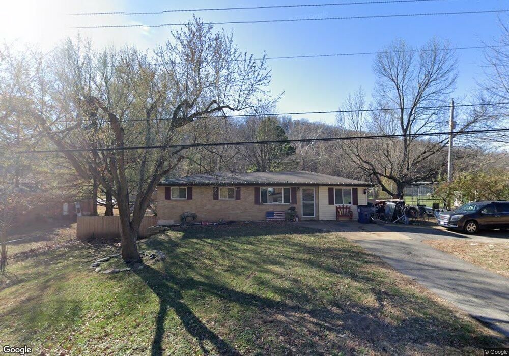
6228 Highway Pp High Ridge, MO 63049
Estimated Value: $183,000 - $232,000
Studio
1
Bath
1,248
Sq Ft
$168/Sq Ft
Est. Value
About This Home
This home is located at 6228 Highway Pp, High Ridge, MO 63049 and is currently estimated at $209,171, approximately $167 per square foot. 6228 Highway Pp is a home located in Jefferson County with nearby schools including Northwest High School and St. Anthony School.
Ownership History
Date
Name
Owned For
Owner Type
Purchase Details
Closed on
Feb 19, 2025
Sold by
Ahrens Christopher
Bought by
6217 State Road Pp Llc
Current Estimated Value
Purchase Details
Closed on
Aug 19, 2022
Sold by
Bethany Costello
Bought by
Ahrens Christopher
Purchase Details
Closed on
Aug 21, 2015
Sold by
Vanhorn Ryan D and Vanhorn Erin E
Bought by
Ahrens Christopher W and Costello Bethany
Home Financials for this Owner
Home Financials are based on the most recent Mortgage that was taken out on this home.
Original Mortgage
$90,824
Interest Rate
4.25%
Mortgage Type
FHA
Purchase Details
Closed on
Nov 12, 2009
Sold by
Jones Bessie Pauline and Hoffman Paula A
Bought by
Vanhorn Ryan D and Vanhorn Van Horn
Home Financials for this Owner
Home Financials are based on the most recent Mortgage that was taken out on this home.
Original Mortgage
$83,361
Interest Rate
4.83%
Mortgage Type
FHA
Create a Home Valuation Report for This Property
The Home Valuation Report is an in-depth analysis detailing your home's value as well as a comparison with similar homes in the area
Home Values in the Area
Average Home Value in this Area
Purchase History
| Date | Buyer | Sale Price | Title Company |
|---|---|---|---|
| 6217 State Road Pp Llc | -- | None Listed On Document | |
| Ahrens Christopher | -- | None Listed On Document | |
| Ahrens Christopher W | -- | None Available | |
| Vanhorn Ryan D | -- | Investors Title Co |
Source: Public Records
Mortgage History
| Date | Status | Borrower | Loan Amount |
|---|---|---|---|
| Previous Owner | Ahrens Christopher W | $90,824 | |
| Previous Owner | Vanhorn Ryan D | $83,361 |
Source: Public Records
Tax History
| Year | Tax Paid | Tax Assessment Tax Assessment Total Assessment is a certain percentage of the fair market value that is determined by local assessors to be the total taxable value of land and additions on the property. | Land | Improvement |
|---|---|---|---|---|
| 2025 | $1,336 | $19,800 | $1,800 | $18,000 |
| 2024 | $1,336 | $18,500 | $1,800 | $16,700 |
| 2023 | $1,336 | $18,500 | $1,800 | $16,700 |
| 2022 | $1,330 | $18,500 | $1,800 | $16,700 |
| 2021 | $1,322 | $18,500 | $1,800 | $16,700 |
| 2020 | $1,207 | $16,500 | $1,400 | $15,100 |
| 2019 | $1,206 | $16,500 | $1,400 | $15,100 |
| 2018 | $1,222 | $16,500 | $1,400 | $15,100 |
| 2017 | $1,117 | $16,500 | $1,400 | $15,100 |
| 2016 | $1,010 | $14,800 | $1,300 | $13,500 |
| 2015 | $1,038 | $14,800 | $1,300 | $13,500 |
| 2013 | -- | $14,400 | $1,300 | $13,100 |
Source: Public Records
Map
Nearby Homes
- 6752 Walnut Valley Dr
- 6428 Kathy Dr
- 6028 Antire Rd
- 3483 High Ridge Blvd
- 5800 5800 St Rd Pp
- 0 Old Gravois Rd
- 3208 Echo Lake Dr
- 3 & 5 Broken Arrow Ct
- 5625 Circle Dr
- 3112 Edgewood Dr
- 45 Rd
- 3275 Echo Lake Dr
- 6302 Upper Byrnes Mill Rd
- 6101 Jo Dr
- 2801 High Ridge Blvd
- 6713 Silverstone Ct
- 186 Bobwhite Ln Unit 186
- 22 Meadowlark Ln Unit 22
- 3628 Wheatfield Cir
- 6099 Timber Hollow Ln
- 6228 State Road Pp
- 6228 State Hwy Pp
- 3101 Willow Ln
- 3105 Willow Ln
- 3100 Willow Ln
- 3104 Willow Ln
- 6305 Missouri Pp
- 6212 Highway Pp
- 6195 Carolyn Sue Dr
- 6208 Pp
- 6208 Highway Pp
- 6208 Missouri Pp
- 6204 Highway Pp
- 6155 Highway Pp
- 6213 Carolyn Sue Dr
- 6196 Carolyn Sue Dr
- 6200 Missouri Pp
- 6209 Carolyn Sue Dr
- 6325 State Road Pp
- 6325 Highway Pp
Your Personal Tour Guide
Ask me questions while you tour the home.