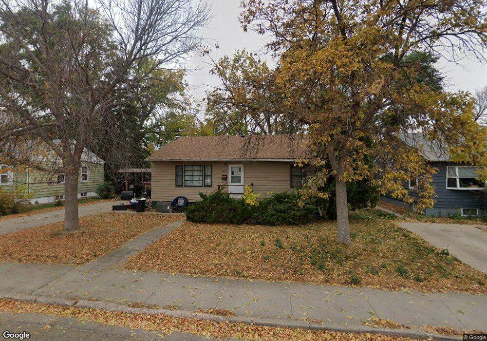
623 N Huron Ave Pierre, SD 57501
Estimated Value: $144,778 - $248,000
3
Beds
1
Bath
952
Sq Ft
$223/Sq Ft
Est. Value
About This Home
This home is located at 623 N Huron Ave, Pierre, SD 57501 and is currently estimated at $212,445, approximately $223 per square foot. 623 N Huron Ave is a home with nearby schools including T.F. Riggs High School and Pierre SDA School.
Ownership History
Date
Name
Owned For
Owner Type
Purchase Details
Closed on
Apr 24, 2010
Sold by
Bartholomew Linda and Johnson Juell M
Bought by
Menning Laura K and Menning Paul H
Current Estimated Value
Home Financials for this Owner
Home Financials are based on the most recent Mortgage that was taken out on this home.
Original Mortgage
$111,733
Outstanding Balance
$75,006
Interest Rate
5.16%
Estimated Equity
$137,439
Create a Home Valuation Report for This Property
The Home Valuation Report is an in-depth analysis detailing your home's value as well as a comparison with similar homes in the area
Home Values in the Area
Average Home Value in this Area
Purchase History
We collect this data history from publicly available records. To have your information removed, we recommend requesting removal directly through your county’s website.
| Date | Buyer | Sale Price | Title Company |
|---|---|---|---|
| Menning Laura K | $109,500 | -- |
Source: Public Records
Mortgage History
We collect this data history from publicly available records. To have your information removed, we recommend requesting removal directly through your county’s website.
| Date | Status | Borrower | Loan Amount |
|---|---|---|---|
| Open | Menning Laura K | $111,733 |
Source: Public Records
Tax History
| Year | Tax Paid | Tax Assessment Tax Assessment Total Assessment is a certain percentage of the fair market value that is determined by local assessors to be the total taxable value of land and additions on the property. | Land | Improvement |
|---|---|---|---|---|
| 2025 | $2,014 | $166,291 | $45,658 | $120,633 |
| 2024 | $2,006 | $160,547 | $45,658 | $114,889 |
| 2023 | $1,850 | $155,779 | $43,692 | $112,087 |
| 2022 | $1,742 | $135,017 | $41,611 | $93,406 |
| 2021 | $1,707 | $120,551 | $37,153 | $83,398 |
| 2020 | $1,747 | $117,040 | $36,071 | $80,969 |
| 2019 | $1,744 | $117,040 | $36,071 | $80,969 |
| 2018 | $1,671 | $113,631 | $35,020 | $78,611 |
| 2017 | -- | $108,220 | $33,352 | $74,868 |
| 2016 | $1,748 | $108,220 | $33,352 | $74,868 |
| 2015 | -- | $105,068 | $32,381 | $72,687 |
| 2014 | -- | $102,008 | $31,438 | $70,570 |
| 2013 | -- | $102,008 | $31,438 | $70,570 |
| 2011 | -- | $95,147 | $31,438 | $63,709 |
Source: Public Records
Map
Nearby Homes
- 618 N Huron Ave
- 703 N Huron Ave
- 523 N Huron Ave
- 723 N Grand Ave
- 609 N Oneida Ave
- 822 N Huron Ave
- 903 N Grand Ave
- 212 E 1st St
- 818 N Euclid Ave
- 512 N Highland Ave
- 201 N Oneida Ave
- 900 N Euclid Ave
- 212 N Sebree Place
- 1004 N Grand Ave
- 814 N Harney Ct
- 702 W Bridgeview Ave
- 314 W 7th St
- 109 S Oneida Ave
- 111 E 6th St
- 115 E 6th St
- 619 N Huron Ave
- 627 N Huron Ave
- 617 N Huron Ave
- 631 N Huron Ave
- 624 N Huron Ave
- 626 N Huron Ave
- 207 W 2nd St
- 121 W 2nd St
- 616 N Huron Ave
- 217 W 2nd St
- 202 W Elizabeth St
- 626 N Central Ave
- 622 N Central Ave
- 208 W 2nd St
- 616 N Central Ave
- 120 W Elizabeth St
- 120 W 2nd St
- 221 W 2nd St
- 210 W Elizabeth St
- 212 W Elizabeth St
Your Personal Tour Guide
Ask me questions while you tour the home.