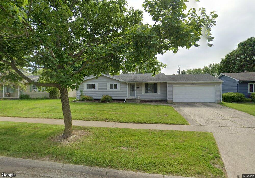
623 Somerset Dr Flushing, MI 48433
Estimated Value: $208,603 - $239,000
3
Beds
2
Baths
1,324
Sq Ft
$171/Sq Ft
Est. Value
About This Home
This home is located at 623 Somerset Dr, Flushing, MI 48433 and is currently estimated at $226,401, approximately $170 per square foot. 623 Somerset Dr is a home located in Genesee County with nearby schools including Seymour Elementary School, Flushing Middle School, and Flushing High School.
Ownership History
Date
Name
Owned For
Owner Type
Purchase Details
Closed on
Jan 22, 2021
Sold by
Solomon Samuel T
Bought by
Solomon Samuel T and Whitson Lisa A
Current Estimated Value
Purchase Details
Closed on
Feb 11, 1999
Sold by
Vera David Issa and Vera David
Bought by
Solomon Samuel T
Home Financials for this Owner
Home Financials are based on the most recent Mortgage that was taken out on this home.
Original Mortgage
$65,000
Interest Rate
10.87%
Mortgage Type
Purchase Money Mortgage
Create a Home Valuation Report for This Property
The Home Valuation Report is an in-depth analysis detailing your home's value as well as a comparison with similar homes in the area
Home Values in the Area
Average Home Value in this Area
Purchase History
We collect this data history from publicly available records. To have your information removed, we recommend requesting removal directly through your county’s website.
| Date | Buyer | Sale Price | Title Company |
|---|---|---|---|
| Solomon Samuel T | -- | None Listed On Document | |
| Solomon Samuel T | -- | -- |
Source: Public Records
Mortgage History
We collect this data history from publicly available records. To have your information removed, we recommend requesting removal directly through your county’s website.
| Date | Status | Borrower | Loan Amount |
|---|---|---|---|
| Previous Owner | Solomon Samuel T | $65,000 |
Source: Public Records
Tax History
| Year | Tax Paid | Tax Assessment Tax Assessment Total Assessment is a certain percentage of the fair market value that is determined by local assessors to be the total taxable value of land and additions on the property. | Land | Improvement |
|---|---|---|---|---|
| 2025 | $2,659 | $99,200 | $0 | $0 |
| 2024 | $2,166 | $90,800 | $0 | $0 |
| 2023 | $2,086 | $82,000 | $0 | $0 |
| 2022 | $2,297 | $74,400 | $0 | $0 |
| 2021 | $2,297 | $68,100 | $0 | $0 |
| 2020 | $1,836 | $64,600 | $0 | $0 |
| 2019 | $1,807 | $60,400 | $0 | $0 |
| 2018 | $2,128 | $56,500 | $0 | $0 |
| 2017 | $1,996 | $55,600 | $0 | $0 |
| 2016 | $1,980 | $43,513 | $0 | $0 |
| 2015 | $1,972 | $0 | $0 | $0 |
| 2012 | -- | $44,700 | $44,700 | $0 |
Source: Public Records
Map
Nearby Homes
- 0 Winters Eave Dr Unit 50117986
- 527 Spring Ln
- 0 E River Rd Unit 50180952
- 241 Aberdeen Ct Unit 11 bldg 6
- 312 Sunrise Dr
- 100 Aberdeen Dr Unit 36
- 218 S Cherry St
- 227 Emily St
- 000 Potter Rd
- 6106 E River Rd
- 223 Primrose Ln
- 6017 W Pierson Rd
- 221 N Cherry St
- 588 Oakbrook Cir
- 8399 Potter Rd
- 580 Oakbrook Cir
- 748 Bending Ct
- 746 Bending Brook Dr
- 203 Boman St
- 530 Coutant St
- 627 Somerset Dr
- 619 Somerset Dr
- 631 Somerset Dr
- 615 Somerset Dr
- 620 Somerset Dr
- 616 Somerset Dr
- 622 S Mckinley Rd
- 635 Somerset Dr
- 618 S Mckinley Rd
- 626 S Mckinley Rd
- 645 Winters Eave
- 641 Winters Eave
- 616 Autumn Dr
- 648 Winters Eave
- 614 S Mckinley Rd
- 630 S Mckinley Rd
- 611 Somerset Dr
- 612 Somerset Dr
- 644 Winters Eave
- 610 S Mckinley Rd
Your Personal Tour Guide
Ask me questions while you tour the home.