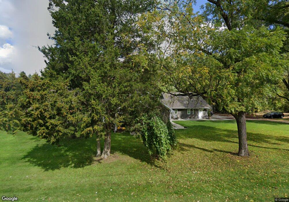
6232 King Rd Spring Arbor, MI 49283
Estimated Value: $250,119 - $278,000
Studio
--
Bath
1,944
Sq Ft
$136/Sq Ft
Est. Value
About This Home
This home is located at 6232 King Rd, Spring Arbor, MI 49283 and is currently estimated at $263,780, approximately $135 per square foot. 6232 King Rd is a home located in Jackson County with nearby schools including Western High School, Paragon Charter Academy, and Trinity Lutheran School.
Ownership History
Date
Name
Owned For
Owner Type
Purchase Details
Closed on
Apr 16, 1999
Sold by
Cox Jamie D and Cox Jacqueline M
Bought by
Fransted Jeffery G and Fransted Carradin R
Current Estimated Value
Home Financials for this Owner
Home Financials are based on the most recent Mortgage that was taken out on this home.
Original Mortgage
$68,850
Outstanding Balance
$17,623
Interest Rate
7.17%
Estimated Equity
$246,157
Purchase Details
Closed on
Apr 25, 1997
Sold by
Dillion Charles E
Bought by
Cox Jamie D and Cox Jacqueline M
Create a Home Valuation Report for This Property
The Home Valuation Report is an in-depth analysis detailing your home's value as well as a comparison with similar homes in the area
Purchase History
| Date | Buyer | Sale Price | Title Company |
|---|---|---|---|
| Fransted Jeffery G | $71,000 | -- | |
| Cox Jamie D | $56,900 | -- |
Source: Public Records
Mortgage History
| Date | Status | Borrower | Loan Amount |
|---|---|---|---|
| Open | Fransted Jeffery G | $68,850 |
Source: Public Records
Tax History
| Year | Tax Paid | Tax Assessment Tax Assessment Total Assessment is a certain percentage of the fair market value that is determined by local assessors to be the total taxable value of land and additions on the property. | Land | Improvement |
|---|---|---|---|---|
| 2025 | $4,155 | $126,600 | $0 | $0 |
| 2024 | $23 | $121,500 | $0 | $0 |
| 2023 | $2,260 | $114,600 | $0 | $0 |
| 2022 | $3,836 | $114,300 | $0 | $0 |
| 2021 | $3,773 | $111,630 | $0 | $0 |
| 2020 | $3,785 | $99,160 | $0 | $0 |
| 2019 | $3,714 | $87,850 | $0 | $0 |
| 2018 | $3,605 | $89,200 | $6,830 | $82,370 |
| 2017 | $3,144 | $75,290 | $0 | $0 |
| 2016 | $1,567 | $74,820 | $74,820 | $0 |
| 2015 | $76,889 | $68,230 | $68,230 | $0 |
| 2014 | $76,889 | $77,560 | $0 | $0 |
| 2013 | -- | $77,560 | $77,560 | $0 |
Source: Public Records
Map
Nearby Homes
- 6728 King Rd
- V/L S Dearing Rd Unit 40 Acres Vacant Land
- 5513 Sherwood Dr
- 2625 S Dearing Rd
- 7315 King Rd
- 7052 Gilroy Ct
- 4557 Westbrook Dr Unit 31
- 4532 Westbrook Dr Unit 47
- 1035 Engelhardt Strasse
- 33 Aviara Oaks Pkwy
- 4849 Indian Creek Dr Unit 6
- 2503 Milford Rd
- 4830 Stonewood Dr Unit 15
- 2326 Pioneer Dr
- 7969 Brandon Dr
- 5454 Vrooman Rd
- 4894 Indian Creek Dr
- 2175 Pioneer Dr
- 4835 Staten Dr
- 5427 Vrooman Rd
- 6234 King Rd
- 5765 Highland Bell Dr
- 6128 King Rd
- 6233 King Rd
- 6235 King Rd
- 5761 Highland Bell Dr
- 6229 King Rd
- 6225 King Rd
- 6236 King Rd
- 2958 S Sandstone Rd
- 2958 S Sandstone Rd
- 5757 Highland Bell Dr
- 6405 King Rd
- 5764 Highland Bell Dr
- 6231 King Rd
- 6240 King Rd
- 2950 S Sandstone Rd
- 3030 S Sandstone Rd Unit Sandstone
- 3030 S Sandstone Rd Unit King Road
- 3030 S Sandstone Rd
Your Personal Tour Guide
Ask me questions while you tour the home.