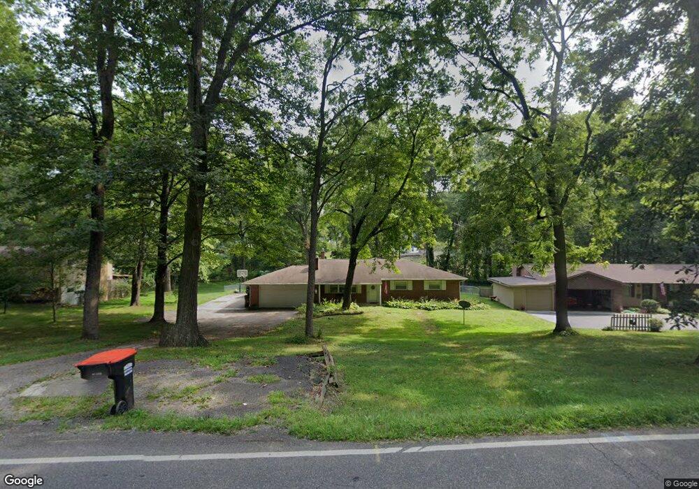
625 Cedar Run Rd Newark, OH 43055
Estimated Value: $291,000 - $372,000
2
Beds
2
Baths
1,980
Sq Ft
$163/Sq Ft
Est. Value
About This Home
This home is located at 625 Cedar Run Rd, Newark, OH 43055 and is currently estimated at $322,659, approximately $162 per square foot. 625 Cedar Run Rd is a home located in Licking County with nearby schools including Hillview Elementary School, Heritage Middle School, and Newark High School.
Ownership History
Date
Name
Owned For
Owner Type
Purchase Details
Closed on
Aug 13, 2025
Sold by
Marty William C and Marty Jo Ann
Bought by
Marty William C and Marty Jo Ann
Current Estimated Value
Purchase Details
Closed on
Nov 30, 2016
Sold by
David A Long
Bought by
Marty William
Home Financials for this Owner
Home Financials are based on the most recent Mortgage that was taken out on this home.
Original Mortgage
$115,940
Interest Rate
4.03%
Purchase Details
Closed on
Mar 3, 2010
Sold by
Hupp Betsy L and Hupp Charles
Bought by
Long Pamela S
Create a Home Valuation Report for This Property
The Home Valuation Report is an in-depth analysis detailing your home's value as well as a comparison with similar homes in the area
Home Values in the Area
Average Home Value in this Area
Purchase History
| Date | Buyer | Sale Price | Title Company |
|---|---|---|---|
| Marty William C | -- | None Listed On Document | |
| Marty William | -- | -- | |
| Long Pamela S | $30,000 | Attorney |
Source: Public Records
Mortgage History
| Date | Status | Borrower | Loan Amount |
|---|---|---|---|
| Previous Owner | Marty William | $115,940 | |
| Previous Owner | Marty William | -- |
Source: Public Records
Tax History
| Year | Tax Paid | Tax Assessment Tax Assessment Total Assessment is a certain percentage of the fair market value that is determined by local assessors to be the total taxable value of land and additions on the property. | Land | Improvement |
|---|---|---|---|---|
| 2024 | $3,184 | $89,080 | $21,560 | $67,520 |
| 2023 | $3,178 | $89,080 | $21,560 | $67,520 |
| 2022 | $2,667 | $66,540 | $12,360 | $54,180 |
| 2021 | $2,797 | $66,540 | $12,360 | $54,180 |
| 2020 | $2,860 | $66,540 | $12,360 | $54,180 |
| 2019 | $2,386 | $53,450 | $11,760 | $41,690 |
| 2018 | $2,388 | $0 | $0 | $0 |
| 2017 | $2,287 | $0 | $0 | $0 |
| 2016 | $1,188 | $0 | $0 | $0 |
| 2015 | $1,214 | $0 | $0 | $0 |
| 2014 | $1,514 | $0 | $0 | $0 |
| 2013 | $1,197 | $0 | $0 | $0 |
Source: Public Records
Map
Nearby Homes
- 738 N Buena Vista St
- 1630 Martinsburg Rd NE
- 161 E Postal Ave
- 160 E Channel St
- 109 Bolton Ave
- 667 Maple Ave
- 20 Cherry St
- 397 Arlington Ave
- 49 E Channel St
- 239 N Cedar St
- 194 Fielde Dr
- 468 Garfield Ave
- 1042 Stewart St
- 167 Fielde Dr
- 205 Hunter St
- 655 Evans St
- 311 Clinton St
- 27 W North St
- 167 Essex St
- 12 E Saint Clair St
- 635 Cedar Run Rd
- 615 Cedar Run Rd
- 635 Cedar Run Rd NE
- 647 Cedar Run Rd NE
- 605 Cedar Run Rd
- 647 Cedar Run Rd
- 819 Larkspur Dr
- 817 Larkspur Dr
- 601 Cedar Run Rd
- 550 Woodswalk Dr
- 550 Woods Walk Dr
- 630 Cedar Run Rd
- 530 Woodswalk Dr
- 815 Larkspur Dr
- 610 Cedar Run Rd
- 570 Dogwood Dr
- 813 Larkspur Dr
- 667 Cedar Run Rd
- 600 Cedar Run Rd
Your Personal Tour Guide
Ask me questions while you tour the home.