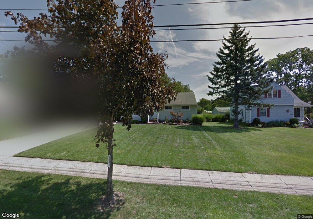
6251 Dunham Rd Maple Heights, OH 44137
Estimated Value: $171,000 - $189,000
3
Beds
2
Baths
1,352
Sq Ft
$130/Sq Ft
Est. Value
About This Home
This home is located at 6251 Dunham Rd, Maple Heights, OH 44137 and is currently estimated at $176,250, approximately $130 per square foot. 6251 Dunham Rd is a home located in Cuyahoga County with nearby schools including Abraham Lincoln Elementary School, Rockside/ J.F. Kennedy School, and Barack Obama School.
Ownership History
Date
Name
Owned For
Owner Type
Purchase Details
Closed on
Feb 6, 2003
Sold by
Vining Richard T and Vining Erbe M
Bought by
Jackson Ronald S and Jackson Gloria J
Current Estimated Value
Home Financials for this Owner
Home Financials are based on the most recent Mortgage that was taken out on this home.
Original Mortgage
$113,223
Outstanding Balance
$45,815
Interest Rate
5.94%
Mortgage Type
FHA
Estimated Equity
$130,435
Purchase Details
Closed on
Apr 1, 1985
Sold by
Vining Richard T and E M
Bought by
Vining Richard T
Purchase Details
Closed on
Jan 1, 1975
Bought by
Vining Richard T and E M
Create a Home Valuation Report for This Property
The Home Valuation Report is an in-depth analysis detailing your home's value as well as a comparison with similar homes in the area
Home Values in the Area
Average Home Value in this Area
Purchase History
We collect this data history from publicly available records. To have your information removed, we recommend requesting removal directly through your county’s website.
| Date | Buyer | Sale Price | Title Company |
|---|---|---|---|
| Jackson Ronald S | $115,000 | -- | |
| Vining Richard T | -- | -- | |
| Vining Richard T | -- | -- |
Source: Public Records
Mortgage History
We collect this data history from publicly available records. To have your information removed, we recommend requesting removal directly through your county’s website.
| Date | Status | Borrower | Loan Amount |
|---|---|---|---|
| Open | Jackson Ronald S | $113,223 |
Source: Public Records
Tax History
| Year | Tax Paid | Tax Assessment Tax Assessment Total Assessment is a certain percentage of the fair market value that is determined by local assessors to be the total taxable value of land and additions on the property. | Land | Improvement |
|---|---|---|---|---|
| 2025 | $3,816 | $47,180 | $8,715 | $38,465 |
| 2024 | $4,241 | $47,180 | $8,715 | $38,465 |
| 2023 | $3,348 | $31,920 | $7,140 | $24,780 |
| 2022 | $3,335 | $31,920 | $7,140 | $24,780 |
| 2021 | $3,559 | $31,920 | $7,140 | $24,780 |
| 2020 | $3,215 | $25,900 | $5,850 | $20,060 |
| 2019 | $3,195 | $74,000 | $16,700 | $57,300 |
| 2018 | $3,180 | $25,900 | $5,850 | $20,060 |
| 2017 | $3,088 | $24,470 | $5,110 | $19,360 |
| 2016 | $2,982 | $24,470 | $5,110 | $19,360 |
| 2015 | $2,844 | $24,470 | $5,110 | $19,360 |
| 2014 | $2,844 | $25,240 | $5,290 | $19,950 |
Source: Public Records
Map
Nearby Homes
- 15321 Longvale Ave
- 15521 Corkhill Rd
- 15816 Mendota Ave
- 15522 Turney Rd
- 15413 Shirley Ave
- 14750 Schreiber Rd
- 15021 Florence Dr
- 6089 Dunham Rd
- 15401 Walvern Blvd
- 14956 Carol Dr
- 6045 Dunham Rd
- 15701 Walvern Blvd
- 15305 Steinway Blvd
- 14900 Summit Ave
- 16112 Rowena Ave
- SL15 Rocky Top Ct
- 15 Rockytop Ct
- 6378 Valley Ranch Dr
- 6372 Valley Ranch Dr
- 185 Creekside Dr
- 6241 Dunham Rd
- 6261 Dunham Rd
- 6231 Dunham Rd
- 15210 Corkhill Rd
- 15214 Corkhill Rd
- 6265 Dunham Rd
- 6230 Dunham Rd
- 15218 Corkhill Rd
- 15309 Longvale Ave
- 6244 Dunham Rd
- 6240 Dunham Rd
- 6221 Dunham Rd
- 6271 Dunham Rd
- 6250 Dunham Rd
- 6236 Dunham Rd
- 15302 Corkhill Rd
- 6254 Dunham Rd
- 6232 Dunham Rd
- 6217 Dunham Rd
- 6258 Dunham Rd
Your Personal Tour Guide
Ask me questions while you tour the home.