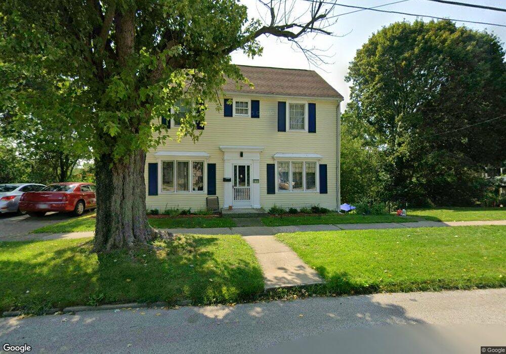
629 Main St Conneaut, OH 44030
Estimated Value: $87,000 - $110,825
4
Beds
1
Bath
1,600
Sq Ft
$61/Sq Ft
Est. Value
About This Home
This home is located at 629 Main St, Conneaut, OH 44030 and is currently estimated at $97,956, approximately $61 per square foot. 629 Main St is a home located in Ashtabula County with nearby schools including Lakeshore Primary Elementary School, Gateway Elementary School, and Conneaut Middle School.
Ownership History
Date
Name
Owned For
Owner Type
Purchase Details
Closed on
Sep 24, 2018
Sold by
Irish David K
Bought by
Heinonen Daniel L and Heinonen Donna M
Current Estimated Value
Home Financials for this Owner
Home Financials are based on the most recent Mortgage that was taken out on this home.
Original Mortgage
$44,184
Outstanding Balance
$38,623
Interest Rate
4.99%
Mortgage Type
FHA
Estimated Equity
$59,333
Purchase Details
Closed on
Aug 16, 2012
Sold by
Strack J William J J and Strack Dorothy J
Bought by
Dorothy William J and Dorothy Strac
Create a Home Valuation Report for This Property
The Home Valuation Report is an in-depth analysis detailing your home's value as well as a comparison with similar homes in the area
Home Values in the Area
Average Home Value in this Area
Purchase History
We collect this data history from publicly available records. To have your information removed, we recommend requesting removal directly through your county’s website.
| Date | Buyer | Sale Price | Title Company |
|---|---|---|---|
| Heinonen Daniel L | $45,000 | Chicago Title Agency | |
| Dorothy William J | -- | -- |
Source: Public Records
Mortgage History
We collect this data history from publicly available records. To have your information removed, we recommend requesting removal directly through your county’s website.
| Date | Status | Borrower | Loan Amount |
|---|---|---|---|
| Open | Heinonen Daniel L | $44,184 |
Source: Public Records
Tax History
| Year | Tax Paid | Tax Assessment Tax Assessment Total Assessment is a certain percentage of the fair market value that is determined by local assessors to be the total taxable value of land and additions on the property. | Land | Improvement |
|---|---|---|---|---|
| 2024 | $1,547 | $21,150 | $4,520 | $16,630 |
| 2023 | $987 | $21,150 | $4,520 | $16,630 |
| 2022 | $864 | $16,280 | $3,470 | $12,810 |
| 2021 | $879 | $16,280 | $3,470 | $12,810 |
| 2020 | $878 | $16,280 | $3,470 | $12,810 |
| 2019 | $787 | $14,320 | $2,560 | $11,760 |
| 2018 | $765 | $14,320 | $2,560 | $11,760 |
| 2017 | $371 | $13,930 | $2,170 | $11,760 |
| 2016 | $990 | $20,270 | $3,150 | $17,120 |
| 2015 | $1,000 | $20,270 | $3,150 | $17,120 |
| 2014 | $885 | $20,270 | $3,150 | $17,120 |
| 2013 | $786 | $18,520 | $3,470 | $15,050 |
Source: Public Records
Map
Nearby Homes
Your Personal Tour Guide
Ask me questions while you tour the home.