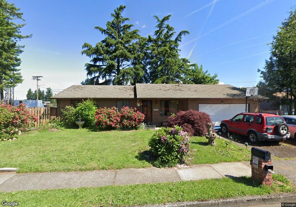
629 NW 25th St Gresham, OR 97030
North Central NeighborhoodEstimated Value: $395,000 - $471,000
3
Beds
2
Baths
1,344
Sq Ft
$321/Sq Ft
Est. Value
About This Home
This home is located at 629 NW 25th St, Gresham, OR 97030 and is currently estimated at $432,043, approximately $321 per square foot. 629 NW 25th St is a home located in Multnomah County with nearby schools including North Gresham Elementary School, Clear Creek Middle School, and Gresham High School.
Ownership History
Date
Name
Owned For
Owner Type
Purchase Details
Closed on
Jul 6, 2005
Sold by
Gordon Randy P
Bought by
Davidson Cathey and Mable M Gillooly Trust
Current Estimated Value
Purchase Details
Closed on
May 27, 1999
Sold by
Box Robert W
Bought by
Gordon Randy P
Home Financials for this Owner
Home Financials are based on the most recent Mortgage that was taken out on this home.
Original Mortgage
$115,200
Interest Rate
2.9%
Mortgage Type
Purchase Money Mortgage
Create a Home Valuation Report for This Property
The Home Valuation Report is an in-depth analysis detailing your home's value as well as a comparison with similar homes in the area
Home Values in the Area
Average Home Value in this Area
Purchase History
| Date | Buyer | Sale Price | Title Company |
|---|---|---|---|
| Davidson Cathey | $167,000 | First American | |
| Gordon Randy P | $144,000 | Oregon Title Insurance Co |
Source: Public Records
Mortgage History
| Date | Status | Borrower | Loan Amount |
|---|---|---|---|
| Previous Owner | Gordon Randy P | $115,200 |
Source: Public Records
Tax History
| Year | Tax Paid | Tax Assessment Tax Assessment Total Assessment is a certain percentage of the fair market value that is determined by local assessors to be the total taxable value of land and additions on the property. | Land | Improvement |
|---|---|---|---|---|
| 2025 | $4,412 | $216,810 | -- | -- |
| 2024 | $4,223 | $210,500 | -- | -- |
| 2023 | $3,848 | $204,370 | $0 | $0 |
| 2022 | $3,740 | $198,420 | $0 | $0 |
| 2021 | $3,646 | $192,650 | $0 | $0 |
| 2020 | $3,431 | $187,040 | $0 | $0 |
| 2019 | $3,341 | $181,600 | $0 | $0 |
| 2018 | $3,186 | $176,320 | $0 | $0 |
| 2017 | $3,057 | $171,190 | $0 | $0 |
| 2016 | $2,695 | $166,210 | $0 | $0 |
Source: Public Records
Map
Nearby Homes
- 21532 SE Alder St
- 1035 SE 225th Ave
- 21400 SE Stark St Unit 2
- 21260 SE Stark St
- 21525 SE Oak St
- 210 SE 218th Ave
- 21033 SE Clay Ct
- 21016 SE Stark St Unit 71
- 21016 SE Stark St Unit 69
- 21553 SE Ankeny Terrace
- 209 SE 214th Ave
- 132 SE 214th Ave
- 2013 NW Bella Vista Dr
- 1811 NW 19th St
- 450 NE 22nd St
- 349 NE 18th St
- 535 NE 24th St
- 54 NW 13th St
- 1783 1791 NE Beech Place
- 1861 NW Wonderview Ave
- 613 NW 25th St
- 21712 SE Yamhill St
- 21728 SE Yamhill St
- 2442 NW 217th Ave
- 601 NW 25th St
- 608 NW 25th St
- 21740 SE Yamhill St
- 0 SE Yamhill St
- 2430 NW 217th Ave
- 537 NW 25th St
- 950 SE 217th Ave
- 2433 NW Norman Ave
- 21804 SE Yamhill St
- 21733 SE Yamhill St
- 2426 NW 217th Ave
- 2444 NW Norman Ave
- 525 NW 25th St
- 2427 NW Norman Ave
- 944 SE 217th Ave
- 21822 SE Yamhill St
Your Personal Tour Guide
Ask me questions while you tour the home.