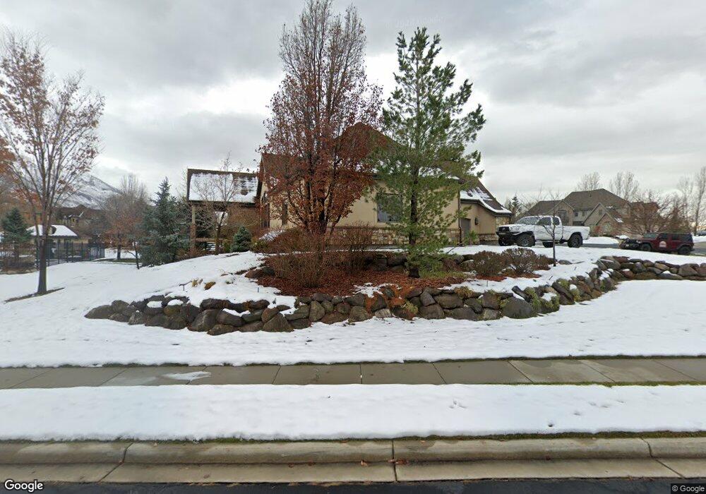
629 S Pheasant Ridge Ct Alpine, UT 84004
Estimated Value: $1,923,000 - $2,155,135
6
Beds
7
Baths
6,120
Sq Ft
$333/Sq Ft
Est. Value
About This Home
This home is located at 629 S Pheasant Ridge Ct, Alpine, UT 84004 and is currently estimated at $2,038,534, approximately $333 per square foot. 629 S Pheasant Ridge Ct is a home located in Utah County with nearby schools including Westfield School, Timberline Middle School, and Lone Peak High School.
Ownership History
Date
Name
Owned For
Owner Type
Purchase Details
Closed on
Mar 5, 2013
Sold by
Mccord Rick D
Bought by
Mccord Rick D and Mccord Penny J
Current Estimated Value
Home Financials for this Owner
Home Financials are based on the most recent Mortgage that was taken out on this home.
Original Mortgage
$594,500
Outstanding Balance
$404,186
Interest Rate
2.75%
Mortgage Type
Adjustable Rate Mortgage/ARM
Estimated Equity
$1,634,348
Purchase Details
Closed on
Mar 29, 2011
Sold by
Freeman Tom W and Freeman Nicole P
Bought by
Mccord Rick D and Mccord Penny J
Home Financials for this Owner
Home Financials are based on the most recent Mortgage that was taken out on this home.
Original Mortgage
$600,000
Interest Rate
4.95%
Mortgage Type
Adjustable Rate Mortgage/ARM
Purchase Details
Closed on
Jun 11, 2004
Sold by
Sundance Homes Llc
Bought by
Freeman Tom W and Freeman Nicole P
Create a Home Valuation Report for This Property
The Home Valuation Report is an in-depth analysis detailing your home's value as well as a comparison with similar homes in the area
Home Values in the Area
Average Home Value in this Area
Purchase History
| Date | Buyer | Sale Price | Title Company |
|---|---|---|---|
| Mccord Rick D | -- | Affiliated First Title Co | |
| Mccord Rick D | -- | Affiliated First Title Co | |
| Mccord Rick D | -- | Premier Title Insurance Age | |
| Freeman Tom W | -- | Signature Title Insurance A | |
| Sundance Homes Llc | -- | Signature Title Insurance A |
Source: Public Records
Mortgage History
| Date | Status | Borrower | Loan Amount |
|---|---|---|---|
| Open | Mccord Rick D | $594,500 | |
| Closed | Mccord Rick D | $600,000 |
Source: Public Records
Tax History
| Year | Tax Paid | Tax Assessment Tax Assessment Total Assessment is a certain percentage of the fair market value that is determined by local assessors to be the total taxable value of land and additions on the property. | Land | Improvement |
|---|---|---|---|---|
| 2025 | $7,636 | $1,020,305 | -- | -- |
| 2024 | $7,636 | $890,010 | $0 | $0 |
| 2023 | $7,218 | $903,210 | $0 | $0 |
| 2022 | $7,858 | $954,910 | $0 | $0 |
| 2021 | $6,303 | $1,189,700 | $429,000 | $760,700 |
| 2020 | $6,229 | $1,150,700 | $390,000 | $760,700 |
| 2019 | $5,967 | $1,150,700 | $390,000 | $760,700 |
| 2018 | $5,979 | $1,139,300 | $390,000 | $749,300 |
| 2017 | $5,968 | $605,165 | $0 | $0 |
| 2016 | $5,720 | $540,705 | $0 | $0 |
| 2015 | $6,046 | $540,705 | $0 | $0 |
| 2014 | $5,401 | $477,840 | $0 | $0 |
Source: Public Records
Map
Nearby Homes
- 596 S Cascade Ct
- 875 S Blue Ridge Ln
- 682 Healey Blvd
- 5046 W Jonathon Rd Unit 10
- 250 S Main St Unit 25
- 250 S Main St Unit 9
- 250 S Main St Unit 7
- 868 S Braddock Ln
- 202 E Alpine Dr
- 243 W Conrad Ct
- 259 Twin River Loop
- 30 S Main St
- 48 N 100 E
- 366 River Rd
- 11056 N Manor Dr
- 887 E Village Way
- 11107 Manor Dr Unit 1
- 1063 E Alpine Dr
- 1263 E Chapman Ct
- 5246 W 11200 N Unit 1
- 629 S Pheasant Ridge Ct Unit 8
- 629 S Pheasant Ridge Ct
- 629 S Pheasant Ridge Ct Unit 8
- 629 S Pheasant Ridge Cir
- 661 S Pheasant Ridge Ct Unit 9
- 661 S Pheasant Ridge Ct
- 661 S Pheasant Ridge Ct Unit 9
- 351 E Pheasant Ridge Dr
- 351 E Pheasant Ridge Dr Unit 4
- 378 E Pheasant Ridge Dr
- 378 E Pheasant Ridge Dr Unit 7
- 303 E Pheasant Ridge Dr
- 303 E Pheasant Ridge Dr Unit 3
- 634 S Pheasant Ridge Ct
- 634 S Pheasant Ridge Ct Unit 2
- 634 S Pheasant Ridge Ct
- 668 S Pheasant Ridge Ct Unit 1
- 668 S Pheasant Ridge Ct Unit 1
- 668 S Pheasant Ridge Ct
- 668 S Pheasant Ridge Ct Unit 1
Your Personal Tour Guide
Ask me questions while you tour the home.