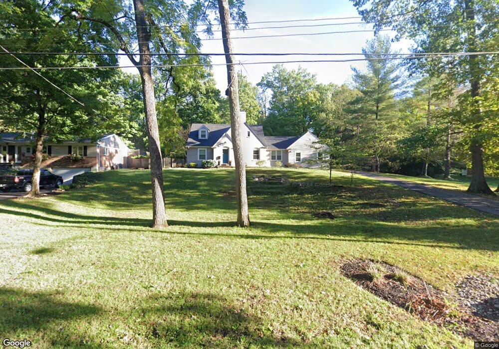
6290 Dawes Ln Cincinnati, OH 45230
Mount Washington NeighborhoodEstimated Value: $333,000 - $375,000
About This Home
This home is located at 6290 Dawes Ln, Cincinnati, OH 45230 and is currently estimated at $360,999, approximately $171 per square foot. 6290 Dawes Ln is a home located in Hamilton County with nearby schools including Mt. Washington Elementary School, Clark Montessori High School, and Shroder High School.
Ownership History
We collect this data history from publicly available records. To have your information removed, we recommend requesting removal directly through your county’s website.
Purchase Details
Purchase Details
Purchase Details
Home Values in the Area
Average Home Value in this Area
Purchase History
We collect this data history from publicly available records. To have your information removed, we recommend requesting removal directly through your county’s website.
| Date | Buyer | Sale Price | Title Company |
|---|---|---|---|
| -- | Attorney | ||
| $93,750 | Attorney | ||
| -- | Attorney |
Tax History
We collect this data history from publicly available records. To have your information removed, we recommend requesting removal directly through your county’s website.
| Year | Tax Paid | Tax Assessment Tax Assessment Total Assessment is a certain percentage of the fair market value that is determined by local assessors to be the total taxable value of land and additions on the property. | Land | Improvement |
|---|---|---|---|---|
| 2025 | $5,930 | $93,136 | $14,746 | $78,390 |
| 2023 | $5,932 | $93,136 | $14,746 | $78,390 |
| 2022 | $2,081 | $29,054 | $12,432 | $16,622 |
| 2021 | $2,035 | $29,054 | $12,432 | $16,622 |
| 2020 | $2,041 | $29,054 | $12,432 | $16,622 |
| 2019 | $1,967 | $25,487 | $10,906 | $14,581 |
| 2018 | $1,968 | $25,487 | $10,906 | $14,581 |
| 2017 | $1,894 | $25,487 | $10,906 | $14,581 |
| 2016 | $4,974 | $65,734 | $12,467 | $53,267 |
| 2015 | $4,447 | $65,734 | $12,467 | $53,267 |
| 2014 | $3,693 | $65,734 | $12,467 | $53,267 |
| 2013 | $3,756 | $65,734 | $12,467 | $53,267 |
Map
- 6193 Dawes Ln
- 6193 Dawes Ln
- 1555 Brandon Ave
- 1679 Brachman Ave
- 1639 Sutton Ave
- 6249 Benneville St
- 6984 Shadow Ridge Rd
- 1508 Beth Ln
- 1735 Sutton Ave
- 6227 Leroy Place
- 6518 Waldorf Place
- 6060 Luwista Ln
- 6038 Stanhill Ct
- 1944 Rockland Ave
- 6009 Lockard Ave
- a Salem Rd
- 6638 Foster Ave
- 6648 Foster Ave
- 6648 Foster Ave
- 6041 Colter Ave
Ask me questions while you tour the home.